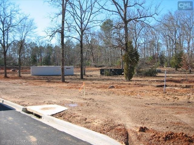
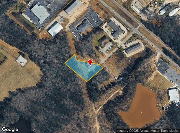
Property Record
126 Snapdragon Ct, Chapin, SC 29036
NEARBY LISTINGS FOR SALE OR LEASE
Property Detail
126 Snapdragon Ct
Columbia, SC
LEGACY PARK LOT 4
000700-04-092
Lexington
Commercialacreage
South Carolina
X
4
45063C0040J
1.25 AC
2025
Dutch Fork/Irmo
2024
Columbia
021204
DEMOGRAPHICS near 126 Snapdragon Ct
1 Mile
3 Mile
5 Mile
2024 Total Population
1,934
10,520
29,053
2029 Population
2,113
11,412
31,162
Pop Growth 2024-2029
+ 9.26%
+ 8.48%
+ 7.26%
Average Age
39
40
42
2024 Total Households
731
3,924
10,901
HH Growth 2024-2029
+ 9.30%
+ 8.56%
+ 7.49%
Median Household Inc
$70,824
$75,546
$102,622
Avg Household Size
2.60
2.60
2.60
2024 Avg HH Vehicles
2.00
2.00
2.00
Median Home Value
$219,337
$264,393
$331,505
Median Year Built
2002
2000
2001
Nearby Places
Map Layers
Map Styles
 Street
 Aerial
- Restaurants
- Banks
- Shops
- Fitness
- Groceries
PUBLIC TRANSPORTATION
AIRPORT
Columbia Metro
DRIVE
WALK
Distance
Columbia Metro
45 min
26.9 mi
SALE & LEASE HISTORY
LISTING DATE
SALE/LEASE

Sep 25, 2016
For Lease
Sep 23, 2016
For Sale
Jul 21, 2020
For Lease
Nearby Properties
Address
Land Use
TOTAL SIZE
Lot Size
Zoning
Address
Land Use
TOTAL SIZE
Lot Size
Zoning
20,344 SF
13.21 AC
RU
Address
Land Use
TOTAL SIZE
Lot Size
Zoning
10,764 SF
1.84 AC
GC
Address
Land Use
TOTAL SIZE
Lot Size
Zoning
60.57 AC
RU
Address
Land Use
TOTAL SIZE
Lot Size
Zoning
46,031 SF
12.16 AC
GC
Address
Land Use
TOTAL SIZE
Lot Size
Zoning
6,231 SF
1.83 AC
RU
Address
Land Use
TOTAL SIZE
Lot Size
Zoning
960 SF
45 AC
RU
Address
Land Use
TOTAL SIZE
Lot Size
Zoning
3,848 SF
1.13 AC
RU
Address
Land Use
TOTAL SIZE
Lot Size
Zoning
3,500 SF
1.90 AC
RU
Address
Land Use
TOTAL SIZE
Lot Size
Zoning
36 AC
RU
Address
Land Use
TOTAL SIZE
Lot Size
Zoning
61,972 SF
7.82 AC
GC
Address
Land Use
TOTAL SIZE
Lot Size
Zoning
4,800 SF
1.16 AC
RU
Address
Land Use
TOTAL SIZE
Lot Size
Zoning
4,000 SF
1.08 AC
RU
Address
Land Use
TOTAL SIZE
Lot Size
Zoning
8,960 SF
0.75 AC
GC
Address
Land Use
TOTAL SIZE
Lot Size
Zoning
2,121 SF
1.89 AC
RU
Address
Land Use
TOTAL SIZE
Lot Size
Zoning
66,432 SF
2.89 AC
GC
Address
Land Use
TOTAL SIZE
Lot Size
Zoning
100,075 SF
12.10 AC
LM
Address
Land Use
TOTAL SIZE
Lot Size
Zoning
1,984 SF
1.36 AC
GC
Address
Land Use
TOTAL SIZE
Lot Size
Zoning
0.83 AC
GC
Address
Land Use
TOTAL SIZE
Lot Size
Zoning
46,244 SF
2.50 AC
INC
Address
Land Use
TOTAL SIZE
Lot Size
Zoning
5,000 SF
3.23 AC
PDD
Address
Land Use
TOTAL SIZE
Lot Size
Zoning
18.55 AC
RU
Address
Land Use
TOTAL SIZE
Lot Size
Zoning
13,200 SF
5.27 AC
RU
Address
Land Use
TOTAL SIZE
Lot Size
Zoning
1,430 SF
0.95 AC
RU
Address
Land Use
TOTAL SIZE
Lot Size
Zoning
20,595 SF
5.09 AC
GC
Address
Land Use
TOTAL SIZE
Lot Size
Zoning
43,119 SF
5.99 AC
GC
Address
Land Use
TOTAL SIZE
Lot Size
Zoning
5,520 SF
1.55 AC
GC
Address
Land Use
TOTAL SIZE
Lot Size
Zoning
32,737 SF
4.76 AC
ID
Address
Land Use
TOTAL SIZE
Lot Size
Zoning
11,300 SF
1.23 AC
ID
Address
Land Use
TOTAL SIZE
Lot Size
Zoning
7.08 AC
RU
Address
Land Use
TOTAL SIZE
Lot Size
Zoning
13,310 SF
1.46 AC
GC
The World's #1 Commercial Real Estate Marketplace
Connect with us
© 2025 CoStar Group
The information above has been obtained from sources believed reliable. While we do not doubt its accuracy we have not verified it and make no guarantee, warranty or representation about it. It is your responsibility to independently confirm its accuracy and completeness. Any projections, opinions, assumptions, or estimates used are for example only and do not represent the current or future performance of the property. The value of this transaction to you depends on tax and other factors which should be evaluated by your tax, financial, and legal advisors. You and your advisors should conduct a careful, independent investigation of the property to determine to your satisfaction the suitability of the property for your needs.