Property Record
1260 Mars Hill Rd, Watkinsville, GA 30677
NEARBY LISTINGS FOR SALE OR LEASE
Property Detail
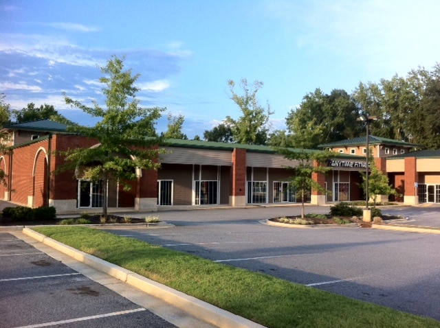
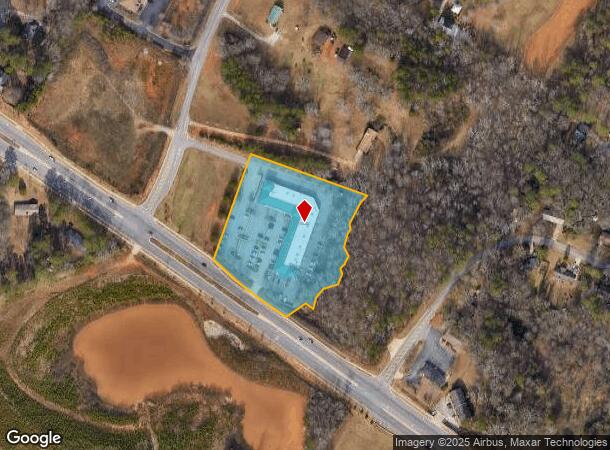
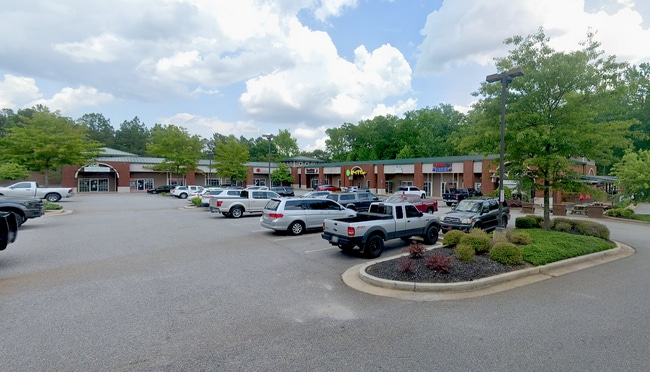
1260 Mars Hill Rd
Other Market Areas
The Village At Manders Crossing
Athens-Clarke County, GA
1757/493 1263/454 32/36
C-02AE002
Oconee
Stripcommercialcenter
Georgia
2024
2
2024
3.82 AC
030202
Athens/Gainesville
25,506 SF
DEMOGRAPHICS near 1260 Mars Hill Rd
1 Mile
3 Mile
5 Mile
2024 Total Population
2,371
16,060
50,926
2029 Population
2,641
18,050
54,601
Pop Growth 2024-2029
+ 11.39%
+ 12.39%
+ 7.22%
Average Age
39
39
38
2024 Total Households
812
5,552
19,526
HH Growth 2024-2029
+ 11.45%
+ 12.39%
+ 6.55%
Median Household Inc
$88,970
$103,849
$81,337
Avg Household Size
2.90
2.90
2.60
2024 Avg HH Vehicles
2.00
2.00
2.00
Median Home Value
$330,991
$359,230
$345,097
Median Year Built
1986
1992
1994
Nearby Places
Map Layers
Map Styles
 Street
 Aerial
- Restaurants
- Banks
- Shops
- Fitness
- Groceries
SALE & LEASE HISTORY
LISTING DATE
SALE/LEASE

Sep 25, 2016
For Lease
Sep 07, 2018
For Lease
Oct 04, 2023
For Sale
Jul 25, 2017
For Lease
Jan 26, 2017
For Lease
Jan 09, 2017
For Lease
Apr 14, 2021
For Lease
Nearby Properties
Address
Land Use
TOTAL SIZE
Lot Size
Zoning
Address
Land Use
TOTAL SIZE
Lot Size
Zoning
98,402 SF
8.11 AC
B-2
Address
Land Use
TOTAL SIZE
Lot Size
Zoning
108,668 SF
37.79 AC
001
Address
Land Use
TOTAL SIZE
Lot Size
Zoning
20,748 SF
80.77 AC
AG
Address
Land Use
TOTAL SIZE
Lot Size
Zoning
Address
Land Use
TOTAL SIZE
Lot Size
Zoning
107,030 SF
34.62 AC
AR
Address
Land Use
TOTAL SIZE
Lot Size
Zoning
154,270 SF
23.19 AC
Address
Land Use
TOTAL SIZE
Lot Size
Zoning
17,356 SF
10.66 AC
B-2
Address
Land Use
TOTAL SIZE
Lot Size
Zoning
70,000 SF
5.40 AC
O-B-P
Address
Land Use
TOTAL SIZE
Lot Size
Zoning
90,670 SF
11.86 AC
B-2
Address
Land Use
TOTAL SIZE
Lot Size
Zoning
12,483 SF
8.13 AC
Address
Land Use
TOTAL SIZE
Lot Size
Zoning
68,931 SF
5.56 AC
O-B-P
Address
Land Use
TOTAL SIZE
Lot Size
Zoning
4.86 AC
B-1
Address
Land Use
TOTAL SIZE
Lot Size
Zoning
29,376 SF
197.43 AC
AG
Address
Land Use
TOTAL SIZE
Lot Size
Zoning
58,725 SF
3.14 AC
B-2
Address
Land Use
TOTAL SIZE
Lot Size
Zoning
24,826 SF
4.80 AC
B-2
Address
Land Use
TOTAL SIZE
Lot Size
Zoning
5,216 SF
12.81 AC
R-3
Address
Land Use
TOTAL SIZE
Lot Size
Zoning
154,871 SF
27.16 AC
B-1
Address
Land Use
TOTAL SIZE
Lot Size
Zoning
29,032 SF
14 AC
AG
Address
Land Use
TOTAL SIZE
Lot Size
Zoning
76,360 SF
10.25 AC
B-1
Address
Land Use
TOTAL SIZE
Lot Size
Zoning
37,572 SF
0.43 AC
O-B-P
Address
Land Use
TOTAL SIZE
Lot Size
Zoning
51,646 SF
3.53 AC
B-2
Address
Land Use
TOTAL SIZE
Lot Size
Zoning
13,584 SF
18.46 AC
B-2
Address
Land Use
TOTAL SIZE
Lot Size
Zoning
36,822 SF
2.57 AC
B-2
Address
Land Use
TOTAL SIZE
Lot Size
Zoning
57,735 SF
35 AC
AG
Address
Land Use
TOTAL SIZE
Lot Size
Zoning
135,129 SF
14.75 AC
B-1
Address
Land Use
TOTAL SIZE
Lot Size
Zoning
37,572 SF
0.43 AC
O-B-P
Address
Land Use
TOTAL SIZE
Lot Size
Zoning
20,714 SF
2.56 AC
Address
Land Use
TOTAL SIZE
Lot Size
Zoning
25,519 SF
7.63 AC
OIP
Address
Land Use
TOTAL SIZE
Lot Size
Zoning
23,265 SF
2.23 AC
B-2
Address
Land Use
TOTAL SIZE
Lot Size
Zoning
45,945 SF
2.27 AC
OIP
The World's #1 Commercial Real Estate Marketplace
Connect with us
© 2025 CoStar Group
The information above has been obtained from sources believed reliable. While we do not doubt its accuracy we have not verified it and make no guarantee, warranty or representation about it. It is your responsibility to independently confirm its accuracy and completeness. Any projections, opinions, assumptions, or estimates used are for example only and do not represent the current or future performance of the property. The value of this transaction to you depends on tax and other factors which should be evaluated by your tax, financial, and legal advisors. You and your advisors should conduct a careful, independent investigation of the property to determine to your satisfaction the suitability of the property for your needs.