Property Record
12600 S Torrence Ave, Chicago, IL 60633
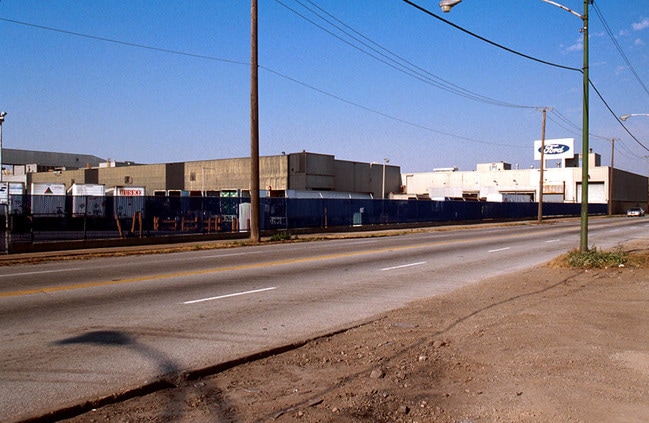

Property Detail
12600 S Torrence Ave
25-25-402-001-0000
(TAYLOR) & (KREIGHS) SUB OF EH NW SEC 04-38-14
Industrialgeneral
Cook
PMD 6
Illinois
A Areas with a 1% annual chance of flooding and a 26% chance of flooding over the life of a 30-year mortgage.
5,9
2023
65.94 AC
2025
South Chicago
838800
Chicago
8,400 SF
Chicago-Naperville-Elgin, IL-IN
NEARBY LISTINGS FOR SALE OR LEASE
DEMOGRAPHICS near 12600 S Torrence Ave
1 mile
3 mile
5 mile
2025 Total Population
4,538
62,229
268,694
2030 Population
4,466
62,219
270,498
Pop Growth 2025-2030
(1.59%)
(0.02%)
+ 0.67%
Average Age
40
39
40
2025 Total Households
1,634
22,667
100,131
HH Growth 2025-2030
(1.90%)
(0.24%)
+ 0.48%
Median Household Inc
$65,044
$52,027
$52,446
Avg Household Size
2.80
2.70
2.60
2025 Avg HH Vehicles
2.00
1.00
1.00
Median Home Value
$167,137
$163,181
$156,687
Median Year Built
1952
1958
1953
Nearby Places
Map Layers
Map Styles
 Street
 Aerial
Layers
 Traffic
 Biking
Places
Listings with unknown addresses are not visible on the map
- Restaurants
- Banks
- Shops
- Fitness
- Groceries
PUBLIC TRANSPORTATION
COMMUTER RAIL
Hegewisch Station (South Shore Line - Northern Indiana Commuter Transportation District (South Shore Line))
Drive
Walk
Distance
Hegewisch Station (South Shore Line - Northern Indiana Commuter Transportation District (South Shore Line))
4 min
1.6 mi
Kensington Street Station (Metra Electric Line - Northeast Illinois Regional Commuter Railroad (Metra), South Shore Line - Northeast Illinois Regional Commuter Railroad (Metra))
Drive
Walk
Distance
Kensington Street Station (Metra Electric Line - Northeast Illinois Regional Commuter Railroad (Metra), South Shore Line - Northeast Illinois Regional Commuter Railroad (Metra))
9 min
4.5 mi
AIRPORT
Chicago Midway International
Drive
Walk
Distance
Chicago Midway International
32 min
19.2 mi
Chicago O'Hare International
Drive
Walk
Distance
Chicago O'Hare International
54 min
36.3 mi
Freight Ports
Port Milwaukee
Drive
Walk
Distance
Port Milwaukee
132 min
104.5 mi
Nearby Properties
Address
Land Use
TOTAL SIZE
Lot Size
Zoning
Address
Land Use
TOTAL SIZE
Lot Size
Zoning
99,042 SF
255 AC
Address
Land Use
TOTAL SIZE
Lot Size
Zoning
790,642 SF
37.20 AC
Address
Land Use
TOTAL SIZE
Lot Size
Zoning
29.25 AC
PMD 6
Address
Land Use
TOTAL SIZE
Lot Size
Zoning
600,448 SF
36.42 AC
Address
Land Use
TOTAL SIZE
Lot Size
Zoning
344,488 SF
30.19 AC
Address
Land Use
TOTAL SIZE
Lot Size
Zoning
92,633 SF
8 AC
Address
Land Use
TOTAL SIZE
Lot Size
Zoning
164,909 SF
14.28 AC
PD 248
Address
Land Use
TOTAL SIZE
Lot Size
Zoning
17,692 SF
32.17 AC
Address
Land Use
TOTAL SIZE
Lot Size
Zoning
547,200 SF
29.76 AC
PD 804
Address
Land Use
TOTAL SIZE
Lot Size
Zoning
361,023 SF
Address
Land Use
TOTAL SIZE
Lot Size
Zoning
65,830 SF
6.30 AC
R3
Address
Land Use
TOTAL SIZE
Lot Size
Zoning
11,862 SF
137.06 AC
Address
Land Use
TOTAL SIZE
Lot Size
Zoning
17,360 SF
6.74 AC
Address
Land Use
TOTAL SIZE
Lot Size
Zoning
460,800 SF
20.63 AC
PD 804
Address
Land Use
TOTAL SIZE
Lot Size
Zoning
607,000 SF
Address
Land Use
TOTAL SIZE
Lot Size
Zoning
387,750 SF
20.33 AC
PD 804
Address
Land Use
TOTAL SIZE
Lot Size
Zoning
12,334 SF
53.37 AC
PD 1160
Address
Land Use
TOTAL SIZE
Lot Size
Zoning
6,047 SF
0.58 AC
Address
Land Use
TOTAL SIZE
Lot Size
Zoning
542,852 SF
PMD 6,M2-1
Address
Land Use
TOTAL SIZE
Lot Size
Zoning
5,300 SF
36.84 AC
PMD 6
Address
Land Use
TOTAL SIZE
Lot Size
Zoning
74,754 SF
8.18 AC
Address
Land Use
TOTAL SIZE
Lot Size
Zoning
155,765 SF
8.75 AC
PD 1167
Address
Land Use
TOTAL SIZE
Lot Size
Zoning
35,157 SF
2.11 AC
Address
Land Use
TOTAL SIZE
Lot Size
Zoning
Address
Land Use
TOTAL SIZE
Lot Size
Zoning
20,539 SF
1.73 AC
Address
Land Use
TOTAL SIZE
Lot Size
Zoning
362,552 SF
44.53 AC
PD 1350
Address
Land Use
TOTAL SIZE
Lot Size
Zoning
298,886 SF
7.50 AC
PMD 6
Address
Land Use
TOTAL SIZE
Lot Size
Zoning
247,000 SF
17.85 AC
PMD 6,PD 8
Address
Land Use
TOTAL SIZE
Lot Size
Zoning
37,306 SF
8.38 AC
M3-3
The World's #1 Commercial Real Estate Marketplace
Connect with us
© 2026 CoStar Group
The information above has been obtained from sources believed reliable. While we do not doubt its accuracy we have not verified it and make no guarantee, warranty or representation about it. It is your responsibility to independently confirm its accuracy and completeness. Any projections, opinions, assumptions, or estimates used are for example only and do not represent the current or future performance of the property. The value of this transaction to you depends on tax and other factors which should be evaluated by your tax, financial, and legal advisors. You and your advisors should conduct a careful, independent investigation of the property to determine to your satisfaction the suitability of the property for your needs.