Property Record
12607 Ne 119Th St, Kirkland, WA 98034
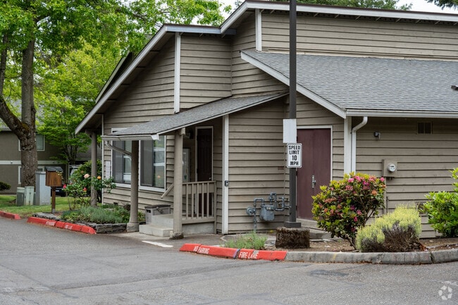

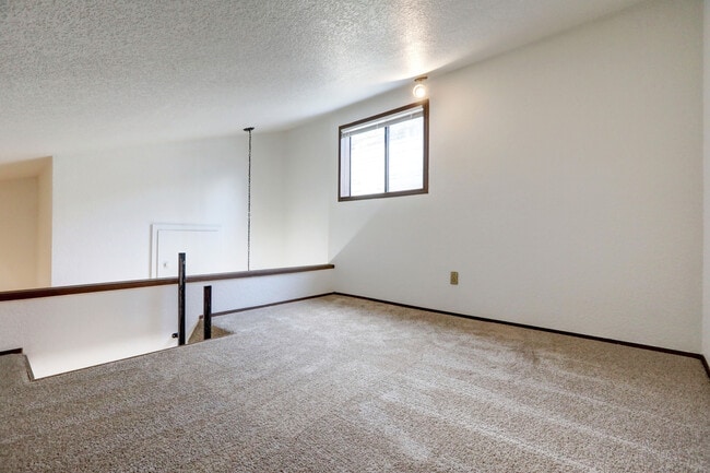
This Property Is For Sale
NEARBY LISTINGS FOR SALE OR LEASE
Property Detail
12607 Ne 119Th St
Seattle/Puget Sound
Studio Eight(0005)
Seattle-Tacoma-Bellevue, WA
King
806310-0005
Washington
Condominium
0.23 AC
X
North Rose Hill
53033C0358H
DEMOGRAPHICS near 12607 Ne 119Th St
1 Mile
3 Mile
5 Mile
2024 Total Population
13,003
118,507
246,128
2029 Population
13,218
119,916
248,675
Pop Growth 2024-2029
+ 1.65%
+ 1.19%
+ 1.03%
Average Age
38
39
39
2024 Total Households
5,476
47,601
99,908
HH Growth 2024-2029
+ 1.61%
+ 1.18%
+ 1.06%
Median Household Inc
$108,202
$137,395
$139,021
Avg Household Size
2.30
2.40
2.40
2024 Avg HH Vehicles
2.00
2.00
2.00
Median Home Value
$870,531
$911,017
$934,418
Median Year Built
1987
1986
1987
Nearby Places
Map Layers
Map Styles
 Street
 Aerial
- Restaurants
- Banks
- Shops
- Fitness
- Groceries
PUBLIC TRANSPORTATION
AIRPORT
Seattle Paine Field International
DRIVE
WALK
Distance
Seattle Paine Field International
25 min
17.0 mi
Seattle-Tacoma International
DRIVE
WALK
Distance
Seattle-Tacoma International
34 min
23.6 mi
Freight Ports
Port of Seattle
DRIVE
WALK
Distance
Port of Seattle
29 min
19.3 mi
Nearby Properties
Address
Land Use
TOTAL SIZE
Lot Size
Zoning
Address
Land Use
TOTAL SIZE
Lot Size
Zoning
570,472 SF
17.39 AC
TL 3A
Address
Land Use
TOTAL SIZE
Lot Size
Zoning
407,216 SF
45.12 AC
PLA 9
Address
Land Use
TOTAL SIZE
Lot Size
Zoning
747,347 SF
8.91 AC
BP
Address
Land Use
TOTAL SIZE
Lot Size
Zoning
11,970 SF
4.81 AC
TL 6A
Address
Land Use
TOTAL SIZE
Lot Size
Zoning
572,539 SF
2.50 AC
CBD 5A
Address
Land Use
TOTAL SIZE
Lot Size
Zoning
364,208 SF
16.94 AC
NMF
Address
Land Use
TOTAL SIZE
Lot Size
Zoning
279,488 SF
20.82 AC
NMF
Address
Land Use
TOTAL SIZE
Lot Size
Zoning
209,400 SF
1.80 AC
TSQ
Address
Land Use
TOTAL SIZE
Lot Size
Zoning
98,914 SF
10.38 AC
SMT
Address
Land Use
TOTAL SIZE
Lot Size
Zoning
212,688 SF
1.46 AC
JBD 1
Address
Land Use
TOTAL SIZE
Lot Size
Zoning
173,119 SF
1.50 AC
SMT
Address
Land Use
TOTAL SIZE
Lot Size
Zoning
177,772 SF
2.03 AC
JBD 1
Address
Land Use
TOTAL SIZE
Lot Size
Zoning
231,840 SF
22.82 AC
RMA 2.4
Address
Land Use
TOTAL SIZE
Lot Size
Zoning
7,381 SF
1.30 AC
CBD 1B
Address
Land Use
TOTAL SIZE
Lot Size
Zoning
159,152 SF
2.83 AC
JBD 1
Address
Land Use
TOTAL SIZE
Lot Size
Zoning
211,344 SF
7.78 AC
RVT
Address
Land Use
TOTAL SIZE
Lot Size
Zoning
272,800 SF
19.26 AC
RM 2.4
Address
Land Use
TOTAL SIZE
Lot Size
Zoning
213,200 SF
5.90 AC
SMT
Address
Land Use
TOTAL SIZE
Lot Size
Zoning
73,729 SF
42.57 AC
RSX 7.2
Address
Land Use
TOTAL SIZE
Lot Size
Zoning
261,010 SF
24.27 AC
NR
Address
Land Use
TOTAL SIZE
Lot Size
Zoning
444,618 SF
4.78 AC
PLA 6G
Address
Land Use
TOTAL SIZE
Lot Size
Zoning
100,736 SF
0.96 AC
CBD 1B
Address
Land Use
TOTAL SIZE
Lot Size
Zoning
65,622 SF
6.20 AC
LIT
Address
Land Use
TOTAL SIZE
Lot Size
Zoning
187,860 SF
12.68 AC
TL 11
Address
Land Use
TOTAL SIZE
Lot Size
Zoning
43,016 SF
10.33 AC
TL 2
Address
Land Use
TOTAL SIZE
Lot Size
Zoning
1.62 AC
NWDD
Address
Land Use
TOTAL SIZE
Lot Size
Zoning
134,918 SF
1.55 AC
CBD 6
Address
Land Use
TOTAL SIZE
Lot Size
Zoning
147,795 SF
1.17 AC
TSQ
Address
Land Use
TOTAL SIZE
Lot Size
Zoning
220,523 SF
11.63 AC
BP
The World's #1 Commercial Real Estate Marketplace
Connect with us
© 2025 CoStar Group
The information above has been obtained from sources believed reliable. While we do not doubt its accuracy we have not verified it and make no guarantee, warranty or representation about it. It is your responsibility to independently confirm its accuracy and completeness. Any projections, opinions, assumptions, or estimates used are for example only and do not represent the current or future performance of the property. The value of this transaction to you depends on tax and other factors which should be evaluated by your tax, financial, and legal advisors. You and your advisors should conduct a careful, independent investigation of the property to determine to your satisfaction the suitability of the property for your needs.