Property Record
1261 Babbitt Rd, Euclid, OH 44132
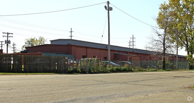

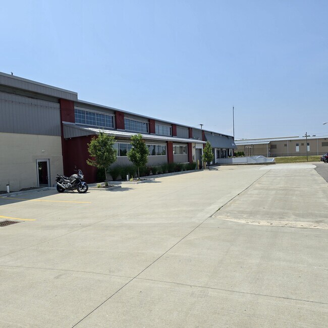

Property Detail
1261 Babbitt Rd
648-03-002
18 39
Lightindustrial
Cuyahoga
U6
Ohio
B and X Area of moderate flood hazard, usually the area between the limits of the 100-year and 500-year floods.
18
2025
4.55 AC
2025
Euclid
152303
Cleveland
102,935 SF
Cleveland-Elyria, OH
NEARBY LISTINGS FOR SALE OR LEASE
DEMOGRAPHICS near 1261 Babbitt Rd
1 mile
3 mile
5 mile
2025 Total Population
11,628
84,379
180,517
2030 Population
11,673
84,484
180,429
Pop Growth 2025-2030
+ 0.39%
+ 0.12%
(0.05%)
Average Age
39
42
43
2025 Total Households
5,370
39,427
82,904
HH Growth 2025-2030
+ 0.34%
+ 0.18%
(0.02%)
Median Household Inc
$39,999
$51,213
$55,117
Avg Household Size
2.10
2.10
2.10
2025 Avg HH Vehicles
1.00
1.00
1.00
Median Home Value
$109,124
$145,701
$157,758
Median Year Built
1960
1957
1957
Nearby Places
Map Layers
Map Styles
 Street
 Aerial
Layers
 Traffic
 Biking
Places
Listings with unknown addresses are not visible on the map
- Restaurants
- Banks
- Shops
- Fitness
- Groceries
PUBLIC TRANSPORTATION
AIRPORT
Cleveland-Hopkins International
Drive
Walk
Distance
Cleveland-Hopkins International
38 min
25.6 mi
SALE & LEASE HISTORY
LISTING DATE
SALE/LEASE

Nov 28, 2023
For Lease
Jul 10, 2019
For Sale
Dec 31, 2019
For Lease
Nearby Properties
Address
Land Use
TOTAL SIZE
Lot Size
Zoning
Address
Land Use
TOTAL SIZE
Lot Size
Zoning
71.14 AC
U4
Address
Land Use
TOTAL SIZE
Lot Size
Zoning
44,577 SF
39.90 AC
SI
Address
Land Use
TOTAL SIZE
Lot Size
Zoning
386,776 SF
14.70 AC
CI
Address
Land Use
TOTAL SIZE
Lot Size
Zoning
112,657 SF
19.88 AC
U3
Address
Land Use
TOTAL SIZE
Lot Size
Zoning
149,685 SF
27.66 AC
R-1
Address
Land Use
TOTAL SIZE
Lot Size
Zoning
19,776 SF
13.41 AC
CI
Address
Land Use
TOTAL SIZE
Lot Size
Zoning
166,392 SF
36.46 AC
RMF-2
Address
Land Use
TOTAL SIZE
Lot Size
Zoning
1,283,872 SF
11.33 AC
U3
Address
Land Use
TOTAL SIZE
Lot Size
Zoning
190,580 SF
7.90 AC
P.F.
Address
Land Use
TOTAL SIZE
Lot Size
Zoning
208,119 SF
72.98 AC
1-R
Address
Land Use
TOTAL SIZE
Lot Size
Zoning
2.53 AC
U6
Address
Land Use
TOTAL SIZE
Lot Size
Zoning
628,514 SF
25.95 AC
B-2
Address
Land Use
TOTAL SIZE
Lot Size
Zoning
39.06 AC
U6
Address
Land Use
TOTAL SIZE
Lot Size
Zoning
275,040 SF
9.07 AC
U3
Address
Land Use
TOTAL SIZE
Lot Size
Zoning
628,514 SF
0.67 AC
B-2
Address
Land Use
TOTAL SIZE
Lot Size
Zoning
300,691 SF
36.39 AC
1R
Address
Land Use
TOTAL SIZE
Lot Size
Zoning
10,200 SF
23.91 AC
Address
Land Use
TOTAL SIZE
Lot Size
Zoning
44,875 SF
4.87 AC
I-1
Address
Land Use
TOTAL SIZE
Lot Size
Zoning
400,985 SF
34.80 AC
CI
Address
Land Use
TOTAL SIZE
Lot Size
Zoning
34.14 AC
U6
Address
Land Use
TOTAL SIZE
Lot Size
Zoning
47,055 SF
154.97 AC
I-1
Address
Land Use
TOTAL SIZE
Lot Size
Zoning
27,466 SF
13.39 AC
U6
Address
Land Use
TOTAL SIZE
Lot Size
Zoning
92,659 SF
4.25 AC
M
Address
Land Use
TOTAL SIZE
Lot Size
Zoning
175,620 SF
8.65 AC
M
Address
Land Use
TOTAL SIZE
Lot Size
Zoning
208,610 SF
7.54 AC
M
Address
Land Use
TOTAL SIZE
Lot Size
Zoning
263,441 SF
17.18 AC
I
Address
Land Use
TOTAL SIZE
Lot Size
Zoning
827,164 SF
8 AC
U3
Address
Land Use
TOTAL SIZE
Lot Size
Zoning
70,574 SF
6.35 AC
CI
Address
Land Use
TOTAL SIZE
Lot Size
Zoning
70,643 SF
8.26 AC
CI
Address
Land Use
TOTAL SIZE
Lot Size
Zoning
358,547 SF
8.22 AC
U3EL
The World's #1 Commercial Real Estate Marketplace
Connect with us
© 2026 CoStar Group
The information above has been obtained from sources believed reliable. While we do not doubt its accuracy we have not verified it and make no guarantee, warranty or representation about it. It is your responsibility to independently confirm its accuracy and completeness. Any projections, opinions, assumptions, or estimates used are for example only and do not represent the current or future performance of the property. The value of this transaction to you depends on tax and other factors which should be evaluated by your tax, financial, and legal advisors. You and your advisors should conduct a careful, independent investigation of the property to determine to your satisfaction the suitability of the property for your needs.