Property Record
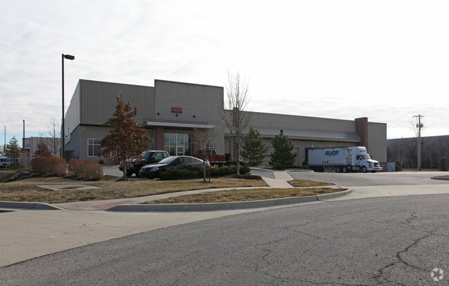
12615 W 92Nd St, Lenexa, KS 66215


Property Detail
12615 W 92Nd St
IP64650000-0002A
ROSEHILL EXECUTIVE BUSINESS PARK SECOND PLAT PT LT 2 BG SECR W 293.57 TO SW CR N 143.99 NE CUR LF 84.57 NE 104.20 E 169.27 S 249 TO POB LEC 195 4 2A
Warehouse
Johnson
BP2
Kansas
B and X Area of moderate flood hazard, usually the area between the limits of the 100-year and 500-year floods.
2
2024
1.59 AC
2025
Lenexa
052417
Kansas City
24,340 SF
Kansas City, MO-KS
NEARBY LISTINGS FOR SALE OR LEASE
DEMOGRAPHICS near 12615 W 92Nd St
1 mile
3 mile
5 mile
2025 Total Population
9,883
100,132
231,351
2030 Population
10,223
103,187
238,839
Pop Growth 2025-2030
+ 3.44%
+ 3.05%
+ 3.24%
Average Age
39
40
41
2025 Total Households
4,367
43,494
100,804
HH Growth 2025-2030
+ 3.85%
+ 3.20%
+ 3.35%
Median Household Inc
$67,488
$84,891
$87,671
Avg Household Size
2.10
2.20
2.20
2025 Avg HH Vehicles
2.00
2.00
2.00
Median Home Value
$275,192
$327,349
$343,554
Median Year Built
1979
1979
1981
Nearby Places
Map Layers
Map Styles
 Street
 Aerial
Layers
 Traffic
 Biking
Places
Listings with unknown addresses are not visible on the map
- Restaurants
- Banks
- Shops
- Fitness
- Groceries
PUBLIC TRANSPORTATION
AIRPORT
Kansas City International
Drive
Walk
Distance
Kansas City International
42 min
31.6 mi
Nearby Properties
Address
Land Use
TOTAL SIZE
Lot Size
Zoning
Address
Land Use
TOTAL SIZE
Lot Size
Zoning
1,051,458 SF
74.32 AC
R-1
Address
Land Use
TOTAL SIZE
Lot Size
Zoning
787,363 SF
88.91 AC
RP5
Address
Land Use
TOTAL SIZE
Lot Size
Zoning
203,079 SF
8.10 AC
BP2
Address
Land Use
TOTAL SIZE
Lot Size
Zoning
247,991 SF
21.19 AC
R-1
Address
Land Use
TOTAL SIZE
Lot Size
Zoning
208,693 SF
22.30 AC
BP1
Address
Land Use
TOTAL SIZE
Lot Size
Zoning
148,018 SF
7.14 AC
MXD
Address
Land Use
TOTAL SIZE
Lot Size
Zoning
238,812 SF
37.40 AC
R-1
Address
Land Use
TOTAL SIZE
Lot Size
Zoning
199,452 SF
29.81 AC
R-1
Address
Land Use
TOTAL SIZE
Lot Size
Zoning
133,932 SF
3.29 AC
CC
Address
Land Use
TOTAL SIZE
Lot Size
Zoning
512,680 SF
18.03 AC
R-1
Address
Land Use
TOTAL SIZE
Lot Size
Zoning
304,926 SF
7.87 AC
CC
Address
Land Use
TOTAL SIZE
Lot Size
Zoning
166,039 SF
35.38 AC
R-1
Address
Land Use
TOTAL SIZE
Lot Size
Zoning
49,029 SF
15.02 AC
BP1
Address
Land Use
TOTAL SIZE
Lot Size
Zoning
222,396 SF
14.76 AC
BP2
Address
Land Use
TOTAL SIZE
Lot Size
Zoning
62,293 SF
6.50 AC
MXD
Address
Land Use
TOTAL SIZE
Lot Size
Zoning
89,226 SF
4.37 AC
R-1
Address
Land Use
TOTAL SIZE
Lot Size
Zoning
146,143 SF
10.59 AC
CP-2
Address
Land Use
TOTAL SIZE
Lot Size
Zoning
81,762 SF
9.66 AC
R-1
Address
Land Use
TOTAL SIZE
Lot Size
Zoning
120,492 SF
10 AC
R1
Address
Land Use
TOTAL SIZE
Lot Size
Zoning
411,435 SF
17.41 AC
CP-2
Address
Land Use
TOTAL SIZE
Lot Size
Zoning
94,034 SF
6.96 AC
MXD
Address
Land Use
TOTAL SIZE
Lot Size
Zoning
72,994 SF
7.99 AC
RP3
Address
Land Use
TOTAL SIZE
Lot Size
Zoning
85,703 SF
7.84 AC
R-1
Address
Land Use
TOTAL SIZE
Lot Size
Zoning
49,282 SF
11.89 AC
RP1
Address
Land Use
TOTAL SIZE
Lot Size
Zoning
85,940 SF
9.08 AC
RGA
Address
Land Use
TOTAL SIZE
Lot Size
Zoning
139,880 SF
17.18 AC
R1
Address
Land Use
TOTAL SIZE
Lot Size
Zoning
89,002 SF
8.77 AC
R-1
Address
Land Use
TOTAL SIZE
Lot Size
Zoning
79,737 SF
11.90 AC
R-1
Address
Land Use
TOTAL SIZE
Lot Size
Zoning
36,903 SF
0.55 AC
CC
Address
Land Use
TOTAL SIZE
Lot Size
Zoning
471,323 SF
6.25 AC
MXD
The World's #1 Commercial Real Estate Marketplace
Connect with us
© 2026 CoStar Group
The information above has been obtained from sources believed reliable. While we do not doubt its accuracy we have not verified it and make no guarantee, warranty or representation about it. It is your responsibility to independently confirm its accuracy and completeness. Any projections, opinions, assumptions, or estimates used are for example only and do not represent the current or future performance of the property. The value of this transaction to you depends on tax and other factors which should be evaluated by your tax, financial, and legal advisors. You and your advisors should conduct a careful, independent investigation of the property to determine to your satisfaction the suitability of the property for your needs.