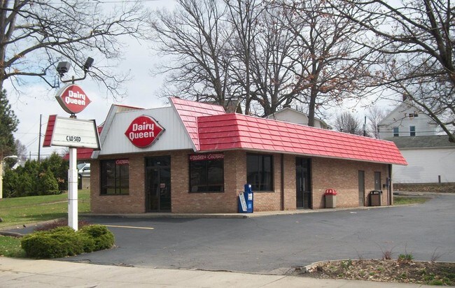
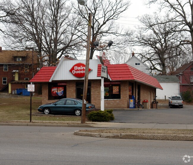
Property Record
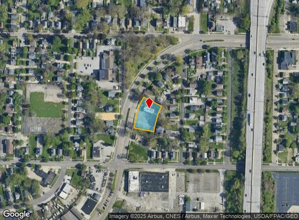
1262 Kenmore Blvd, Akron, OH 44314
NEARBY LISTINGS FOR SALE OR LEASE
Property Detail
1262 Kenmore Blvd
Cleveland
Kenmore Allotment
Akron, OH
KENMORE LOTS 241- 244 ALL
67-31888
Summit
Restaurantbuilding
Ohio
2023
242
2025
0.52 AC
505700
Akron
1,827 SF
DEMOGRAPHICS near 1262 Kenmore Blvd
1 Mile
3 Mile
5 Mile
2024 Total Population
11,631
67,005
166,107
2029 Population
11,581
66,674
165,410
Pop Growth 2024-2029
(0.43%)
(0.49%)
(0.42%)
Average Age
39
41
40
2024 Total Households
5,000
29,281
72,150
HH Growth 2024-2029
(0.46%)
(0.58%)
(0.46%)
Median Household Inc
$41,490
$40,866
$42,315
Avg Household Size
2.30
2.20
2.20
2024 Avg HH Vehicles
2.00
2.00
2.00
Median Home Value
$62,922
$82,844
$109,844
Median Year Built
1949
1953
1953
Nearby Places
Map Layers
Map Styles
 Street
 Aerial
- Restaurants
- Banks
- Shops
- Fitness
- Groceries
PUBLIC TRANSPORTATION
COMMUTER RAIL
Akron Northside (National Park Scenic Railway - Cuyahoga Valley Scenic Railroad)
DRIVE
WALK
Distance
Akron Northside (National Park Scenic Railway - Cuyahoga Valley Scenic Railroad)
12 min
5.2 mi
Big Bend (National Park Scenic Railway - Cuyahoga Valley Scenic Railroad)
DRIVE
WALK
Distance
Big Bend (National Park Scenic Railway - Cuyahoga Valley Scenic Railroad)
18 min
7.4 mi
AIRPORT
Akron-Canton Regional
DRIVE
WALK
Distance
Akron-Canton Regional
20 min
14.4 mi
Cleveland-Hopkins International
DRIVE
WALK
Distance
Cleveland-Hopkins International
56 min
40.2 mi
Freight Ports
Port of Toledo
DRIVE
WALK
Distance
Port of Toledo
160 min
135.4 mi
Nearby Properties
Address
Land Use
TOTAL SIZE
Lot Size
Zoning
Address
Land Use
TOTAL SIZE
Lot Size
Zoning
1,397,532 SF
92.95 AC
Address
Land Use
TOTAL SIZE
Lot Size
Zoning
252,222 SF
12.65 AC
Address
Land Use
TOTAL SIZE
Lot Size
Zoning
203,458 SF
10.41 AC
Address
Land Use
TOTAL SIZE
Lot Size
Zoning
9.19 AC
Address
Land Use
TOTAL SIZE
Lot Size
Zoning
Address
Land Use
TOTAL SIZE
Lot Size
Zoning
132,611 SF
3.56 AC
Address
Land Use
TOTAL SIZE
Lot Size
Zoning
91,678 SF
5.24 AC
Address
Land Use
TOTAL SIZE
Lot Size
Zoning
Address
Land Use
TOTAL SIZE
Lot Size
Zoning
166,625 SF
11.37 AC
Address
Land Use
TOTAL SIZE
Lot Size
Zoning
Address
Land Use
TOTAL SIZE
Lot Size
Zoning
227,634 SF
21.46 AC
Address
Land Use
TOTAL SIZE
Lot Size
Zoning
184,791 SF
3.25 AC
Address
Land Use
TOTAL SIZE
Lot Size
Zoning
154,926 SF
12.38 AC
Address
Land Use
TOTAL SIZE
Lot Size
Zoning
127,297 SF
6.03 AC
Address
Land Use
TOTAL SIZE
Lot Size
Zoning
Address
Land Use
TOTAL SIZE
Lot Size
Zoning
121,006 SF
6.09 AC
Address
Land Use
TOTAL SIZE
Lot Size
Zoning
295,142 SF
24.69 AC
Address
Land Use
TOTAL SIZE
Lot Size
Zoning
57,180 SF
6.67 AC
Address
Land Use
TOTAL SIZE
Lot Size
Zoning
123,800 SF
76.50 AC
Address
Land Use
TOTAL SIZE
Lot Size
Zoning
54,398 SF
8.10 AC
Address
Land Use
TOTAL SIZE
Lot Size
Zoning
Address
Land Use
TOTAL SIZE
Lot Size
Zoning
148.10 AC
Address
Land Use
TOTAL SIZE
Lot Size
Zoning
51,520 SF
2.70 AC
Address
Land Use
TOTAL SIZE
Lot Size
Zoning
81,108 SF
3.86 AC
Address
Land Use
TOTAL SIZE
Lot Size
Zoning
253,690 SF
12.18 AC
Address
Land Use
TOTAL SIZE
Lot Size
Zoning
130,893 SF
11.70 AC
Address
Land Use
TOTAL SIZE
Lot Size
Zoning
Address
Land Use
TOTAL SIZE
Lot Size
Zoning
59,492 SF
5.51 AC
Address
Land Use
TOTAL SIZE
Lot Size
Zoning
63,918 SF
4.95 AC
Address
Land Use
TOTAL SIZE
Lot Size
Zoning
112,894 SF
12.26 AC
The World's #1 Commercial Real Estate Marketplace
Connect with us
© 2025 CoStar Group
The information above has been obtained from sources believed reliable. While we do not doubt its accuracy we have not verified it and make no guarantee, warranty or representation about it. It is your responsibility to independently confirm its accuracy and completeness. Any projections, opinions, assumptions, or estimates used are for example only and do not represent the current or future performance of the property. The value of this transaction to you depends on tax and other factors which should be evaluated by your tax, financial, and legal advisors. You and your advisors should conduct a careful, independent investigation of the property to determine to your satisfaction the suitability of the property for your needs.