Property Record
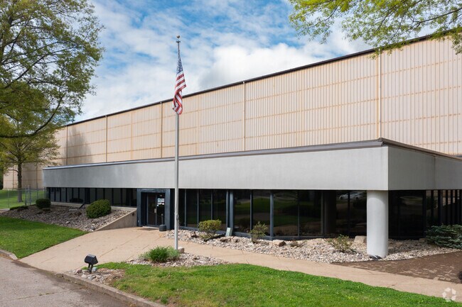
1262 Us Route 50, Milford, OH 45150


NEARBY LISTINGS FOR SALE OR LEASE
Property Detail
1262 Us Route 50
19-24-08B-048
Strvens Military Survey 1675 And 1676
Manufacturinglight
.193 SPLIT TO 182408B001.
X
Clermont
39025C0138G
Ohio
2024
17.22 AC
2024
East
040600
Cincinnati/Dayton
52,774 SF
Cincinnati, OH-KY-IN
DEMOGRAPHICS near 1262 Us Route 50
1 Mile
3 Mile
5 Mile
2024 Total Population
342
23,015
81,628
2029 Population
348
23,490
83,743
Pop Growth 2024-2029
+ 1.75%
+ 2.06%
+ 2.59%
Average Age
42
40
41
2024 Total Households
132
8,397
33,174
HH Growth 2024-2029
+ 1.52%
+ 2.12%
+ 2.71%
Median Household Inc
$88,749
$88,070
$71,805
Avg Household Size
2.60
2.70
2.40
2024 Avg HH Vehicles
2.00
2.00
2.00
Median Home Value
$249,122
$239,491
$233,519
Median Year Built
1988
1983
1983
Nearby Places
Map Layers
Map Styles
 Street
 Aerial
- Restaurants
- Banks
- Shops
- Fitness
- Groceries
PUBLIC TRANSPORTATION
AIRPORT
Cincinnati/Northern Kentucky International
DRIVE
WALK
Distance
Cincinnati/Northern Kentucky International
49 min
33.2 mi
SALE & LEASE HISTORY
LISTING DATE
SALE/LEASE

Oct 24, 2019
For Lease
Oct 03, 2019
For Lease
Nearby Properties
Address
Land Use
TOTAL SIZE
Lot Size
Zoning
Address
Land Use
TOTAL SIZE
Lot Size
Zoning
315,096 SF
9.48 AC
Address
Land Use
TOTAL SIZE
Lot Size
Zoning
2,555 SF
23.68 AC
Address
Land Use
TOTAL SIZE
Lot Size
Zoning
43,511 SF
12.36 AC
Address
Land Use
TOTAL SIZE
Lot Size
Zoning
14.24 AC
Address
Land Use
TOTAL SIZE
Lot Size
Zoning
10.89 AC
Address
Land Use
TOTAL SIZE
Lot Size
Zoning
Address
Land Use
TOTAL SIZE
Lot Size
Zoning
221,360 SF
34.62 AC
Address
Land Use
TOTAL SIZE
Lot Size
Zoning
59,730 SF
9.28 AC
Address
Land Use
TOTAL SIZE
Lot Size
Zoning
4,938 SF
18.99 AC
Address
Land Use
TOTAL SIZE
Lot Size
Zoning
75,944 SF
4.09 AC
Address
Land Use
TOTAL SIZE
Lot Size
Zoning
26,878 SF
14.94 AC
Address
Land Use
TOTAL SIZE
Lot Size
Zoning
74,252 SF
20.47 AC
Address
Land Use
TOTAL SIZE
Lot Size
Zoning
36,380 SF
5.45 AC
Address
Land Use
TOTAL SIZE
Lot Size
Zoning
7,000 SF
0.18 AC
M1
Address
Land Use
TOTAL SIZE
Lot Size
Zoning
7,192 SF
19.87 AC
Address
Land Use
TOTAL SIZE
Lot Size
Zoning
11,706 SF
1.96 AC
Address
Land Use
TOTAL SIZE
Lot Size
Zoning
126,837 SF
11.70 AC
Address
Land Use
TOTAL SIZE
Lot Size
Zoning
31,216 SF
5.05 AC
Address
Land Use
TOTAL SIZE
Lot Size
Zoning
4,778 SF
14 AC
Address
Land Use
TOTAL SIZE
Lot Size
Zoning
14,533 SF
1.54 AC
Address
Land Use
TOTAL SIZE
Lot Size
Zoning
44,132 SF
4 AC
Address
Land Use
TOTAL SIZE
Lot Size
Zoning
26,510 SF
5.15 AC
Address
Land Use
TOTAL SIZE
Lot Size
Zoning
109,625 SF
24.06 AC
Address
Land Use
TOTAL SIZE
Lot Size
Zoning
5,352 SF
12.91 AC
Address
Land Use
TOTAL SIZE
Lot Size
Zoning
2,584 SF
46.31 AC
Address
Land Use
TOTAL SIZE
Lot Size
Zoning
78,393 SF
8.62 AC
Address
Land Use
TOTAL SIZE
Lot Size
Zoning
32,586 SF
5.05 AC
Address
Land Use
TOTAL SIZE
Lot Size
Zoning
30,182 SF
9.83 AC
Address
Land Use
TOTAL SIZE
Lot Size
Zoning
8,130 SF
10 AC
Address
Land Use
TOTAL SIZE
Lot Size
Zoning
58,394 SF
5.87 AC
The World's #1 Commercial Real Estate Marketplace
Connect with us
© 2026 CoStar Group
The information above has been obtained from sources believed reliable. While we do not doubt its accuracy we have not verified it and make no guarantee, warranty or representation about it. It is your responsibility to independently confirm its accuracy and completeness. Any projections, opinions, assumptions, or estimates used are for example only and do not represent the current or future performance of the property. The value of this transaction to you depends on tax and other factors which should be evaluated by your tax, financial, and legal advisors. You and your advisors should conduct a careful, independent investigation of the property to determine to your satisfaction the suitability of the property for your needs.