Property Record
1263 Souter Dr, Troy, MI 48083


Property Detail
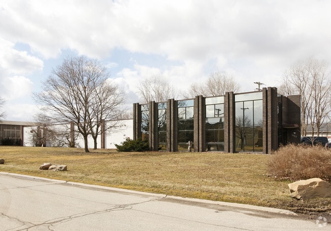
1263 Souter Dr
20-34-226-017
T2N, R11E, SEC 34 TROY INDUSTRIAL SUB E 300 FT OF LOTS 14, 15 & 16
Industrialgeneral
Oakland
M1
Michigan
AE The base floodplain where base flood elevations are provided. AE Zones are now used on new format FIRMs instead of A1-A30 Zones.
14-16
2024
2.07 AC
2022
Troy Area Central
197400
Detroit
22,026 SF
Detroit-Warren-Dearborn, MI
NEARBY LISTINGS FOR SALE OR LEASE
DEMOGRAPHICS near 1263 Souter Dr
1 mile
3 mile
5 mile
2025 Total Population
7,601
98,284
294,765
2030 Population
7,830
100,084
299,262
Pop Growth 2025-2030
+ 3.01%
+ 1.83%
+ 1.53%
Average Age
42
41
42
2025 Total Households
3,611
43,645
125,116
HH Growth 2025-2030
+ 2.88%
+ 1.93%
+ 1.70%
Median Household Inc
$80,421
$85,875
$93,261
Avg Household Size
2.10
2.20
2.30
2025 Avg HH Vehicles
2.00
2.00
2.00
Median Home Value
$260,486
$290,589
$309,165
Median Year Built
1969
1969
1966
Nearby Places
Map Layers
Map Styles
 Street
 Aerial
Transit
 Traffic
 Biking
Places
Listings with unknown addresses are not visible on the map
- Restaurants
- Banks
- Shops
- Fitness
- Groceries
PUBLIC TRANSPORTATION
COMMUTER RAIL
Drive
Walk
Distance
8 min
3.7 mi
Drive
Walk
Distance
11 min
4.4 mi
AIRPORT
Windsor International
Drive
Walk
Distance
Windsor International
45 min
26.2 mi
Detroit Metro Wayne County
Drive
Walk
Distance
Detroit Metro Wayne County
49 min
35.8 mi
Nearby Properties
Address
Land Use
TOTAL SIZE
Lot Size
Zoning
Address
Land Use
TOTAL SIZE
Lot Size
Zoning
272,233 SF
90.90 AC
Address
Land Use
TOTAL SIZE
Lot Size
Zoning
136,137 SF
12.28 AC
RM2
Address
Land Use
TOTAL SIZE
Lot Size
Zoning
224,766 SF
19.92 AC
B2
Address
Land Use
TOTAL SIZE
Lot Size
Zoning
300,925 SF
10.13 AC
Address
Land Use
TOTAL SIZE
Lot Size
Zoning
512,471 SF
21 AC
Address
Land Use
TOTAL SIZE
Lot Size
Zoning
512,475 SF
20.02 AC
Address
Land Use
TOTAL SIZE
Lot Size
Zoning
21.76 AC
Address
Land Use
TOTAL SIZE
Lot Size
Zoning
476,388 SF
23 AC
Address
Land Use
TOTAL SIZE
Lot Size
Zoning
40.32 AC
RM-2
Address
Land Use
TOTAL SIZE
Lot Size
Zoning
208,296 SF
8.16 AC
OSC
Address
Land Use
TOTAL SIZE
Lot Size
Zoning
157,500 SF
20.79 AC
OM
Address
Land Use
TOTAL SIZE
Lot Size
Zoning
272,233 SF
9.09 AC
OSC
Address
Land Use
TOTAL SIZE
Lot Size
Zoning
399,212 SF
26.18 AC
RM1
Address
Land Use
TOTAL SIZE
Lot Size
Zoning
136,672 SF
32 AC
Address
Land Use
TOTAL SIZE
Lot Size
Zoning
12.16 AC
PUD
Address
Land Use
TOTAL SIZE
Lot Size
Zoning
427,945 SF
18.26 AC
OSC
Address
Land Use
TOTAL SIZE
Lot Size
Zoning
251,735 SF
10.57 AC
RM3
Address
Land Use
TOTAL SIZE
Lot Size
Zoning
250,868 SF
6 AC
OSC
Address
Land Use
TOTAL SIZE
Lot Size
Zoning
362,816 SF
29 AC
Address
Land Use
TOTAL SIZE
Lot Size
Zoning
300,925 SF
10.13 AC
OSC
Address
Land Use
TOTAL SIZE
Lot Size
Zoning
300,924 SF
10.13 AC
Address
Land Use
TOTAL SIZE
Lot Size
Zoning
301,728 SF
2.83 AC
B2
Address
Land Use
TOTAL SIZE
Lot Size
Zoning
94,228 SF
17.66 AC
Address
Land Use
TOTAL SIZE
Lot Size
Zoning
16,022 SF
4.07 AC
OSC
Address
Land Use
TOTAL SIZE
Lot Size
Zoning
228,421 SF
17.18 AC
RMMUL
Address
Land Use
TOTAL SIZE
Lot Size
Zoning
150,240 SF
10.70 AC
OSC
Address
Land Use
TOTAL SIZE
Lot Size
Zoning
206,913 SF
16.99 AC
O1
Address
Land Use
TOTAL SIZE
Lot Size
Zoning
349,226 SF
21.62 AC
RMMUL
Address
Land Use
TOTAL SIZE
Lot Size
Zoning
4.21 AC
Address
Land Use
TOTAL SIZE
Lot Size
Zoning
276,235 SF
14.49 AC
OM
The World's #1 Commercial Real Estate Marketplace
Connect with us
© 2026 CoStar Group
The information above has been obtained from sources believed reliable. While we do not doubt its accuracy we have not verified it and make no guarantee, warranty or representation about it. It is your responsibility to independently confirm its accuracy and completeness. Any projections, opinions, assumptions, or estimates used are for example only and do not represent the current or future performance of the property. The value of this transaction to you depends on tax and other factors which should be evaluated by your tax, financial, and legal advisors. You and your advisors should conduct a careful, independent investigation of the property to determine to your satisfaction the suitability of the property for your needs.