Property Record
1263 Stuyvesant Ave, Union, NJ 07083


Save to a Folder
{{folder.Name}}
{{folder.ListingIds.length}} Properties
{{folder.ListingIds.length}} Property
Create a New Folder
Property Detail
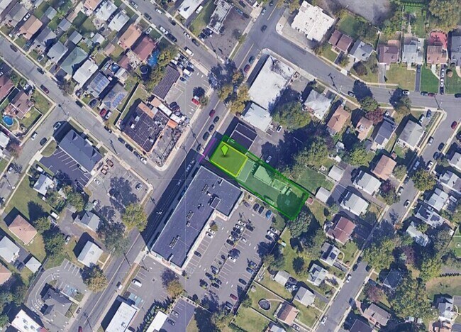
1263 Stuyvesant Ave
19-02302-0000-00004
Union
Retailwithmorethanonenonretailuse
New Jersey
B and X Area of moderate flood hazard, usually the area between the limits of the 100-year and 500-year floods.
4
2025
0.30 AC
2026
Route 22 East
033100
Northern New Jersey
5,895 SF
Newark, NJ
NEARBY LISTINGS FOR SALE OR LEASE
DEMOGRAPHICS near 1263 Stuyvesant Ave
1 mile
3 mile
5 mile
2025 Total Population
21,990
255,395
688,844
2030 Population
22,986
265,752
716,201
Pop Growth 2025-2030
+ 4.53%
+ 4.06%
+ 3.97%
Average Age
41
40
39
2025 Total Households
7,459
89,462
245,922
HH Growth 2025-2030
+ 4.60%
+ 4.19%
+ 4.16%
Median Household Inc
$117,297
$97,769
$82,112
Avg Household Size
2.90
2.80
2.70
2025 Avg HH Vehicles
2.00
2.00
1.00
Median Home Value
$441,595
$458,776
$478,649
Median Year Built
1952
1952
1956
Nearby Places
Map Layers
Map Styles
 Street
 Aerial
Layers
 Traffic
 Biking
Places
Listings with unknown addresses are not visible on the map
- Restaurants
- Banks
- Shops
- Fitness
- Groceries
PUBLIC TRANSPORTATION
COMMUTER RAIL
Union (Raritan Valley Line - NJ Transit Commuter Rail (NJ Transit))
Drive
Walk
Distance
Union (Raritan Valley Line - NJ Transit Commuter Rail (NJ Transit))
5 min
2.1 mi
Maplewood (Morris & Essex Gladstone Branch - NJ Transit Commuter Rail (NJ Transit), Morris & Essex Morristown Line - NJ Transit Commuter Rail (NJ Transit))
Drive
Walk
Distance
Maplewood (Morris & Essex Gladstone Branch - NJ Transit Commuter Rail (NJ Transit), Morris & Essex Morristown Line - NJ Transit Commuter Rail (NJ Transit))
9 min
3.6 mi
AIRPORT
Newark Liberty International
Drive
Walk
Distance
Newark Liberty International
13 min
8.2 mi
LaGuardia
Drive
Walk
Distance
LaGuardia
47 min
27.5 mi
John F Kennedy International
Drive
Walk
Distance
John F Kennedy International
56 min
36.3 mi
Freight Ports
Maher Terminal
Drive
Walk
Distance
Maher Terminal
14 min
8.3 mi
Nearby Properties
Address
Land Use
TOTAL SIZE
Lot Size
Zoning
Address
Land Use
TOTAL SIZE
Lot Size
Zoning
1,136 SF
6.51 AC
Address
Land Use
TOTAL SIZE
Lot Size
Zoning
32.27 AC
CCRC
Address
Land Use
TOTAL SIZE
Lot Size
Zoning
107.41 AC
Address
Land Use
TOTAL SIZE
Lot Size
Zoning
Address
Land Use
TOTAL SIZE
Lot Size
Zoning
13.80 AC
R1-5
Address
Land Use
TOTAL SIZE
Lot Size
Zoning
310.45 AC
Address
Land Use
TOTAL SIZE
Lot Size
Zoning
1 SF
117.50 AC
Address
Land Use
TOTAL SIZE
Lot Size
Zoning
Address
Land Use
TOTAL SIZE
Lot Size
Zoning
7.07 AC
Address
Land Use
TOTAL SIZE
Lot Size
Zoning
5.48 AC
Address
Land Use
TOTAL SIZE
Lot Size
Zoning
Address
Land Use
TOTAL SIZE
Lot Size
Zoning
2.29 AC
Address
Land Use
TOTAL SIZE
Lot Size
Zoning
117,703 SF
8.29 AC
Address
Land Use
TOTAL SIZE
Lot Size
Zoning
19,498 SF
0.67 AC
FVRZ
Address
Land Use
TOTAL SIZE
Lot Size
Zoning
6.05 AC
RO
Address
Land Use
TOTAL SIZE
Lot Size
Zoning
Address
Land Use
TOTAL SIZE
Lot Size
Zoning
16.10 AC
R1-5
Address
Land Use
TOTAL SIZE
Lot Size
Zoning
4 AC
R1-5
Address
Land Use
TOTAL SIZE
Lot Size
Zoning
Address
Land Use
TOTAL SIZE
Lot Size
Zoning
37,191 SF
8.52 AC
Address
Land Use
TOTAL SIZE
Lot Size
Zoning
8.10 AC
Address
Land Use
TOTAL SIZE
Lot Size
Zoning
0.38 AC
Address
Land Use
TOTAL SIZE
Lot Size
Zoning
176,492 SF
8 AC
Address
Land Use
TOTAL SIZE
Lot Size
Zoning
7,132 SF
2.46 AC
R50
Address
Land Use
TOTAL SIZE
Lot Size
Zoning
5,479 SF
2.96 AC
Address
Land Use
TOTAL SIZE
Lot Size
Zoning
16.82 AC
R1-7
Address
Land Use
TOTAL SIZE
Lot Size
Zoning
12.20 AC
Address
Land Use
TOTAL SIZE
Lot Size
Zoning
20,914 SF
1.93 AC
Address
Land Use
TOTAL SIZE
Lot Size
Zoning
253,287 SF
6.03 AC
Address
Land Use
TOTAL SIZE
Lot Size
Zoning
55,362 SF
9.58 AC
The World's #1 Commercial Real Estate Marketplace
Connect with us
© 2026 CoStar Group
The information above has been obtained from sources believed reliable. While we do not doubt its accuracy we have not verified it and make no guarantee, warranty or representation about it. It is your responsibility to independently confirm its accuracy and completeness. Any projections, opinions, assumptions, or estimates used are for example only and do not represent the current or future performance of the property. The value of this transaction to you depends on tax and other factors which should be evaluated by your tax, financial, and legal advisors. You and your advisors should conduct a careful, independent investigation of the property to determine to your satisfaction the suitability of the property for your needs.