Property Record
12631 Tamiami Trl E, Naples, FL 34113


Save to a Folder
{{folder.Name}}
{{folder.ListingIds.length}} Properties
{{folder.ListingIds.length}} Property
Create a New Folder
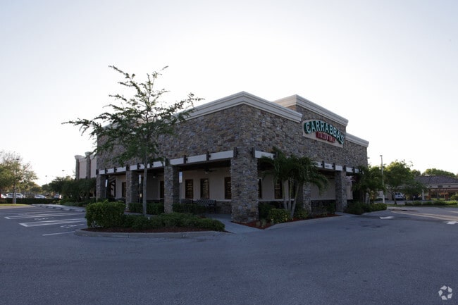
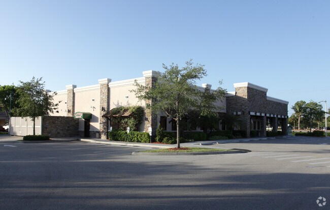
Property Detail
12631 Tamiami Trl E
Naples-Marco Island, FL
FREEDOM SQUARE SE'LY 183FT OF TRACT 3C & NW'LY 19.3FT OF TRACT 3D, ALL BEING MORE PARTICULARLY DESC AS FOLLOWS: BEGIN MOST NLY CNR OF TR 3D, N 54DEG W 183FT, S 35DEG W 275FT TO NELY R/W LI US 41, S 54DEG E 202.29FT, N 35DEG E 275FT, N 54DEG W 19.29FT
34520001306
COLLIER
Restaurantbuilding
Florida
AE The base floodplain where base flood elevations are provided. AE Zones are now used on new format FIRMs instead of A1-A30 Zones.
1
2024
1.28 AC
2025
Lely
010807
Southwest Florida
6,407 SF
NEARBY LISTINGS FOR SALE OR LEASE
DEMOGRAPHICS near 12631 Tamiami Trl E
1 mile
3 mile
5 mile
2025 Total Population
6,763
40,419
69,958
2030 Population
7,545
44,934
78,058
Pop Growth 2025-2030
+ 11.56%
+ 11.17%
+ 11.58%
Average Age
52
51
53
2025 Total Households
2,992
17,399
31,346
HH Growth 2025-2030
+ 11.20%
+ 11.01%
+ 11.31%
Median Household Inc
$75,214
$79,342
$80,542
Avg Household Size
2.20
2.20
2.10
2025 Avg HH Vehicles
2.00
2.00
2.00
Median Home Value
$460,735
$548,088
$497,745
Median Year Built
2003
2005
2003
Nearby Places
Map Layers
Map Styles
 Street
 Aerial
Layers
 Traffic
 Biking
Places
Listings with unknown addresses are not visible on the map
- Restaurants
- Banks
- Shops
- Fitness
- Groceries
PUBLIC TRANSPORTATION
AIRPORT
Southwest Florida International
Drive
Walk
Distance
Southwest Florida International
53 min
40.4 mi
Nearby Properties
Address
Land Use
TOTAL SIZE
Lot Size
Zoning
Address
Land Use
TOTAL SIZE
Lot Size
Zoning
484,174 SF
38.74 AC
Address
Land Use
TOTAL SIZE
Lot Size
Zoning
359,711 SF
14.89 AC
Address
Land Use
TOTAL SIZE
Lot Size
Zoning
305,545 SF
60 AC
A
Address
Land Use
TOTAL SIZE
Lot Size
Zoning
340,436 SF
18.10 AC
PUD
Address
Land Use
TOTAL SIZE
Lot Size
Zoning
351,576 SF
17.79 AC
PUD
Address
Land Use
TOTAL SIZE
Lot Size
Zoning
170,126 SF
50 AC
PUD
Address
Land Use
TOTAL SIZE
Lot Size
Zoning
58,639 SF
20 AC
PUD
Address
Land Use
TOTAL SIZE
Lot Size
Zoning
285,739 SF
50 AC
A
Address
Land Use
TOTAL SIZE
Lot Size
Zoning
224,217 SF
89.07 AC
A
Address
Land Use
TOTAL SIZE
Lot Size
Zoning
228,696 SF
27.40 AC
Address
Land Use
TOTAL SIZE
Lot Size
Zoning
200,272 SF
7.40 AC
PUD
Address
Land Use
TOTAL SIZE
Lot Size
Zoning
212,093 SF
22.23 AC
PUD
Address
Land Use
TOTAL SIZE
Lot Size
Zoning
122,803 SF
27.48 AC
PUD
Address
Land Use
TOTAL SIZE
Lot Size
Zoning
98,859 SF
22 AC
PUD
Address
Land Use
TOTAL SIZE
Lot Size
Zoning
100,588 SF
24 AC
PUD
Address
Land Use
TOTAL SIZE
Lot Size
Zoning
201,783 SF
28.36 AC
PUD
Address
Land Use
TOTAL SIZE
Lot Size
Zoning
65,846 SF
8.80 AC
PUD
Address
Land Use
TOTAL SIZE
Lot Size
Zoning
123,201 SF
20.59 AC
Address
Land Use
TOTAL SIZE
Lot Size
Zoning
76,460 SF
17.53 AC
PUD
Address
Land Use
TOTAL SIZE
Lot Size
Zoning
75,658 SF
2.36 AC
PUD
Address
Land Use
TOTAL SIZE
Lot Size
Zoning
124,919 SF
13.28 AC
C4
Address
Land Use
TOTAL SIZE
Lot Size
Zoning
41,657 SF
13.33 AC
PUD
Address
Land Use
TOTAL SIZE
Lot Size
Zoning
71,938 SF
8.31 AC
C-4
Address
Land Use
TOTAL SIZE
Lot Size
Zoning
43,780 SF
6.21 AC
Address
Land Use
TOTAL SIZE
Lot Size
Zoning
104,760 SF
3.57 AC
Address
Land Use
TOTAL SIZE
Lot Size
Zoning
136.47 AC
A
Address
Land Use
TOTAL SIZE
Lot Size
Zoning
94,958 SF
2.28 AC
Address
Land Use
TOTAL SIZE
Lot Size
Zoning
90,972 SF
2.44 AC
C-4
Address
Land Use
TOTAL SIZE
Lot Size
Zoning
55,048 SF
6.45 AC
Address
Land Use
TOTAL SIZE
Lot Size
Zoning
20,541 SF
32.91 AC
P
The World's #1 Commercial Real Estate Marketplace
Connect with us
© 2026 CoStar Group
The information above has been obtained from sources believed reliable. While we do not doubt its accuracy we have not verified it and make no guarantee, warranty or representation about it. It is your responsibility to independently confirm its accuracy and completeness. Any projections, opinions, assumptions, or estimates used are for example only and do not represent the current or future performance of the property. The value of this transaction to you depends on tax and other factors which should be evaluated by your tax, financial, and legal advisors. You and your advisors should conduct a careful, independent investigation of the property to determine to your satisfaction the suitability of the property for your needs.