Property Record
12633 Highway 231, Youngstown, FL 32466


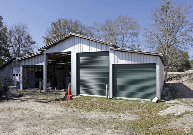
Property Detail
12633 Highway 231
03570-000-000
28 1S 12W -1- 199B BEG AT NE COR OF NE1/4 OF NE1/4 TH W 315 S 210 E 315 N 210 TO POB LESS R/W ORB 1348 P 70 ORB 1699 P 1485 ORB 1725 P 1377 ORB 4253 P 2383
Officebuilding
Bay
BC05
Florida
B and X Area of moderate flood hazard, usually the area between the limits of the 100-year and 500-year floods.
1.04 AC
2024
Panama City
2025
Other Market Areas
000302
Panama City-Panama City Beach, FL
2,100 SF
NEARBY LISTINGS FOR SALE OR LEASE
-
-
View all Youngstown listings for sale on LoopNet.com
DEMOGRAPHICS near 12633 Highway 231
1 mile
3 mile
5 mile
2025 Total Population
161
426
2,048
2030 Population
176
465
2,238
Pop Growth 2025-2030
+ 9.32%
+ 9.15%
+ 9.28%
Average Age
39
40
39
2025 Total Households
49
139
631
HH Growth 2025-2030
+ 10.20%
+ 9.35%
+ 9.35%
Median Household Inc
$59,166
$59,230
$60,446
Avg Household Size
2.70
2.70
2.70
2025 Avg HH Vehicles
2.00
2.00
2.00
Median Home Value
$174,999
$172,368
$181,987
Median Year Built
1998
1994
1996
Nearby Places
Map Layers
Map Styles
 Street
 Aerial
Layers
 Traffic
 Biking
Places
Listings with unknown addresses are not visible on the map
- Restaurants
- Banks
- Shops
- Fitness
- Groceries
PUBLIC TRANSPORTATION
AIRPORT
Northwest Florida Beaches International
Drive
Walk
Distance
Northwest Florida Beaches International
45 min
31.9 mi
Freight Ports
Port of Panama City
Drive
Walk
Distance
Port of Panama City
35 min
24.2 mi
Nearby Properties
Address
Land Use
TOTAL SIZE
Lot Size
Zoning
Address
Land Use
TOTAL SIZE
Lot Size
Zoning
87,526 SF
5.41 AC
BC14
Address
Land Use
TOTAL SIZE
Lot Size
Zoning
61,768 SF
13 AC
BC11
Address
Land Use
TOTAL SIZE
Lot Size
Zoning
13,600 SF
1 AC
BC14
Address
Land Use
TOTAL SIZE
Lot Size
Zoning
4,414 SF
1.22 AC
BC05
Address
Land Use
TOTAL SIZE
Lot Size
Zoning
14,658 SF
3.57 AC
BC11
Address
Land Use
TOTAL SIZE
Lot Size
Zoning
5,048 SF
1.09 AC
BC02
Address
Land Use
TOTAL SIZE
Lot Size
Zoning
6,800 SF
2.91 AC
BC03
Address
Land Use
TOTAL SIZE
Lot Size
Zoning
39,610 SF
262.23 AC
BC02
Address
Land Use
TOTAL SIZE
Lot Size
Zoning
2,428 SF
48.89 AC
BC02
Address
Land Use
TOTAL SIZE
Lot Size
Zoning
6,708 SF
3.86 AC
BC16
Address
Land Use
TOTAL SIZE
Lot Size
Zoning
4,000 SF
3.74 AC
BC05
Address
Land Use
TOTAL SIZE
Lot Size
Zoning
3,134 SF
640 AC
BC01
Address
Land Use
TOTAL SIZE
Lot Size
Zoning
5,104 SF
1.76 AC
BC05
Address
Land Use
TOTAL SIZE
Lot Size
Zoning
11,260 SF
11 AC
BC05
Address
Land Use
TOTAL SIZE
Lot Size
Zoning
5.40 AC
BC05
Address
Land Use
TOTAL SIZE
Lot Size
Zoning
8,152 SF
1.64 AC
BC05
Address
Land Use
TOTAL SIZE
Lot Size
Zoning
1,900 SF
0.57 AC
BC04
Address
Land Use
TOTAL SIZE
Lot Size
Zoning
2,400 SF
3.40 AC
BC15
Address
Land Use
TOTAL SIZE
Lot Size
Zoning
1,936 SF
1.38 AC
BC05
Address
Land Use
TOTAL SIZE
Lot Size
Zoning
4,992 SF
13 AC
BC11
Address
Land Use
TOTAL SIZE
Lot Size
Zoning
7,040 SF
2.83 AC
BC05
Address
Land Use
TOTAL SIZE
Lot Size
Zoning
3,300 SF
3.47 AC
BC05
Address
Land Use
TOTAL SIZE
Lot Size
Zoning
3,522 SF
3.50 AC
BC15
Address
Land Use
TOTAL SIZE
Lot Size
Zoning
2,262 SF
16.41 AC
BC16
Address
Land Use
TOTAL SIZE
Lot Size
Zoning
900 SF
202 AC
BC01
Address
Land Use
TOTAL SIZE
Lot Size
Zoning
5,600 SF
608 AC
BC01
Address
Land Use
TOTAL SIZE
Lot Size
Zoning
6 AC
BC15
Address
Land Use
TOTAL SIZE
Lot Size
Zoning
1,088 SF
632.50 AC
BC01
Address
Land Use
TOTAL SIZE
Lot Size
Zoning
2,355 SF
11.38 AC
BC01
The World's #1 Commercial Real Estate Marketplace
Connect with us
© 2026 CoStar Group
The information above has been obtained from sources believed reliable. While we do not doubt its accuracy we have not verified it and make no guarantee, warranty or representation about it. It is your responsibility to independently confirm its accuracy and completeness. Any projections, opinions, assumptions, or estimates used are for example only and do not represent the current or future performance of the property. The value of this transaction to you depends on tax and other factors which should be evaluated by your tax, financial, and legal advisors. You and your advisors should conduct a careful, independent investigation of the property to determine to your satisfaction the suitability of the property for your needs.