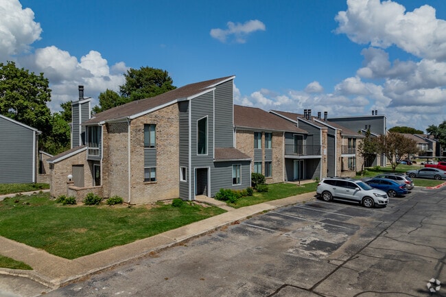
Property Record
12635 Scarsdale St, San Antonio, TX 78217


NEARBY LISTINGS FOR SALE OR LEASE
Property Detail
12635 Scarsdale St
San Antonio-New Braunfels, TX
Scardale North Ncb 17167
17167-050-0020
NCB 17167 BLK 50 LOT 2 (9.957 AC) (SCARSDALE NORTH) & NCB 15837 P-77B (.019 AC) 2020-UPDATED LEGAL DESC AND ACRES (TO DESCRIBE .019 AC TRACT) PER CR 48879. JF/GIS/2-6-2020
Multifamilydwelling
Bexar
X
Texas
48029C0270G
2
2024
9.98 AC
2025
Northern Hills
121112
San Antonio
187,548 SF
DEMOGRAPHICS near 12635 Scarsdale St
1 Mile
3 Mile
5 Mile
2024 Total Population
9,665
99,330
249,328
2029 Population
10,200
104,671
264,267
Pop Growth 2024-2029
+ 5.54%
+ 5.38%
+ 5.99%
Average Age
39
39
39
2024 Total Households
4,016
39,828
99,655
HH Growth 2024-2029
+ 5.73%
+ 5.56%
+ 6.19%
Median Household Inc
$58,105
$63,544
$64,913
Avg Household Size
2.40
2.40
2.40
2024 Avg HH Vehicles
2.00
2.00
2.00
Median Home Value
$172,300
$197,112
$220,817
Median Year Built
1980
1983
1984
Nearby Places
Map Layers
Map Styles
 Street
 Aerial
- Restaurants
- Banks
- Shops
- Fitness
- Groceries
PUBLIC TRANSPORTATION
AIRPORT
San Antonio International
DRIVE
WALK
Distance
San Antonio International
11 min
5.7 mi
Freight Ports
Calhoun Port
DRIVE
WALK
Distance
Calhoun Port
185 min
152.3 mi
Nearby Properties
Address
Land Use
TOTAL SIZE
Lot Size
Zoning
Address
Land Use
TOTAL SIZE
Lot Size
Zoning
298,710 SF
11.36 AC
Address
Land Use
TOTAL SIZE
Lot Size
Zoning
359,349 SF
23.59 AC
Address
Land Use
TOTAL SIZE
Lot Size
Zoning
239,264 SF
9.02 AC
Address
Land Use
TOTAL SIZE
Lot Size
Zoning
266,702 SF
13.49 AC
Address
Land Use
TOTAL SIZE
Lot Size
Zoning
288,350 SF
13.01 AC
Address
Land Use
TOTAL SIZE
Lot Size
Zoning
46,674 SF
53.43 AC
Address
Land Use
TOTAL SIZE
Lot Size
Zoning
180,000 SF
40.73 AC
Address
Land Use
TOTAL SIZE
Lot Size
Zoning
92,859 SF
11.95 AC
Address
Land Use
TOTAL SIZE
Lot Size
Zoning
205,862 SF
10.79 AC
Address
Land Use
TOTAL SIZE
Lot Size
Zoning
275,327 SF
13.52 AC
Address
Land Use
TOTAL SIZE
Lot Size
Zoning
373,134 SF
16.29 AC
Address
Land Use
TOTAL SIZE
Lot Size
Zoning
263,209 SF
13.67 AC
Address
Land Use
TOTAL SIZE
Lot Size
Zoning
257,263 SF
10.07 AC
Address
Land Use
TOTAL SIZE
Lot Size
Zoning
276,202 SF
17.32 AC
Address
Land Use
TOTAL SIZE
Lot Size
Zoning
324,905 SF
22.32 AC
Address
Land Use
TOTAL SIZE
Lot Size
Zoning
212,078 SF
9.83 AC
Address
Land Use
TOTAL SIZE
Lot Size
Zoning
213,566 SF
10.17 AC
Address
Land Use
TOTAL SIZE
Lot Size
Zoning
171,118 SF
14.14 AC
Address
Land Use
TOTAL SIZE
Lot Size
Zoning
241,922 SF
18.20 AC
Address
Land Use
TOTAL SIZE
Lot Size
Zoning
261,471 SF
11 AC
Address
Land Use
TOTAL SIZE
Lot Size
Zoning
312,516 SF
15.61 AC
Address
Land Use
TOTAL SIZE
Lot Size
Zoning
325,697 SF
18.17 AC
Address
Land Use
TOTAL SIZE
Lot Size
Zoning
228,927 SF
16.25 AC
Address
Land Use
TOTAL SIZE
Lot Size
Zoning
191,072 SF
9.78 AC
Address
Land Use
TOTAL SIZE
Lot Size
Zoning
39,920 SF
15.23 AC
Address
Land Use
TOTAL SIZE
Lot Size
Zoning
231,706 SF
10.47 AC
Address
Land Use
TOTAL SIZE
Lot Size
Zoning
187,743 SF
10.41 AC
Address
Land Use
TOTAL SIZE
Lot Size
Zoning
94,659 SF
13.16 AC
Address
Land Use
TOTAL SIZE
Lot Size
Zoning
166,324 SF
11.72 AC
Address
Land Use
TOTAL SIZE
Lot Size
Zoning
114,083 SF
5.35 AC
The World's #1 Commercial Real Estate Marketplace
Connect with us
© 2026 CoStar Group
The information above has been obtained from sources believed reliable. While we do not doubt its accuracy we have not verified it and make no guarantee, warranty or representation about it. It is your responsibility to independently confirm its accuracy and completeness. Any projections, opinions, assumptions, or estimates used are for example only and do not represent the current or future performance of the property. The value of this transaction to you depends on tax and other factors which should be evaluated by your tax, financial, and legal advisors. You and your advisors should conduct a careful, independent investigation of the property to determine to your satisfaction the suitability of the property for your needs.