Property Record
1264 Route 52, Carmel, NY 10512

NEARBY LISTINGS FOR SALE OR LEASE
-
-
View all Carmel listings for sale on LoopNet.com
Property Detail
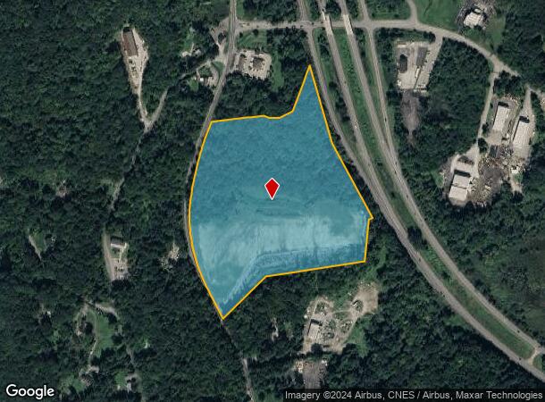
1264 Route 52
372200-012-000-0001-044-000-0000
Putnam
Commercialacreage
New York
AE
44.00
36079C0043E
22.03 AC
0
Carmel
2024
Westchester/So Connecticut
010500
Dutchess County-Putnam County, NY
DEMOGRAPHICS near 1264 Route 52
1 Mile
3 Mile
5 Mile
2024 Total Population
1,089
8,277
24,493
2029 Population
1,092
8,300
24,573
Pop Growth 2024-2029
+ 0.28%
+ 0.28%
+ 0.33%
Average Age
43
43
43
2024 Total Households
389
3,033
9,028
HH Growth 2024-2029
0.00%
+ 0.23%
+ 0.31%
Median Household Inc
$115,894
$109,274
$108,262
Avg Household Size
2.70
2.70
2.70
2024 Avg HH Vehicles
2.00
2.00
2.00
Median Home Value
$351,351
$349,889
$367,806
Median Year Built
1971
1967
1969
Nearby Places
Map Layers
Map Styles
 Street
 Aerial
- Restaurants
- Banks
- Shops
- Fitness
- Groceries
PUBLIC TRANSPORTATION
COMMUTER RAIL
Patterson Station (Harlem Line - Metro-North Commuter Railroad Company (Metro-North))
DRIVE
WALK
Distance
Patterson Station (Harlem Line - Metro-North Commuter Railroad Company (Metro-North))
12 min
7.8 mi
AIRPORT
New York Stewart International
DRIVE
WALK
Distance
New York Stewart International
38 min
27.5 mi
Freight Ports
Port of New Haven
DRIVE
WALK
Distance
Port of New Haven
77 min
54.6 mi
Nearby Properties
Address
Land Use
TOTAL SIZE
Lot Size
Zoning
Address
Land Use
TOTAL SIZE
Lot Size
Zoning
36,877 SF
65.72 AC
R10
Address
Land Use
TOTAL SIZE
Lot Size
Zoning
101,756 SF
25.78 AC
R40
Address
Land Use
TOTAL SIZE
Lot Size
Zoning
33,627 SF
57.08 AC
R80
Address
Land Use
TOTAL SIZE
Lot Size
Zoning
581.90 AC
R4
Address
Land Use
TOTAL SIZE
Lot Size
Zoning
3,360 SF
4.89 AC
IOC
Address
Land Use
TOTAL SIZE
Lot Size
Zoning
2,727 SF
1.37 AC
IOC
Address
Land Use
TOTAL SIZE
Lot Size
Zoning
149.68 AC
C1
Address
Land Use
TOTAL SIZE
Lot Size
Zoning
21,160 SF
3.54 AC
R40
Address
Land Use
TOTAL SIZE
Lot Size
Zoning
11.20 AC
R3
Address
Land Use
TOTAL SIZE
Lot Size
Zoning
60,828 SF
6.95 AC
R80
Address
Land Use
TOTAL SIZE
Lot Size
Zoning
19,495 SF
11.88 AC
IOC
Address
Land Use
TOTAL SIZE
Lot Size
Zoning
0.23 AC
R4
Address
Land Use
TOTAL SIZE
Lot Size
Zoning
129.60 AC
R3
Address
Land Use
TOTAL SIZE
Lot Size
Zoning
210.40 AC
R40
Address
Land Use
TOTAL SIZE
Lot Size
Zoning
120 AC
R3
Address
Land Use
TOTAL SIZE
Lot Size
Zoning
117 AC
R3
Address
Land Use
TOTAL SIZE
Lot Size
Zoning
85.96 AC
R3
Address
Land Use
TOTAL SIZE
Lot Size
Zoning
34,496 SF
3.06 AC
IOC
Address
Land Use
TOTAL SIZE
Lot Size
Zoning
108.18 AC
R3
Address
Land Use
TOTAL SIZE
Lot Size
Zoning
18,332 SF
3.30 AC
IOC
Address
Land Use
TOTAL SIZE
Lot Size
Zoning
7,542 SF
270 AC
R40
Address
Land Use
TOTAL SIZE
Lot Size
Zoning
170.78 AC
R80
Address
Land Use
TOTAL SIZE
Lot Size
Zoning
11,738 SF
62.46 AC
R80
Address
Land Use
TOTAL SIZE
Lot Size
Zoning
77.10 AC
R3
Address
Land Use
TOTAL SIZE
Lot Size
Zoning
24,590 SF
421.13 AC
R-4
Address
Land Use
TOTAL SIZE
Lot Size
Zoning
7,504 SF
8.87 AC
R4
Address
Land Use
TOTAL SIZE
Lot Size
Zoning
89.01 AC
R80
Address
Land Use
TOTAL SIZE
Lot Size
Zoning
6,406 SF
19.18 AC
R4
Address
Land Use
TOTAL SIZE
Lot Size
Zoning
150.56 AC
R80
The World's #1 Commercial Real Estate Marketplace
Connect with us
© 2026 CoStar Group
The information above has been obtained from sources believed reliable. While we do not doubt its accuracy we have not verified it and make no guarantee, warranty or representation about it. It is your responsibility to independently confirm its accuracy and completeness. Any projections, opinions, assumptions, or estimates used are for example only and do not represent the current or future performance of the property. The value of this transaction to you depends on tax and other factors which should be evaluated by your tax, financial, and legal advisors. You and your advisors should conduct a careful, independent investigation of the property to determine to your satisfaction the suitability of the property for your needs.