Property Record
12641 Fm 3083 Rd, Conroe, TX 77302
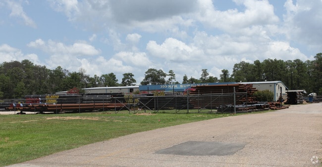

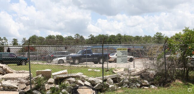
Property Detail
12641 Fm 3083 Rd
8465-00-08700
S846500 - ROY HARRIS FOUR CORNER, LOT 1-B, ACRES 5.988
Industrialgeneral
Montgomery
1
Texas
B and X Area of moderate flood hazard, usually the area between the limits of the 100-year and 500-year floods.
1-b
2024
5.99 AC
2025
The Woodlands/Conroe
693002
Houston
41,456 SF
Houston-Pasadena-The Woodlands, TX
NEARBY LISTINGS FOR SALE OR LEASE
DEMOGRAPHICS near 12641 Fm 3083 Rd
1 mile
3 mile
5 mile
2025 Total Population
1,583
16,186
67,126
2030 Population
1,883
19,460
79,605
Pop Growth 2025-2030
+ 18.95%
+ 20.23%
+ 18.59%
Average Age
35
36
36
2025 Total Households
487
5,327
21,751
HH Growth 2025-2030
+ 19.71%
+ 20.86%
+ 19.14%
Median Household Inc
$91,037
$80,972
$73,139
Avg Household Size
3.10
3.00
3.00
2025 Avg HH Vehicles
2.00
2.00
2.00
Median Home Value
$110,417
$254,733
$247,530
Median Year Built
2007
2010
2004
Nearby Places
Map Layers
Map Styles
 Street
 Aerial
Layers
 Traffic
 Biking
Places
Listings with unknown addresses are not visible on the map
- Restaurants
- Banks
- Shops
- Fitness
- Groceries
PUBLIC TRANSPORTATION
AIRPORT
George Bush Intcntl/Houston
Drive
Walk
Distance
George Bush Intcntl/Houston
44 min
34.6 mi
Freight Ports
Port of Houston
Drive
Walk
Distance
Port of Houston
67 min
50.4 mi
Nearby Properties
Address
Land Use
TOTAL SIZE
Lot Size
Zoning
Address
Land Use
TOTAL SIZE
Lot Size
Zoning
326,478 SF
20.22 AC
Address
Land Use
TOTAL SIZE
Lot Size
Zoning
266,751 SF
12.95 AC
1
Address
Land Use
TOTAL SIZE
Lot Size
Zoning
186,100 SF
29.68 AC
1
Address
Land Use
TOTAL SIZE
Lot Size
Zoning
262,564 SF
51.89 AC
1
Address
Land Use
TOTAL SIZE
Lot Size
Zoning
159,185 SF
18.45 AC
1
Address
Land Use
TOTAL SIZE
Lot Size
Zoning
117,392 SF
27 AC
1
Address
Land Use
TOTAL SIZE
Lot Size
Zoning
143,641 SF
14.80 AC
1
Address
Land Use
TOTAL SIZE
Lot Size
Zoning
187,426 SF
61.77 AC
1
Address
Land Use
TOTAL SIZE
Lot Size
Zoning
140,900 SF
83.24 AC
1
Address
Land Use
TOTAL SIZE
Lot Size
Zoning
84,192 SF
23.22 AC
1
Address
Land Use
TOTAL SIZE
Lot Size
Zoning
70,912 SF
5.07 AC
1
Address
Land Use
TOTAL SIZE
Lot Size
Zoning
14,750 SF
1.66 AC
Address
Land Use
TOTAL SIZE
Lot Size
Zoning
44,182 SF
6.25 AC
1
Address
Land Use
TOTAL SIZE
Lot Size
Zoning
64,150 SF
6.41 AC
1
Address
Land Use
TOTAL SIZE
Lot Size
Zoning
60,000 SF
5.02 AC
1
Address
Land Use
TOTAL SIZE
Lot Size
Zoning
65,448 SF
10 AC
1
Address
Land Use
TOTAL SIZE
Lot Size
Zoning
Address
Land Use
TOTAL SIZE
Lot Size
Zoning
90,180 SF
3.22 AC
1
Address
Land Use
TOTAL SIZE
Lot Size
Zoning
163,880 SF
11 AC
Address
Land Use
TOTAL SIZE
Lot Size
Zoning
13,143 SF
24 AC
Address
Land Use
TOTAL SIZE
Lot Size
Zoning
30,204 SF
4 AC
1
Address
Land Use
TOTAL SIZE
Lot Size
Zoning
80,948 SF
15 AC
Address
Land Use
TOTAL SIZE
Lot Size
Zoning
19.41 AC
Address
Land Use
TOTAL SIZE
Lot Size
Zoning
23,912 SF
53.69 AC
1
Address
Land Use
TOTAL SIZE
Lot Size
Zoning
75,058 SF
12.66 AC
Address
Land Use
TOTAL SIZE
Lot Size
Zoning
70,794 SF
25.34 AC
1
Address
Land Use
TOTAL SIZE
Lot Size
Zoning
34,181 SF
1.89 AC
1
Address
Land Use
TOTAL SIZE
Lot Size
Zoning
38,020 SF
28.47 AC
1
Address
Land Use
TOTAL SIZE
Lot Size
Zoning
10,108 SF
6 AC
Address
Land Use
TOTAL SIZE
Lot Size
Zoning
37,300 SF
11.70 AC
1
The World's #1 Commercial Real Estate Marketplace
Connect with us
© 2026 CoStar Group
The information above has been obtained from sources believed reliable. While we do not doubt its accuracy we have not verified it and make no guarantee, warranty or representation about it. It is your responsibility to independently confirm its accuracy and completeness. Any projections, opinions, assumptions, or estimates used are for example only and do not represent the current or future performance of the property. The value of this transaction to you depends on tax and other factors which should be evaluated by your tax, financial, and legal advisors. You and your advisors should conduct a careful, independent investigation of the property to determine to your satisfaction the suitability of the property for your needs.