Property Record
1265 N Capitol Ave, San Jose, CA 95132


NEARBY LISTINGS FOR SALE OR LEASE
Property Detail
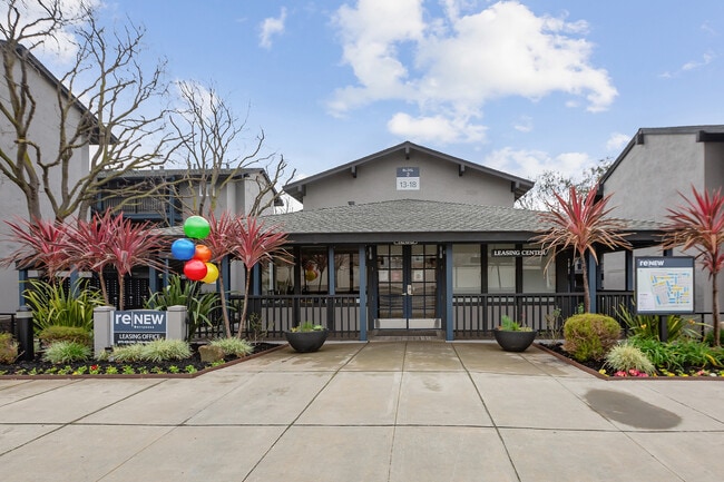
1265 N Capitol Ave
245-04-078
PARCEL MAPS 289 PG 20
Multifamilydwelling
Santa Clara
AE
California
06085C0088J
8.11 AC
2024
Ohlone
2025
South Bay/San Jose
504321
San Jose-Sunnyvale-Santa Clara, CA
153,024 SF
DEMOGRAPHICS near 1265 N Capitol Ave
1 Mile
3 Mile
5 Mile
2024 Total Population
28,630
197,169
432,741
2029 Population
27,371
188,844
415,588
Pop Growth 2024-2029
(4.40%)
(4.22%)
(3.96%)
Average Age
41
39
38
2024 Total Households
8,236
59,523
134,144
HH Growth 2024-2029
(4.72%)
(4.42%)
(4.00%)
Median Household Inc
$146,262
$131,023
$126,299
Avg Household Size
3.30
3.20
3.00
2024 Avg HH Vehicles
3.00
2.00
2.00
Median Home Value
$1,082,833
$1,023,085
$1,000,593
Median Year Built
1976
1978
1979
Nearby Places
Map Layers
Map Styles
 Street
 Aerial
- Restaurants
- Banks
- Shops
- Fitness
- Groceries
PUBLIC TRANSPORTATION
TRANSIT/SUBWAY
Berryessa Station (Alum Rock - Santa Teresa Line - Santa Clara VTA Light Rail)
DRIVE
WALK
Distance
Berryessa Station (Alum Rock - Santa Teresa Line - Santa Clara VTA Light Rail)
1 min
6 min
0.3 mi
Berryessa Station (Mountain View - Alum Rock - VTA)
DRIVE
WALK
Distance
Berryessa Station (Mountain View - Alum Rock - VTA)
1 min
7 min
0.4 mi
Hostetter Station (Mountain View - Alum Rock - VTA)
DRIVE
WALK
Distance
Hostetter Station (Mountain View - Alum Rock - VTA)
3 min
10 min
0.5 mi
Hostetter Station (Alum Rock - Santa Teresa Line - Santa Clara VTA Light Rail)
DRIVE
WALK
Distance
Hostetter Station (Alum Rock - Santa Teresa Line - Santa Clara VTA Light Rail)
3 min
11 min
0.6 mi
Penitencia Creek Station (Alum Rock - Santa Teresa Line - Santa Clara VTA Light Rail)
DRIVE
WALK
Distance
Penitencia Creek Station (Alum Rock - Santa Teresa Line - Santa Clara VTA Light Rail)
2 min
18 min
0.9 mi
COMMUTER RAIL
College Park (Caltrain - Caltrain (Caltrain))
DRIVE
WALK
Distance
College Park (Caltrain - Caltrain (Caltrain))
11 min
5.0 mi
College Park Caltrain Station Southbound (Local Weekday - Caltrain (Caltrain))
DRIVE
WALK
Distance
College Park Caltrain Station Southbound (Local Weekday - Caltrain (Caltrain))
11 min
5.3 mi
AIRPORT
Norman Y Mineta San Jose International
DRIVE
WALK
Distance
Norman Y Mineta San Jose International
12 min
6.4 mi
Freight Ports
Port of Redwood City
DRIVE
WALK
Distance
Port of Redwood City
33 min
24.5 mi
Nearby Properties
Address
Land Use
TOTAL SIZE
Lot Size
Zoning
Address
Land Use
TOTAL SIZE
Lot Size
Zoning
7.49 AC
M2
Address
Land Use
TOTAL SIZE
Lot Size
Zoning
74,528 SF
9.26 AC
TEC
Address
Land Use
TOTAL SIZE
Lot Size
Zoning
1,282,514 SF
99.02 AC
C2-S
Address
Land Use
TOTAL SIZE
Lot Size
Zoning
242,320 SF
8.01 AC
TEC
Address
Land Use
TOTAL SIZE
Lot Size
Zoning
33.32 AC
R140
Address
Land Use
TOTAL SIZE
Lot Size
Zoning
503,840 SF
5.02 AC
MXD2
Address
Land Use
TOTAL SIZE
Lot Size
Zoning
328,189 SF
4.01 AC
R3
Address
Land Use
TOTAL SIZE
Lot Size
Zoning
445,687 SF
6.44 AC
A(PD)
Address
Land Use
TOTAL SIZE
Lot Size
Zoning
3.72 AC
M2S
Address
Land Use
TOTAL SIZE
Lot Size
Zoning
5.21 AC
APD
Address
Land Use
TOTAL SIZE
Lot Size
Zoning
505,150 SF
35.68 AC
CIC
Address
Land Use
TOTAL SIZE
Lot Size
Zoning
4.56 AC
M2
Address
Land Use
TOTAL SIZE
Lot Size
Zoning
366,149 SF
2.98 AC
R3
Address
Land Use
TOTAL SIZE
Lot Size
Zoning
3.74 AC
APD
Address
Land Use
TOTAL SIZE
Lot Size
Zoning
143,242 SF
28.95 AC
C
Address
Land Use
TOTAL SIZE
Lot Size
Zoning
2.55 AC
MXD2
Address
Land Use
TOTAL SIZE
Lot Size
Zoning
6.04 AC
R5-S
Address
Land Use
TOTAL SIZE
Lot Size
Zoning
239,340 SF
2.32 AC
M2
Address
Land Use
TOTAL SIZE
Lot Size
Zoning
230,946 SF
2.86 AC
I
Address
Land Use
TOTAL SIZE
Lot Size
Zoning
270,526 SF
2.29 AC
MXD2
Address
Land Use
TOTAL SIZE
Lot Size
Zoning
192,026 SF
12.64 AC
IP
Address
Land Use
TOTAL SIZE
Lot Size
Zoning
2.78 AC
APD
Address
Land Use
TOTAL SIZE
Lot Size
Zoning
3.34 AC
M2
Address
Land Use
TOTAL SIZE
Lot Size
Zoning
237,570 SF
23.18 AC
I
Address
Land Use
TOTAL SIZE
Lot Size
Zoning
504,768 SF
33.52 AC
I
Address
Land Use
TOTAL SIZE
Lot Size
Zoning
329,433 SF
5.08 AC
CG
Address
Land Use
TOTAL SIZE
Lot Size
Zoning
111,045 SF
9.88 AC
IP
Address
Land Use
TOTAL SIZE
Lot Size
Zoning
137,913 SF
56.18 AC
M25
Address
Land Use
TOTAL SIZE
Lot Size
Zoning
606,482 SF
15.54 AC
R-1-8
Address
Land Use
TOTAL SIZE
Lot Size
Zoning
251,101 SF
2.76 AC
04E
The World's #1 Commercial Real Estate Marketplace
Connect with us
© 2025 CoStar Group
The information above has been obtained from sources believed reliable. While we do not doubt its accuracy we have not verified it and make no guarantee, warranty or representation about it. It is your responsibility to independently confirm its accuracy and completeness. Any projections, opinions, assumptions, or estimates used are for example only and do not represent the current or future performance of the property. The value of this transaction to you depends on tax and other factors which should be evaluated by your tax, financial, and legal advisors. You and your advisors should conduct a careful, independent investigation of the property to determine to your satisfaction the suitability of the property for your needs.