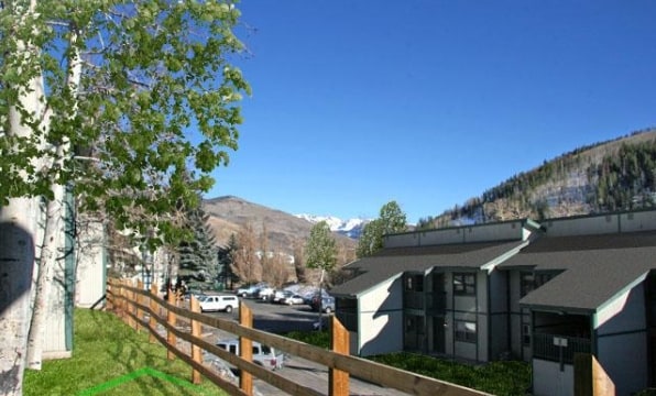
Property Record
1265 N Frontage Rd W, Vail, CO 81657

Property Detail
1265 N Frontage Rd W
Edwards, CO
SUBDIVISION: TIMBER RIDGE SUBDIVISION LOT: 2
R065476
EAGLE
Taxexempt
Colorado
B and X Area of moderate flood hazard, usually the area between the limits of the 100-year and 500-year floods.
2
2024
5.24 AC
2025
Colorado Ski Area
000702
Other Market Areas
93,267 SF
NEARBY LISTINGS FOR SALE OR LEASE
-
-
View all Vail listings for sale on LoopNet.com
DEMOGRAPHICS near 1265 N Frontage Rd W
1 mile
3 mile
5 mile
2025 Total Population
4,079
7,528
10,408
2030 Population
4,454
8,257
10,993
Pop Growth 2025-2030
+ 9.19%
+ 9.68%
+ 5.62%
Average Age
40
41
40
2025 Total Households
1,900
3,485
4,655
HH Growth 2025-2030
+ 8.58%
+ 9.21%
+ 5.63%
Median Household Inc
$113,640
$120,161
$116,112
Avg Household Size
2.10
2.10
2.20
2025 Avg HH Vehicles
2.00
2.00
2.00
Median Home Value
$1,063,281
$1,067,725
$1,063,492
Median Year Built
1986
1986
1986
Nearby Places
Map Layers
Map Styles
 Street
 Aerial
Layers
 Traffic
 Biking
Places
Listings with unknown addresses are not visible on the map
- Restaurants
- Banks
- Shops
- Fitness
- Groceries
PUBLIC TRANSPORTATION
AIRPORT
Eagle County Regional
Drive
Walk
Distance
Eagle County Regional
42 min
34.1 mi
Freight Ports
Tulsa Port Of Catoosa
Drive
Walk
Distance
Tulsa Port Of Catoosa
846 min
807.3 mi
Nearby Properties
Address
Land Use
TOTAL SIZE
Lot Size
Zoning
Address
Land Use
TOTAL SIZE
Lot Size
Zoning
270,369 SF
1.96 AC
Address
Land Use
TOTAL SIZE
Lot Size
Zoning
280,443 SF
2.85 AC
Address
Land Use
TOTAL SIZE
Lot Size
Zoning
194,144 SF
3.52 AC
Address
Land Use
TOTAL SIZE
Lot Size
Zoning
207,625 SF
2.73 AC
Address
Land Use
TOTAL SIZE
Lot Size
Zoning
127,729 SF
1.97 AC
Address
Land Use
TOTAL SIZE
Lot Size
Zoning
50,915 SF
2.71 AC
Address
Land Use
TOTAL SIZE
Lot Size
Zoning
152,022 SF
2.53 AC
Address
Land Use
TOTAL SIZE
Lot Size
Zoning
154,877 SF
1.94 AC
Address
Land Use
TOTAL SIZE
Lot Size
Zoning
5.52 AC
Address
Land Use
TOTAL SIZE
Lot Size
Zoning
165,504 SF
6.02 AC
Address
Land Use
TOTAL SIZE
Lot Size
Zoning
66,422 SF
2.63 AC
Address
Land Use
TOTAL SIZE
Lot Size
Zoning
137,037 SF
2.53 AC
Address
Land Use
TOTAL SIZE
Lot Size
Zoning
41,414 SF
0.42 AC
Address
Land Use
TOTAL SIZE
Lot Size
Zoning
8,717 SF
5.23 AC
Address
Land Use
TOTAL SIZE
Lot Size
Zoning
88,054 SF
3.64 AC
Address
Land Use
TOTAL SIZE
Lot Size
Zoning
36,480 SF
0.41 AC
Address
Land Use
TOTAL SIZE
Lot Size
Zoning
23,976 SF
0.21 AC
Address
Land Use
TOTAL SIZE
Lot Size
Zoning
25,801 SF
3.79 AC
Address
Land Use
TOTAL SIZE
Lot Size
Zoning
79,959 SF
2.10 AC
Address
Land Use
TOTAL SIZE
Lot Size
Zoning
54,452 SF
0.01 AC
Address
Land Use
TOTAL SIZE
Lot Size
Zoning
57,409 SF
0.56 AC
Address
Land Use
TOTAL SIZE
Lot Size
Zoning
29,395 SF
0.51 AC
Address
Land Use
TOTAL SIZE
Lot Size
Zoning
10,123 SF
0.11 AC
Address
Land Use
TOTAL SIZE
Lot Size
Zoning
97,322 SF
2.17 AC
Address
Land Use
TOTAL SIZE
Lot Size
Zoning
41,997 SF
1.92 AC
Address
Land Use
TOTAL SIZE
Lot Size
Zoning
13.24 AC
Address
Land Use
TOTAL SIZE
Lot Size
Zoning
6.17 AC
Address
Land Use
TOTAL SIZE
Lot Size
Zoning
38,258 SF
0.34 AC
Address
Land Use
TOTAL SIZE
Lot Size
Zoning
26,247 SF
3.40 AC
Address
Land Use
TOTAL SIZE
Lot Size
Zoning
43,953 SF
2.68 AC
The World's #1 Commercial Real Estate Marketplace
Connect with us
© 2026 CoStar Group
The information above has been obtained from sources believed reliable. While we do not doubt its accuracy we have not verified it and make no guarantee, warranty or representation about it. It is your responsibility to independently confirm its accuracy and completeness. Any projections, opinions, assumptions, or estimates used are for example only and do not represent the current or future performance of the property. The value of this transaction to you depends on tax and other factors which should be evaluated by your tax, financial, and legal advisors. You and your advisors should conduct a careful, independent investigation of the property to determine to your satisfaction the suitability of the property for your needs.