Property Record
12657 Poway Rd, Poway, CA 92064
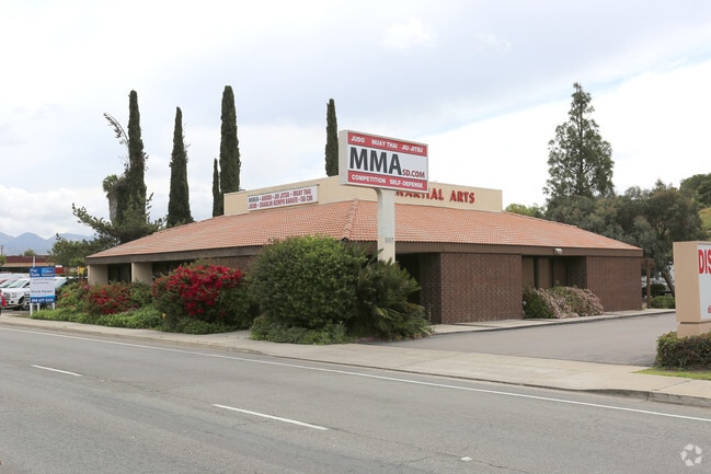


Property Detail
12657 Poway Rd
317-490-62
PAR 4 (EX ST) TR PM03020
Storesoffices
San Diego
PC-8
California
B and X Area of moderate flood hazard, usually the area between the limits of the 100-year and 500-year floods.
0.53 AC
2024
Poway
2025
San Diego
017048
San Diego-Chula Vista-Carlsbad, CA
4,024 SF
NEARBY LISTINGS FOR SALE OR LEASE
DEMOGRAPHICS near 12657 Poway Rd
1 mile
3 mile
5 mile
2024 Total Population
13,920
85,280
187,804
2029 Population
14,031
85,517
188,183
Pop Growth 2024-2029
+ 0.80%
+ 0.28%
+ 0.20%
Average Age
40
40
41
2024 Total Households
4,706
29,487
66,178
HH Growth 2024-2029
+ 0.64%
+ 0.16%
+ 0.13%
Median Household Inc
$116,158
$147,150
$151,226
Avg Household Size
2.90
2.80
2.80
2024 Avg HH Vehicles
2.00
2.00
2.00
Median Home Value
$837,633
$1,021,465
$1,023,818
Median Year Built
1977
1988
1986
Nearby Places
Map Layers
Map Styles
 Street
 Aerial
Transit
 Traffic
 Biking
Places
Listings with unknown addresses are not visible on the map
- Restaurants
- Banks
- Shops
- Fitness
- Groceries
PUBLIC TRANSPORTATION
AIRPORT
San Diego International
Drive
Walk
Distance
San Diego International
30 min
20.9 mi
Freight Ports
Port of San Diego
Drive
Walk
Distance
Port of San Diego
33 min
23.1 mi
SALE & LEASE HISTORY
LISTING DATE
SALE/LEASE

Sep 24, 2016
For Sale
Sep 23, 2016
For Sale
Sep 20, 2017
For Sale
Oct 09, 2018
For Sale
Mar 23, 2017
For Lease
Mar 23, 2017
For Sale
Jun 25, 2021
For Sale
Jan 05, 2021
For Sale
Feb 08, 2019
For Sale
Aug 01, 2017
For Lease
Nearby Properties
Address
Land Use
TOTAL SIZE
Lot Size
Zoning
Address
Land Use
TOTAL SIZE
Lot Size
Zoning
28.44 AC
RM-2-5
Address
Land Use
TOTAL SIZE
Lot Size
Zoning
12.53 AC
CV-1-1
Address
Land Use
TOTAL SIZE
Lot Size
Zoning
16.24 AC
IP-2-1
Address
Land Use
TOTAL SIZE
Lot Size
Zoning
38.96 AC
PC-7
Address
Land Use
TOTAL SIZE
Lot Size
Zoning
11.52 AC
RM-1-1
Address
Land Use
TOTAL SIZE
Lot Size
Zoning
55,156 SF
6.62 AC
PC-8
Address
Land Use
TOTAL SIZE
Lot Size
Zoning
1.79 AC
HC
Address
Land Use
TOTAL SIZE
Lot Size
Zoning
14.17 AC
RM-2-5
Address
Land Use
TOTAL SIZE
Lot Size
Zoning
Address
Land Use
TOTAL SIZE
Lot Size
Zoning
Address
Land Use
TOTAL SIZE
Lot Size
Zoning
30.76 AC
RM-1-1
Address
Land Use
TOTAL SIZE
Lot Size
Zoning
Address
Land Use
TOTAL SIZE
Lot Size
Zoning
11.20 AC
PC-8
Address
Land Use
TOTAL SIZE
Lot Size
Zoning
16.75 AC
RM-2-5
Address
Land Use
TOTAL SIZE
Lot Size
Zoning
3.06 AC
IL-2-1
Address
Land Use
TOTAL SIZE
Lot Size
Zoning
5.62 AC
IP-2-1
Address
Land Use
TOTAL SIZE
Lot Size
Zoning
3.82 AC
IP-2-1
Address
Land Use
TOTAL SIZE
Lot Size
Zoning
12.78 AC
IP-2-1
Address
Land Use
TOTAL SIZE
Lot Size
Zoning
1.65 AC
IP-2-1
Address
Land Use
TOTAL SIZE
Lot Size
Zoning
14.87 AC
PC-7
Address
Land Use
TOTAL SIZE
Lot Size
Zoning
5.82 AC
RM-2-5
Address
Land Use
TOTAL SIZE
Lot Size
Zoning
20.87 AC
PC-7
Address
Land Use
TOTAL SIZE
Lot Size
Zoning
2 AC
IP-2-1
Address
Land Use
TOTAL SIZE
Lot Size
Zoning
2.18 AC
CC-1-3
Address
Land Use
TOTAL SIZE
Lot Size
Zoning
41.98 AC
PC-7
Address
Land Use
TOTAL SIZE
Lot Size
Zoning
8.56 AC
RM-2-5
Address
Land Use
TOTAL SIZE
Lot Size
Zoning
9.92 AC
RM-2-5
Address
Land Use
TOTAL SIZE
Lot Size
Zoning
8.80 AC
RA
Address
Land Use
TOTAL SIZE
Lot Size
Zoning
8.56 AC
RM-1-3
Address
Land Use
TOTAL SIZE
Lot Size
Zoning
4.13 AC
IP-2-1
The World's #1 Commercial Real Estate Marketplace
Connect with us
© 2026 CoStar Group
The information above has been obtained from sources believed reliable. While we do not doubt its accuracy we have not verified it and make no guarantee, warranty or representation about it. It is your responsibility to independently confirm its accuracy and completeness. Any projections, opinions, assumptions, or estimates used are for example only and do not represent the current or future performance of the property. The value of this transaction to you depends on tax and other factors which should be evaluated by your tax, financial, and legal advisors. You and your advisors should conduct a careful, independent investigation of the property to determine to your satisfaction the suitability of the property for your needs.