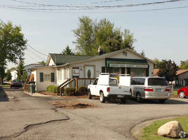
Property Record
12660 10 Mile Rd, South Lyon, MI 48178


NEARBY LISTINGS FOR SALE OR LEASE
Property Detail
12660 10 Mile Rd
16-26-200-010
Part Of Sec 26 T1n R6e
Commercialnec
SEC. 26 T1N, R6E, R E. 156 FT. OF W. 931 FT. OF N. 278 FT. OF NE 1/4 1A
X
Livingston
26093C0479D
Michigan
2025
0.99 AC
2025
Livingston County
744800
Detroit
9,914 SF
Detroit-Warren-Dearborn, MI
DEMOGRAPHICS near 12660 10 Mile Rd
1 Mile
3 Mile
5 Mile
2024 Total Population
3,584
26,264
55,725
2029 Population
3,674
26,520
56,246
Pop Growth 2024-2029
+ 2.51%
+ 0.97%
+ 0.93%
Average Age
46
43
41
2024 Total Households
1,368
10,547
21,512
HH Growth 2024-2029
+ 2.70%
+ 0.96%
+ 0.91%
Median Household Inc
$112,362
$96,818
$97,981
Avg Household Size
2.60
2.50
2.50
2024 Avg HH Vehicles
2.00
2.00
2.00
Median Home Value
$361,026
$312,349
$333,422
Median Year Built
1991
1992
1992
Nearby Places
Map Layers
Map Styles
 Street
 Aerial
- Restaurants
- Banks
- Shops
- Fitness
- Groceries
PUBLIC TRANSPORTATION
AIRPORT
Detroit Metro Wayne County
DRIVE
WALK
Distance
Detroit Metro Wayne County
51 min
37.5 mi
Freight Ports
Port of Toledo
DRIVE
WALK
Distance
Port of Toledo
96 min
76.5 mi
Nearby Properties
Address
Land Use
TOTAL SIZE
Lot Size
Zoning
Address
Land Use
TOTAL SIZE
Lot Size
Zoning
394,554 SF
28.66 AC
GI
Address
Land Use
TOTAL SIZE
Lot Size
Zoning
9,208 SF
230 AC
RE
Address
Land Use
TOTAL SIZE
Lot Size
Zoning
139,056 SF
50.33 AC
GI
Address
Land Use
TOTAL SIZE
Lot Size
Zoning
160,702 SF
16.50 AC
Address
Land Use
TOTAL SIZE
Lot Size
Zoning
140,000 SF
9.08 AC
LI PUD
Address
Land Use
TOTAL SIZE
Lot Size
Zoning
164,517 SF
27.78 AC
GI
Address
Land Use
TOTAL SIZE
Lot Size
Zoning
137,373 SF
16.51 AC
AI
Address
Land Use
TOTAL SIZE
Lot Size
Zoning
54,615 SF
6.14 AC
LI PUD
Address
Land Use
TOTAL SIZE
Lot Size
Zoning
55,744 SF
4.40 AC
Address
Land Use
TOTAL SIZE
Lot Size
Zoning
73,010 SF
25.37 AC
GI
Address
Land Use
TOTAL SIZE
Lot Size
Zoning
107,743 SF
8.06 AC
AI
Address
Land Use
TOTAL SIZE
Lot Size
Zoning
87,046 SF
9.76 AC
GI
Address
Land Use
TOTAL SIZE
Lot Size
Zoning
47,339 SF
9.56 AC
GI
Address
Land Use
TOTAL SIZE
Lot Size
Zoning
91,510 SF
9.73 AC
GI
Address
Land Use
TOTAL SIZE
Lot Size
Zoning
33,808 SF
4.16 AC
LI PUD
Address
Land Use
TOTAL SIZE
Lot Size
Zoning
53,610 SF
4.61 AC
BI
Address
Land Use
TOTAL SIZE
Lot Size
Zoning
128 AC
R3
Address
Land Use
TOTAL SIZE
Lot Size
Zoning
45,340 SF
2.86 AC
LI PUD
Address
Land Use
TOTAL SIZE
Lot Size
Zoning
43,838 SF
10.05 AC
GI
Address
Land Use
TOTAL SIZE
Lot Size
Zoning
1,472 SF
35.14 AC
MM
Address
Land Use
TOTAL SIZE
Lot Size
Zoning
49,710 SF
5.61 AC
LI PUD
Address
Land Use
TOTAL SIZE
Lot Size
Zoning
32,841 SF
10.92 AC
GI
Address
Land Use
TOTAL SIZE
Lot Size
Zoning
64,555 SF
9.60 AC
II
Address
Land Use
TOTAL SIZE
Lot Size
Zoning
45,228 SF
5.35 AC
BI
Address
Land Use
TOTAL SIZE
Lot Size
Zoning
30,000 SF
3.94 AC
GI
Address
Land Use
TOTAL SIZE
Lot Size
Zoning
56,780 SF
5.13 AC
BI
The World's #1 Commercial Real Estate Marketplace
Connect with us
© 2026 CoStar Group
The information above has been obtained from sources believed reliable. While we do not doubt its accuracy we have not verified it and make no guarantee, warranty or representation about it. It is your responsibility to independently confirm its accuracy and completeness. Any projections, opinions, assumptions, or estimates used are for example only and do not represent the current or future performance of the property. The value of this transaction to you depends on tax and other factors which should be evaluated by your tax, financial, and legal advisors. You and your advisors should conduct a careful, independent investigation of the property to determine to your satisfaction the suitability of the property for your needs.