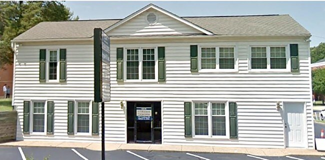
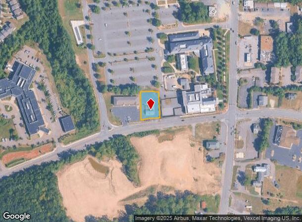
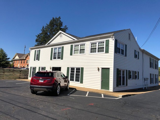
Property Record
1267 Courthouse Rd, Stafford, VA 22554
NEARBY LISTINGS FOR SALE OR LEASE
Property Detail
1267 Courthouse Rd
30-41A
C H
Officebuilding
C H 0.4728 AC (.327 AC & .1458 AC)
X
Stafford
51179C0141F
Virginia
2024
0.47 AC
2025
Stafford County
010210
Washington, DC
4,138 SF
Washington-Arlington-Alexandria, DC-VA-MD-WV
DEMOGRAPHICS near 1267 Courthouse Rd
1 Mile
3 Mile
5 Mile
2024 Total Population
7,625
39,009
82,086
2029 Population
8,439
43,346
91,296
Pop Growth 2024-2029
+ 10.68%
+ 11.12%
+ 11.22%
Average Age
35
35
36
2024 Total Households
2,208
12,024
25,552
HH Growth 2024-2029
+ 11.46%
+ 11.34%
+ 11.34%
Median Household Inc
$105,983
$125,018
$122,361
Avg Household Size
3.00
3.10
3.10
2024 Avg HH Vehicles
2.00
2.00
2.00
Median Home Value
$408,804
$430,887
$402,502
Median Year Built
2001
1997
1996
Nearby Places
Map Layers
Map Styles
 Street
 Aerial
- Restaurants
- Banks
- Shops
- Fitness
- Groceries
PUBLIC TRANSPORTATION
COMMUTER RAIL
Brooke (Fredericksburg Line - Virginia Railway Express)
DRIVE
WALK
Distance
Brooke (Fredericksburg Line - Virginia Railway Express)
9 min
3.9 mi
Leeland Road (Fredericksburg Line - Virginia Railway Express)
DRIVE
WALK
Distance
Leeland Road (Fredericksburg Line - Virginia Railway Express)
15 min
7.6 mi
AIRPORT
Ronald Reagan Washington Ntl
DRIVE
WALK
Distance
Ronald Reagan Washington Ntl
55 min
40.5 mi
SALE & LEASE HISTORY
LISTING DATE
SALE/LEASE

Sep 24, 2019
For Lease
Jul 18, 2018
For Lease
Nearby Properties
Address
Land Use
TOTAL SIZE
Lot Size
Zoning
Address
Land Use
TOTAL SIZE
Lot Size
Zoning
261,502 SF
33.80 AC
B2
Address
Land Use
TOTAL SIZE
Lot Size
Zoning
536,192 SF
72.22 AC
B2
Address
Land Use
TOTAL SIZE
Lot Size
Zoning
85.16 AC
M2
Address
Land Use
TOTAL SIZE
Lot Size
Zoning
4,951 SF
36.12 AC
R2
Address
Land Use
TOTAL SIZE
Lot Size
Zoning
353,124 SF
17.78 AC
UD
Address
Land Use
TOTAL SIZE
Lot Size
Zoning
303,859 SF
77.36 AC
B3
Address
Land Use
TOTAL SIZE
Lot Size
Zoning
249,752 SF
50 AC
A1
Address
Land Use
TOTAL SIZE
Lot Size
Zoning
122,875 SF
11.61 AC
B2
Address
Land Use
TOTAL SIZE
Lot Size
Zoning
189,348 SF
14.05 AC
R3
Address
Land Use
TOTAL SIZE
Lot Size
Zoning
297,647 SF
54.88 AC
M1
Address
Land Use
TOTAL SIZE
Lot Size
Zoning
92,937 SF
540.58 AC
M1
Address
Land Use
TOTAL SIZE
Lot Size
Zoning
244,617 SF
61.73 AC
R3
Address
Land Use
TOTAL SIZE
Lot Size
Zoning
96,370 SF
20.28 AC
PD2
Address
Land Use
TOTAL SIZE
Lot Size
Zoning
496,822 SF
38.33 AC
M1
Address
Land Use
TOTAL SIZE
Lot Size
Zoning
198,448 SF
19.17 AC
R2
Address
Land Use
TOTAL SIZE
Lot Size
Zoning
193,624 SF
15.84 AC
M1
Address
Land Use
TOTAL SIZE
Lot Size
Zoning
174,539 SF
11.37 AC
B3
Address
Land Use
TOTAL SIZE
Lot Size
Zoning
125,322 SF
18.81 AC
B2
Address
Land Use
TOTAL SIZE
Lot Size
Zoning
151,015 SF
36.62 AC
A1
Address
Land Use
TOTAL SIZE
Lot Size
Zoning
77,949 SF
13.59 AC
B2
Address
Land Use
TOTAL SIZE
Lot Size
Zoning
87,891 SF
38.57 AC
PD1
Address
Land Use
TOTAL SIZE
Lot Size
Zoning
84,974 SF
18.76 AC
R1
Address
Land Use
TOTAL SIZE
Lot Size
Zoning
79,114 SF
15.87 AC
R1
Address
Land Use
TOTAL SIZE
Lot Size
Zoning
82,543 SF
20.89 AC
A1
Address
Land Use
TOTAL SIZE
Lot Size
Zoning
85,700 SF
9.55 AC
R1
Address
Land Use
TOTAL SIZE
Lot Size
Zoning
94,014 SF
4.43 AC
B2
The World's #1 Commercial Real Estate Marketplace
Connect with us
© 2025 CoStar Group
The information above has been obtained from sources believed reliable. While we do not doubt its accuracy we have not verified it and make no guarantee, warranty or representation about it. It is your responsibility to independently confirm its accuracy and completeness. Any projections, opinions, assumptions, or estimates used are for example only and do not represent the current or future performance of the property. The value of this transaction to you depends on tax and other factors which should be evaluated by your tax, financial, and legal advisors. You and your advisors should conduct a careful, independent investigation of the property to determine to your satisfaction the suitability of the property for your needs.