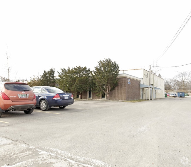
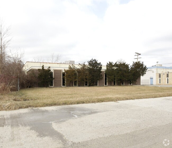
Property Record
12675 Marlin Dr, Redford, MI 48239
NEARBY LISTINGS FOR SALE OR LEASE
Property Detail
12675 Marlin Dr
Detroit-Warren-Dearborn, MI
Ridgemont Homes
79-037-99-0014-003
30F2B2A1A1 PT OF NE 1/4 SEC 30 T1S R10E BEG S87DEG 28M 55S W 451.57FT AND S0DEG 44M 05S E 417.21FT FROM INTER OF CENTERLINES
Manufacturinglight
Wayne
X
Michigan
26163C0068E
0014
2024
0.48 AC
2025
Dearborn
554900
Detroit
8,000 SF
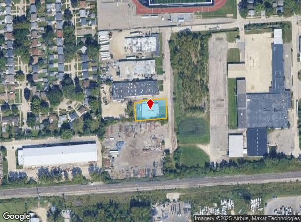
DEMOGRAPHICS near 12675 Marlin Dr
1 Mile
3 Mile
5 Mile
2024 Total Population
10,182
92,665
309,588
2029 Population
9,712
89,224
299,811
Pop Growth 2024-2029
(4.62%)
(3.71%)
(3.16%)
Average Age
40
40
39
2024 Total Households
4,033
37,245
121,769
HH Growth 2024-2029
(4.64%)
(3.75%)
(3.25%)
Median Household Inc
$77,246
$63,997
$58,171
Avg Household Size
2.50
2.40
2.50
2024 Avg HH Vehicles
2.00
2.00
2.00
Median Home Value
$149,318
$154,864
$155,933
Median Year Built
1954
1955
1955
Nearby Places
Map Layers
Map Styles
 Street
 Aerial
- Restaurants
- Banks
- Shops
- Fitness
- Groceries
PUBLIC TRANSPORTATION
AIRPORT
Detroit Metro Wayne County
DRIVE
WALK
Distance
Detroit Metro Wayne County
34 min
17.4 mi
Windsor International
DRIVE
WALK
Distance
Windsor International
43 min
25.7 mi
Freight Ports
DRIVE
WALK
Distance
84 min
68.2 mi
Nearby Properties
Address
Land Use
TOTAL SIZE
Lot Size
Zoning
Address
Land Use
TOTAL SIZE
Lot Size
Zoning
1,071,675 SF
59.61 AC
M-2
Address
Land Use
TOTAL SIZE
Lot Size
Zoning
335,133 SF
22.08 AC
Address
Land Use
TOTAL SIZE
Lot Size
Zoning
909,159 SF
55.33 AC
M-2
Address
Land Use
TOTAL SIZE
Lot Size
Zoning
1,156,275 SF
75.88 AC
M-2
Address
Land Use
TOTAL SIZE
Lot Size
Zoning
85.45 AC
Address
Land Use
TOTAL SIZE
Lot Size
Zoning
1,013,885 SF
36.48 AC
M-1
Address
Land Use
TOTAL SIZE
Lot Size
Zoning
399,770 SF
34.90 AC
M-2
Address
Land Use
TOTAL SIZE
Lot Size
Zoning
121,420 SF
16.01 AC
C-2
Address
Land Use
TOTAL SIZE
Lot Size
Zoning
835,383 SF
36.85 AC
Address
Land Use
TOTAL SIZE
Lot Size
Zoning
137,490 SF
12.16 AC
C-2
Address
Land Use
TOTAL SIZE
Lot Size
Zoning
1,529,287 SF
76.96 AC
M-1
Address
Land Use
TOTAL SIZE
Lot Size
Zoning
158,354 SF
43.70 AC
M4
Address
Land Use
TOTAL SIZE
Lot Size
Zoning
205,368 SF
20.22 AC
C-2
Address
Land Use
TOTAL SIZE
Lot Size
Zoning
216,268 SF
23.58 AC
C-2
Address
Land Use
TOTAL SIZE
Lot Size
Zoning
167,562 SF
9.25 AC
R5
Address
Land Use
TOTAL SIZE
Lot Size
Zoning
151,605 SF
14.66 AC
C-2
Address
Land Use
TOTAL SIZE
Lot Size
Zoning
286,524 SF
16.58 AC
Address
Land Use
TOTAL SIZE
Lot Size
Zoning
244,838 SF
8.93 AC
M-1
Address
Land Use
TOTAL SIZE
Lot Size
Zoning
182,700 SF
20.45 AC
C-2
Address
Land Use
TOTAL SIZE
Lot Size
Zoning
129,975 SF
6.89 AC
R5
Address
Land Use
TOTAL SIZE
Lot Size
Zoning
57,739 SF
1.71 AC
Address
Land Use
TOTAL SIZE
Lot Size
Zoning
115,215 SF
8.83 AC
C-2
Address
Land Use
TOTAL SIZE
Lot Size
Zoning
149,735 SF
6.64 AC
Address
Land Use
TOTAL SIZE
Lot Size
Zoning
141,206 SF
14.01 AC
M-1
Address
Land Use
TOTAL SIZE
Lot Size
Zoning
80,093 SF
7.05 AC
C-2
Address
Land Use
TOTAL SIZE
Lot Size
Zoning
87,175 SF
7.25 AC
M-1
Address
Land Use
TOTAL SIZE
Lot Size
Zoning
135,924 SF
12.90 AC
C-2
Address
Land Use
TOTAL SIZE
Lot Size
Zoning
89,152 SF
7.44 AC
R-9
Address
Land Use
TOTAL SIZE
Lot Size
Zoning
9.07 AC
R-7
Address
Land Use
TOTAL SIZE
Lot Size
Zoning
134,090 SF
14.18 AC
C-2
The World's #1 Commercial Real Estate Marketplace
Connect with us
© 2025 CoStar Group
The information above has been obtained from sources believed reliable. While we do not doubt its accuracy we have not verified it and make no guarantee, warranty or representation about it. It is your responsibility to independently confirm its accuracy and completeness. Any projections, opinions, assumptions, or estimates used are for example only and do not represent the current or future performance of the property. The value of this transaction to you depends on tax and other factors which should be evaluated by your tax, financial, and legal advisors. You and your advisors should conduct a careful, independent investigation of the property to determine to your satisfaction the suitability of the property for your needs.