Property Record
12685 Adams Rd, Granger, IN 46530


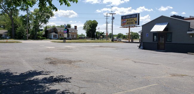
Property Detail
12685 Adams Rd
South Bend-Mishawaka, IN-MI
LOTS 6, 7, 8 EX 20 FT W SIDE SHAFFERS 7 38 4E
71-05-07-378-005.000-011
St Joseph
Servicestation
Indiana
B and X Area of moderate flood hazard, usually the area between the limits of the 100-year and 500-year floods.
6,7,8
2023
0.55 AC
2024
Outlying St Joseph County
011406
South Bend/Mishawaka
4,800 SF
NEARBY LISTINGS FOR SALE OR LEASE
-
-
View all Granger listings for sale on LoopNet.com
DEMOGRAPHICS near 12685 Adams Rd
1 mile
3 mile
5 mile
2024 Total Population
2,371
17,683
50,023
2029 Population
2,337
17,398
49,460
Pop Growth 2024-2029
(1.43%)
(1.61%)
(1.13%)
Average Age
40
40
41
2024 Total Households
795
5,818
18,411
HH Growth 2024-2029
(1.64%)
(1.77%)
(1.20%)
Median Household Inc
$111,770
$121,263
$100,209
Avg Household Size
2.90
3.00
2.70
2024 Avg HH Vehicles
3.00
2.00
2.00
Median Home Value
$312,111
$331,683
$288,567
Median Year Built
1987
1989
1988
Nearby Places
Map Layers
Map Styles
 Street
 Aerial
Transit
 Traffic
 Biking
Places
Listings with unknown addresses are not visible on the map
- Restaurants
- Banks
- Shops
- Fitness
- Groceries
PUBLIC TRANSPORTATION
AIRPORT
South Bend International
Drive
Walk
Distance
South Bend International
34 min
18.7 mi
SALE & LEASE HISTORY
LISTING DATE
SALE/LEASE

Sep 24, 2016
For Sale
Jul 15, 2019
For Sale
Dec 19, 2016
For Sale
Nearby Properties
Address
Land Use
TOTAL SIZE
Lot Size
Zoning
Address
Land Use
TOTAL SIZE
Lot Size
Zoning
24,588 SF
20.82 AC
Address
Land Use
TOTAL SIZE
Lot Size
Zoning
16,530 SF
20.26 AC
Address
Land Use
TOTAL SIZE
Lot Size
Zoning
25,182 SF
5.67 AC
Address
Land Use
TOTAL SIZE
Lot Size
Zoning
32,788 SF
16.33 AC
Address
Land Use
TOTAL SIZE
Lot Size
Zoning
43,400 SF
9.55 AC
Address
Land Use
TOTAL SIZE
Lot Size
Zoning
23,317 SF
7.07 AC
Address
Land Use
TOTAL SIZE
Lot Size
Zoning
3,278 SF
9.60 AC
Address
Land Use
TOTAL SIZE
Lot Size
Zoning
208.06 AC
Address
Land Use
TOTAL SIZE
Lot Size
Zoning
17,703 SF
4.53 AC
Address
Land Use
TOTAL SIZE
Lot Size
Zoning
30,292 SF
7.55 AC
Address
Land Use
TOTAL SIZE
Lot Size
Zoning
133,598 SF
24.33 AC
Address
Land Use
TOTAL SIZE
Lot Size
Zoning
12,230 SF
6.01 AC
Address
Land Use
TOTAL SIZE
Lot Size
Zoning
30,559 SF
14.61 AC
Address
Land Use
TOTAL SIZE
Lot Size
Zoning
191,022 SF
9.60 AC
Address
Land Use
TOTAL SIZE
Lot Size
Zoning
5,950 SF
1.47 AC
Address
Land Use
TOTAL SIZE
Lot Size
Zoning
8,568 SF
41.16 AC
Address
Land Use
TOTAL SIZE
Lot Size
Zoning
17,114 SF
5.24 AC
Address
Land Use
TOTAL SIZE
Lot Size
Zoning
3,874 SF
9.22 AC
Address
Land Use
TOTAL SIZE
Lot Size
Zoning
15,276 SF
1.59 AC
Address
Land Use
TOTAL SIZE
Lot Size
Zoning
5,168 SF
4.22 AC
Address
Land Use
TOTAL SIZE
Lot Size
Zoning
161,884 SF
8.30 AC
Address
Land Use
TOTAL SIZE
Lot Size
Zoning
5,735 SF
38.89 AC
Address
Land Use
TOTAL SIZE
Lot Size
Zoning
14,796 SF
2.34 AC
Address
Land Use
TOTAL SIZE
Lot Size
Zoning
88,328 SF
47.92 AC
Address
Land Use
TOTAL SIZE
Lot Size
Zoning
14,030 SF
35.95 AC
Address
Land Use
TOTAL SIZE
Lot Size
Zoning
14,859 SF
2.11 AC
Address
Land Use
TOTAL SIZE
Lot Size
Zoning
6,464 SF
0.86 AC
Address
Land Use
TOTAL SIZE
Lot Size
Zoning
10,456 SF
2.01 AC
Address
Land Use
TOTAL SIZE
Lot Size
Zoning
9,796 SF
1.43 AC
Address
Land Use
TOTAL SIZE
Lot Size
Zoning
18,882 SF
2.15 AC
The World's #1 Commercial Real Estate Marketplace
Connect with us
© 2026 CoStar Group
The information above has been obtained from sources believed reliable. While we do not doubt its accuracy we have not verified it and make no guarantee, warranty or representation about it. It is your responsibility to independently confirm its accuracy and completeness. Any projections, opinions, assumptions, or estimates used are for example only and do not represent the current or future performance of the property. The value of this transaction to you depends on tax and other factors which should be evaluated by your tax, financial, and legal advisors. You and your advisors should conduct a careful, independent investigation of the property to determine to your satisfaction the suitability of the property for your needs.