Property Record
6627 Kevitt Blvd, Port Charlotte, FL 33981

NEARBY LISTINGS FOR SALE OR LEASE
Property Detail
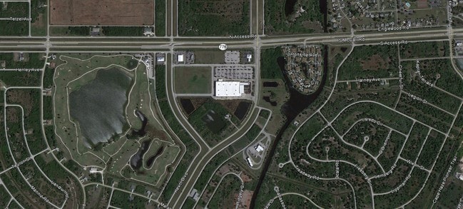
6627 Kevitt Blvd
Punta Gorda, FL
Port Charlotte
412107228006
PORT CHARLOTTE SEC 95 BLK 5189 LTS 21 & 22 1557/2146 3563/1687 3563/1688 3571/235
Commercialacreage
Charlotte
X
Florida
12015C0211G
21,22
2024
0.37 AC
2025
Charlotte County
030102
Southwest Florida
DEMOGRAPHICS near 6627 Kevitt Blvd
1 Mile
3 Mile
5 Mile
2024 Total Population
1,838
22,902
48,998
2029 Population
2,230
27,779
59,606
Pop Growth 2024-2029
+ 21.33%
+ 21.30%
+ 21.65%
Average Age
50
54
57
2024 Total Households
832
10,450
23,327
HH Growth 2024-2029
+ 21.39%
+ 21.46%
+ 21.85%
Median Household Inc
$57,437
$61,588
$60,489
Avg Household Size
2.20
2.20
2.10
2024 Avg HH Vehicles
2.00
2.00
2.00
Median Home Value
$235,000
$273,476
$275,140
Median Year Built
1991
1997
1996
Nearby Places
Map Layers
Map Styles
 Street
 Aerial
- Restaurants
- Banks
- Shops
- Fitness
- Groceries
PUBLIC TRANSPORTATION
AIRPORT
Punta Gorda
DRIVE
WALK
Distance
Punta Gorda
38 min
22.0 mi
Freight Ports
Port Manatee
DRIVE
WALK
Distance
Port Manatee
85 min
61.5 mi
SALE & LEASE HISTORY
LISTING DATE
SALE/LEASE

Sep 24, 2016
For Sale
Nearby Properties
Address
Land Use
TOTAL SIZE
Lot Size
Zoning
Address
Land Use
TOTAL SIZE
Lot Size
Zoning
99,840 SF
7.60 AC
IG
Address
Land Use
TOTAL SIZE
Lot Size
Zoning
67,466 SF
16.30 AC
CG
Address
Land Use
TOTAL SIZE
Lot Size
Zoning
27.65 AC
RMF15
Address
Land Use
TOTAL SIZE
Lot Size
Zoning
108,048 SF
14.84 AC
CG
Address
Land Use
TOTAL SIZE
Lot Size
Zoning
132.79 AC
PKR
Address
Land Use
TOTAL SIZE
Lot Size
Zoning
2,016 SF
315.56 AC
PD
Address
Land Use
TOTAL SIZE
Lot Size
Zoning
51,683 SF
7.16 AC
CG
Address
Land Use
TOTAL SIZE
Lot Size
Zoning
100,910 SF
22.85 AC
RSF3.5
Address
Land Use
TOTAL SIZE
Lot Size
Zoning
106,737 SF
20.80 AC
RMF5
Address
Land Use
TOTAL SIZE
Lot Size
Zoning
34.11 AC
CG
Address
Land Use
TOTAL SIZE
Lot Size
Zoning
20.12 AC
CG
Address
Land Use
TOTAL SIZE
Lot Size
Zoning
38.14 AC
IG
Address
Land Use
TOTAL SIZE
Lot Size
Zoning
12,300 SF
5.02 AC
IG
Address
Land Use
TOTAL SIZE
Lot Size
Zoning
11,509 SF
12.06 AC
RSF3.5
Address
Land Use
TOTAL SIZE
Lot Size
Zoning
6,476 SF
17.26 AC
II
Address
Land Use
TOTAL SIZE
Lot Size
Zoning
4,776 SF
20 AC
II
Address
Land Use
TOTAL SIZE
Lot Size
Zoning
560 SF
10.23 AC
IG
Address
Land Use
TOTAL SIZE
Lot Size
Zoning
16.53 AC
CG
Address
Land Use
TOTAL SIZE
Lot Size
Zoning
8,510 SF
2.25 AC
CG
Address
Land Use
TOTAL SIZE
Lot Size
Zoning
5,222 SF
85.60 AC
RMF10
Address
Land Use
TOTAL SIZE
Lot Size
Zoning
6,852 SF
161.47 AC
RSF5
Address
Land Use
TOTAL SIZE
Lot Size
Zoning
3,864 SF
2 AC
CG
Address
Land Use
TOTAL SIZE
Lot Size
Zoning
12,907 SF
165.69 AC
RSF5
Address
Land Use
TOTAL SIZE
Lot Size
Zoning
18,599 SF
1.96 AC
IG
Address
Land Use
TOTAL SIZE
Lot Size
Zoning
576 SF
5 AC
II
Address
Land Use
TOTAL SIZE
Lot Size
Zoning
10.88 AC
CG
Address
Land Use
TOTAL SIZE
Lot Size
Zoning
11,708 SF
9.99 AC
II
Address
Land Use
TOTAL SIZE
Lot Size
Zoning
3,767 SF
88.50 AC
RSF2
Address
Land Use
TOTAL SIZE
Lot Size
Zoning
4,000 SF
7.78 AC
RMF10
The World's #1 Commercial Real Estate Marketplace
Connect with us
© 2026 CoStar Group
The information above has been obtained from sources believed reliable. While we do not doubt its accuracy we have not verified it and make no guarantee, warranty or representation about it. It is your responsibility to independently confirm its accuracy and completeness. Any projections, opinions, assumptions, or estimates used are for example only and do not represent the current or future performance of the property. The value of this transaction to you depends on tax and other factors which should be evaluated by your tax, financial, and legal advisors. You and your advisors should conduct a careful, independent investigation of the property to determine to your satisfaction the suitability of the property for your needs.