Property Record
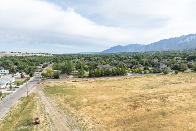
12695 S 1700 Dr E, Draper, UT 84020

NEARBY LISTINGS FOR SALE OR LEASE
Property Detail
12695 S 1700 Dr E
28-33-203-010-0000
COM 2438.45 FT W & 62.7 FT S FR NE COR SEC 33 T 3S R 1E SL MER S 623.7 FT E 194.45 FT S 6.6 FT E 154.85 FT N 630.3 FT W349.35 FT TO BEG 5.03 AC 09958-0241 11491-3582 11538-2697
Residentialacreage
Salt Lake
X
Utah
49035C0464H
5.03 AC
0
Draper
2025
Salt Lake City
112828
Salt Lake City-Murray, UT
DEMOGRAPHICS near 12695 S 1700 Dr E
1 Mile
3 Mile
5 Mile
2024 Total Population
6,530
64,449
149,328
2029 Population
6,595
65,356
152,372
Pop Growth 2024-2029
+ 1.00%
+ 1.41%
+ 2.04%
Average Age
38
39
38
2024 Total Households
1,804
19,127
47,516
HH Growth 2024-2029
+ 0.89%
+ 1.33%
+ 1.97%
Median Household Inc
$159,299
$123,483
$112,720
Avg Household Size
3.50
3.20
3.00
2024 Avg HH Vehicles
3.00
2.00
2.00
Median Home Value
$864,285
$709,701
$626,649
Median Year Built
1995
1996
1995
Nearby Places
Map Layers
Map Styles
 Street
 Aerial
- Restaurants
- Banks
- Shops
- Fitness
- Groceries
PUBLIC TRANSPORTATION
TRANSIT/SUBWAY
Draper Town Center Station (Blue Line - Utah Transit Authority (UTA))
DRIVE
WALK
Distance
Draper Town Center Station (Blue Line - Utah Transit Authority (UTA))
5 min
20 min
1.1 mi
COMMUTER RAIL
Draper Station (FrontRunner - Utah Transit Authority (UTA))
DRIVE
WALK
Distance
Draper Station (FrontRunner - Utah Transit Authority (UTA))
12 min
4.8 mi
South Jordan Station (FrontRunner - Utah Transit Authority (UTA))
DRIVE
WALK
Distance
South Jordan Station (FrontRunner - Utah Transit Authority (UTA))
11 min
5.9 mi
AIRPORT
Salt Lake City International
DRIVE
WALK
Distance
Salt Lake City International
33 min
24.7 mi
Provo Municipal
DRIVE
WALK
Distance
Provo Municipal
45 min
30.5 mi
Freight Ports
Port of Stockton
DRIVE
WALK
Distance
Port of Stockton
733 min
715.1 mi
Nearby Properties
Address
Land Use
TOTAL SIZE
Lot Size
Zoning
Address
Land Use
TOTAL SIZE
Lot Size
Zoning
40,495 SF
33.28 AC
RM-1
Address
Land Use
TOTAL SIZE
Lot Size
Zoning
1,055,572 SF
8.31 AC
CR
Address
Land Use
TOTAL SIZE
Lot Size
Zoning
210,421 SF
6.87 AC
CR
Address
Land Use
TOTAL SIZE
Lot Size
Zoning
398,320 SF
40 AC
1110
Address
Land Use
TOTAL SIZE
Lot Size
Zoning
392,144 SF
30.63 AC
1113
Address
Land Use
TOTAL SIZE
Lot Size
Zoning
186,651 SF
35.87 AC
C-R
Address
Land Use
TOTAL SIZE
Lot Size
Zoning
277,938 SF
13.90 AC
CSD-DD
Address
Land Use
TOTAL SIZE
Lot Size
Zoning
197,645 SF
19.51 AC
1122
Address
Land Use
TOTAL SIZE
Lot Size
Zoning
126,531 SF
11.50 AC
1244
Address
Land Use
TOTAL SIZE
Lot Size
Zoning
311,202 SF
0.01 AC
4180
Address
Land Use
TOTAL SIZE
Lot Size
Zoning
391,078 SF
5.78 AC
IC
Address
Land Use
TOTAL SIZE
Lot Size
Zoning
265,332 SF
8.94 AC
C-C
Address
Land Use
TOTAL SIZE
Lot Size
Zoning
353,500 SF
29.38 AC
CR
Address
Land Use
TOTAL SIZE
Lot Size
Zoning
317.68 AC
1115
Address
Land Use
TOTAL SIZE
Lot Size
Zoning
255,090 SF
17.91 AC
CSDDRC
Address
Land Use
TOTAL SIZE
Lot Size
Zoning
146,280 SF
0.01 AC
CBD
Address
Land Use
TOTAL SIZE
Lot Size
Zoning
77,905 SF
7.15 AC
CO2
Address
Land Use
TOTAL SIZE
Lot Size
Zoning
319,222 SF
6.12 AC
CSD-DD
Address
Land Use
TOTAL SIZE
Lot Size
Zoning
198.67 AC
4280
Address
Land Use
TOTAL SIZE
Lot Size
Zoning
255,928 SF
14.90 AC
M-1
Address
Land Use
TOTAL SIZE
Lot Size
Zoning
144,648 SF
20.53 AC
1110
Address
Land Use
TOTAL SIZE
Lot Size
Zoning
197,352 SF
28.67 AC
2000
Address
Land Use
TOTAL SIZE
Lot Size
Zoning
157,135 SF
13.55 AC
CSD-DP
Address
Land Use
TOTAL SIZE
Lot Size
Zoning
207,380 SF
5.29 AC
CR
Address
Land Use
TOTAL SIZE
Lot Size
Zoning
135,616 SF
10.39 AC
C-R
Address
Land Use
TOTAL SIZE
Lot Size
Zoning
38,260 SF
5.12 AC
5515
Address
Land Use
TOTAL SIZE
Lot Size
Zoning
72,610 SF
8.60 AC
RM1
Address
Land Use
TOTAL SIZE
Lot Size
Zoning
60,260 SF
16.64 AC
OS
Address
Land Use
TOTAL SIZE
Lot Size
Zoning
171,663 SF
7.16 AC
CBP
Address
Land Use
TOTAL SIZE
Lot Size
Zoning
77,905 SF
6.82 AC
C0-2
The World's #1 Commercial Real Estate Marketplace
Connect with us
© 2026 CoStar Group
The information above has been obtained from sources believed reliable. While we do not doubt its accuracy we have not verified it and make no guarantee, warranty or representation about it. It is your responsibility to independently confirm its accuracy and completeness. Any projections, opinions, assumptions, or estimates used are for example only and do not represent the current or future performance of the property. The value of this transaction to you depends on tax and other factors which should be evaluated by your tax, financial, and legal advisors. You and your advisors should conduct a careful, independent investigation of the property to determine to your satisfaction the suitability of the property for your needs.