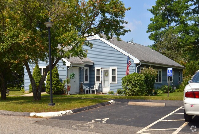
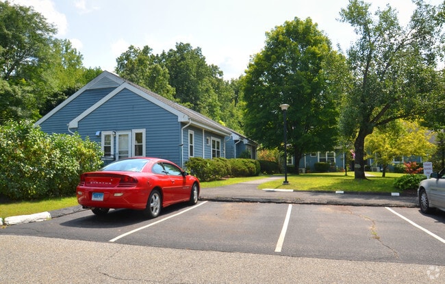
Property Record
126A Laurel Hill Rd, Brookfield, CT 06804

Property Detail
126A Laurel Hill Rd
BROO-000006C-000000-000019
FAIRFIELD
Governmentalpublicusegeneral
Connecticut
TCD-P
19
AE The base floodplain where base flood elevations are provided. AE Zones are now used on new format FIRMs instead of A1-A30 Zones.
18.48 AC
2022
Danbury/Newtown/Monroe
2025
Westchester/So Connecticut
205100
Bridgeport-Stamford-Danbury, CT
NEARBY LISTINGS FOR SALE OR LEASE
DEMOGRAPHICS near 126A Laurel Hill Rd
1 mile
3 mile
5 mile
2025 Total Population
2,781
19,363
52,392
2030 Population
2,899
20,238
54,353
Pop Growth 2025-2030
+ 4.24%
+ 4.52%
+ 3.74%
Average Age
44
44
44
2025 Total Households
1,081
7,394
19,777
HH Growth 2025-2030
+ 4.35%
+ 4.56%
+ 3.74%
Median Household Inc
$141,588
$135,003
$127,501
Avg Household Size
2.60
2.60
2.50
2025 Avg HH Vehicles
2.00
2.00
2.00
Median Home Value
$494,708
$504,956
$463,485
Median Year Built
1973
1972
1975
Nearby Places
Map Layers
Map Styles
 Street
 Aerial
Layers
 Traffic
 Biking
Places
Listings with unknown addresses are not visible on the map
- Restaurants
- Banks
- Shops
- Fitness
- Groceries
PUBLIC TRANSPORTATION
COMMUTER RAIL
Bethel Station (New Haven Line - Metro-North Commuter Railroad Company (Metro-North))
Drive
Walk
Distance
Bethel Station (New Haven Line - Metro-North Commuter Railroad Company (Metro-North))
20 min
9.4 mi
Danbury Station (New Haven Line - Metro-North Commuter Railroad Company (Metro-North))
Drive
Walk
Distance
Danbury Station (New Haven Line - Metro-North Commuter Railroad Company (Metro-North))
15 min
9.7 mi
Freight Ports
Port of New Haven
Drive
Walk
Distance
Port of New Haven
57 min
36.3 mi
Nearby Properties
Address
Land Use
TOTAL SIZE
Lot Size
Zoning
Address
Land Use
TOTAL SIZE
Lot Size
Zoning
45.66 AC
IC/R40
Address
Land Use
TOTAL SIZE
Lot Size
Zoning
168,282 SF
22.83 AC
R-60
Address
Land Use
TOTAL SIZE
Lot Size
Zoning
79.31 AC
R-80
Address
Land Use
TOTAL SIZE
Lot Size
Zoning
4.09 AC
C-1
Address
Land Use
TOTAL SIZE
Lot Size
Zoning
9.39 AC
C-2
Address
Land Use
TOTAL SIZE
Lot Size
Zoning
45.15 AC
I-1 HO
Address
Land Use
TOTAL SIZE
Lot Size
Zoning
77,492 SF
30.25 AC
Address
Land Use
TOTAL SIZE
Lot Size
Zoning
2,173 SF
4.76 AC
TCD
Address
Land Use
TOTAL SIZE
Lot Size
Zoning
53,582 SF
7.71 AC
C-2
Address
Land Use
TOTAL SIZE
Lot Size
Zoning
2,295.68 AC
Address
Land Use
TOTAL SIZE
Lot Size
Zoning
6.54 AC
TCD-P
Address
Land Use
TOTAL SIZE
Lot Size
Zoning
151,200 SF
12.48 AC
I-1
Address
Land Use
TOTAL SIZE
Lot Size
Zoning
110,200 SF
4.96 AC
I-1 HO
Address
Land Use
TOTAL SIZE
Lot Size
Zoning
9.29 AC
R-60
Address
Land Use
TOTAL SIZE
Lot Size
Zoning
57,782 SF
7.14 AC
R-80
Address
Land Use
TOTAL SIZE
Lot Size
Zoning
54.60 AC
R-80
Address
Land Use
TOTAL SIZE
Lot Size
Zoning
4.65 AC
TCD
Address
Land Use
TOTAL SIZE
Lot Size
Zoning
60,042 SF
7.20 AC
TCD
Address
Land Use
TOTAL SIZE
Lot Size
Zoning
29,862 SF
1.41 AC
TCD
Address
Land Use
TOTAL SIZE
Lot Size
Zoning
10.07 AC
I-1
Address
Land Use
TOTAL SIZE
Lot Size
Zoning
4.80 AC
I-1
Address
Land Use
TOTAL SIZE
Lot Size
Zoning
99,524 SF
9.41 AC
I-1
Address
Land Use
TOTAL SIZE
Lot Size
Zoning
2,400 SF
1,190.70 AC
R80
Address
Land Use
TOTAL SIZE
Lot Size
Zoning
1.92 AC
MC
Address
Land Use
TOTAL SIZE
Lot Size
Zoning
36,239 SF
5.93 AC
C-2
Address
Land Use
TOTAL SIZE
Lot Size
Zoning
26.25 AC
RR3
Address
Land Use
TOTAL SIZE
Lot Size
Zoning
22,832 SF
9.70 AC
R-40
Address
Land Use
TOTAL SIZE
Lot Size
Zoning
4.01 AC
I-C
Address
Land Use
TOTAL SIZE
Lot Size
Zoning
36,440 SF
4.70 AC
C-2
Address
Land Use
TOTAL SIZE
Lot Size
Zoning
31,425 SF
3.29 AC
C-2
The World's #1 Commercial Real Estate Marketplace
Connect with us
© 2026 CoStar Group
The information above has been obtained from sources believed reliable. While we do not doubt its accuracy we have not verified it and make no guarantee, warranty or representation about it. It is your responsibility to independently confirm its accuracy and completeness. Any projections, opinions, assumptions, or estimates used are for example only and do not represent the current or future performance of the property. The value of this transaction to you depends on tax and other factors which should be evaluated by your tax, financial, and legal advisors. You and your advisors should conduct a careful, independent investigation of the property to determine to your satisfaction the suitability of the property for your needs.