Property Record
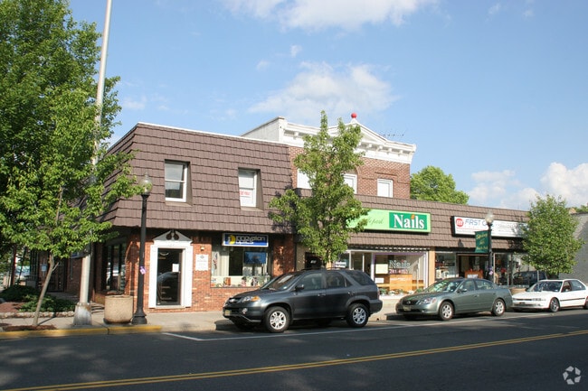
127 Chestnut St, Roselle Park, NJ 07204


NEARBY LISTINGS FOR SALE OR LEASE
Property Detail
127 Chestnut St
15-00909-0000-00002
ADDITIONAL LOTS: 92 3
Officebuilding
Union
AH
New Jersey
34013C0150F
2
2024
0.06 AC
2025
Parkway Cranford Corridor
033900
Northern New Jersey
3,680 SF
Newark, NJ-PA
DEMOGRAPHICS near 127 Chestnut St
1 Mile
3 Mile
5 Mile
2024 Total Population
30,555
230,024
524,714
2029 Population
30,033
225,850
513,604
Pop Growth 2024-2029
(1.71%)
(1.81%)
(2.12%)
Average Age
40
40
39
2024 Total Households
10,898
82,126
185,636
HH Growth 2024-2029
(1.82%)
(1.85%)
(2.17%)
Median Household Inc
$84,716
$80,152
$78,127
Avg Household Size
2.70
2.70
2.70
2024 Avg HH Vehicles
2.00
2.00
2.00
Median Home Value
$353,997
$399,523
$414,944
Median Year Built
1951
1954
1955
Nearby Places
Map Layers
Map Styles
 Street
 Aerial
- Restaurants
- Banks
- Shops
- Fitness
- Groceries
PUBLIC TRANSPORTATION
COMMUTER RAIL
Roselle Park (Raritan Valley Line - NJ Transit Commuter Rail (NJ Transit))
DRIVE
WALK
Distance
Roselle Park (Raritan Valley Line - NJ Transit Commuter Rail (NJ Transit))
3 min
9 min
0.5 mi
Cranford (Raritan Valley Line - NJ Transit Commuter Rail (NJ Transit))
DRIVE
WALK
Distance
Cranford (Raritan Valley Line - NJ Transit Commuter Rail (NJ Transit))
8 min
2.6 mi
AIRPORT
Newark Liberty International
DRIVE
WALK
Distance
Newark Liberty International
17 min
12.3 mi
LaGuardia
DRIVE
WALK
Distance
LaGuardia
50 min
33.1 mi
John F Kennedy International
DRIVE
WALK
Distance
John F Kennedy International
57 min
34.5 mi
SALE & LEASE HISTORY
LISTING DATE
SALE/LEASE

Oct 21, 2020
For Sale
Jul 18, 2018
For Lease
Jan 15, 2021
For Sale
Feb 22, 2017
For Lease
Nearby Properties
Address
Land Use
TOTAL SIZE
Lot Size
Zoning
Address
Land Use
TOTAL SIZE
Lot Size
Zoning
11.36 AC
Address
Land Use
TOTAL SIZE
Lot Size
Zoning
Address
Land Use
TOTAL SIZE
Lot Size
Zoning
Address
Land Use
TOTAL SIZE
Lot Size
Zoning
5.89 AC
Address
Land Use
TOTAL SIZE
Lot Size
Zoning
107.41 AC
Address
Land Use
TOTAL SIZE
Lot Size
Zoning
Address
Land Use
TOTAL SIZE
Lot Size
Zoning
2.21 AC
Address
Land Use
TOTAL SIZE
Lot Size
Zoning
12.46 AC
Address
Land Use
TOTAL SIZE
Lot Size
Zoning
0.83 AC
Address
Land Use
TOTAL SIZE
Lot Size
Zoning
90.28 AC
Address
Land Use
TOTAL SIZE
Lot Size
Zoning
1.01 AC
Address
Land Use
TOTAL SIZE
Lot Size
Zoning
21.25 AC
Address
Land Use
TOTAL SIZE
Lot Size
Zoning
2.22 AC
Address
Land Use
TOTAL SIZE
Lot Size
Zoning
1 SF
117.50 AC
Address
Land Use
TOTAL SIZE
Lot Size
Zoning
151.20 AC
O
Address
Land Use
TOTAL SIZE
Lot Size
Zoning
0.82 AC
Address
Land Use
TOTAL SIZE
Lot Size
Zoning
0.79 AC
Address
Land Use
TOTAL SIZE
Lot Size
Zoning
2.47 AC
Address
Land Use
TOTAL SIZE
Lot Size
Zoning
Address
Land Use
TOTAL SIZE
Lot Size
Zoning
5.48 AC
Address
Land Use
TOTAL SIZE
Lot Size
Zoning
2.29 AC
Address
Land Use
TOTAL SIZE
Lot Size
Zoning
5.73 AC
Address
Land Use
TOTAL SIZE
Lot Size
Zoning
7.51 AC
Address
Land Use
TOTAL SIZE
Lot Size
Zoning
Address
Land Use
TOTAL SIZE
Lot Size
Zoning
2.45 AC
Address
Land Use
TOTAL SIZE
Lot Size
Zoning
34.49 AC
Address
Land Use
TOTAL SIZE
Lot Size
Zoning
2.50 AC
Address
Land Use
TOTAL SIZE
Lot Size
Zoning
197 AC
RA
Address
Land Use
TOTAL SIZE
Lot Size
Zoning
1.62 AC
Address
Land Use
TOTAL SIZE
Lot Size
Zoning
1.59 AC
The World's #1 Commercial Real Estate Marketplace
Connect with us
© 2026 CoStar Group
The information above has been obtained from sources believed reliable. While we do not doubt its accuracy we have not verified it and make no guarantee, warranty or representation about it. It is your responsibility to independently confirm its accuracy and completeness. Any projections, opinions, assumptions, or estimates used are for example only and do not represent the current or future performance of the property. The value of this transaction to you depends on tax and other factors which should be evaluated by your tax, financial, and legal advisors. You and your advisors should conduct a careful, independent investigation of the property to determine to your satisfaction the suitability of the property for your needs.