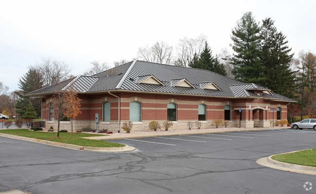
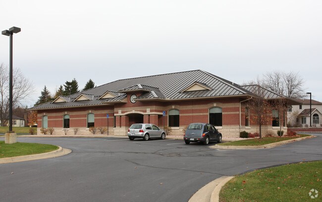
Property Record
127 East Rd, Dimondale, MI 48821

Property Detail
127 East Rd
081-042-000-082-00
COM SE CORNER LOT 8, N 144 FT, N44 40'W 156.72 FT; S45 20'W 345.61 FT; S44 17'20"E 16.64 FT; E 344.78 TO POB. BEING PART OF LOTS 8 & 9. ASSESSORS PLAT NO 2, VILLAGE OF DIMONDALE, SEC 15, T3N,R3W. 12-29-03
Financialbuilding
Eaton
R-1C
Michigan
B and X Area of moderate flood hazard, usually the area between the limits of the 100-year and 500-year floods.
8-9
2024
1.25 AC
2025
Outlying Eaton County
021402
West Michigan
5,954 SF
Lansing-East Lansing, MI
NEARBY LISTINGS FOR SALE OR LEASE
DEMOGRAPHICS near 127 East Rd
1 mile
3 mile
5 mile
2025 Total Population
1,983
8,702
44,525
2030 Population
1,984
8,767
44,736
Pop Growth 2025-2030
+ 0.05%
+ 0.75%
+ 0.47%
Average Age
47
44
40
2025 Total Households
804
3,471
17,620
HH Growth 2025-2030
+ 0.12%
+ 0.75%
+ 0.45%
Median Household Inc
$93,939
$88,665
$65,229
Avg Household Size
2.40
2.40
2.40
2025 Avg HH Vehicles
2.00
2.00
2.00
Median Home Value
$248,924
$236,474
$181,131
Median Year Built
1972
1978
1972
Nearby Places
Map Layers
Map Styles
 Street
 Aerial
Layers
 Traffic
 Biking
Places
Listings with unknown addresses are not visible on the map
- Restaurants
- Banks
- Shops
- Fitness
- Groceries
PUBLIC TRANSPORTATION
AIRPORT
Capital Region International
Drive
Walk
Distance
Capital Region International
22 min
10.8 mi
Nearby Properties
Address
Land Use
TOTAL SIZE
Lot Size
Zoning
Address
Land Use
TOTAL SIZE
Lot Size
Zoning
144,630 SF
11.51 AC
M-1
Address
Land Use
TOTAL SIZE
Lot Size
Zoning
50,364 SF
25.57 AC
M-1
Address
Land Use
TOTAL SIZE
Lot Size
Zoning
1,496 SF
47.39 AC
RM-1
Address
Land Use
TOTAL SIZE
Lot Size
Zoning
7,689 SF
148.47 AC
DM-1 RE
Address
Land Use
TOTAL SIZE
Lot Size
Zoning
48,948 SF
2.10 AC
M-1
Address
Land Use
TOTAL SIZE
Lot Size
Zoning
71,900 SF
5.08 AC
NONE
Address
Land Use
TOTAL SIZE
Lot Size
Zoning
43,150 SF
20.31 AC
NONE
Address
Land Use
TOTAL SIZE
Lot Size
Zoning
44,000 SF
5 AC
M-1
Address
Land Use
TOTAL SIZE
Lot Size
Zoning
50 AC
R-1M
Address
Land Use
TOTAL SIZE
Lot Size
Zoning
50,000 SF
4.22 AC
NONE
Address
Land Use
TOTAL SIZE
Lot Size
Zoning
53.59 AC
DM-1 RE
Address
Land Use
TOTAL SIZE
Lot Size
Zoning
38,338 SF
2.12 AC
B-2
Address
Land Use
TOTAL SIZE
Lot Size
Zoning
31,600 SF
3.05 AC
M-1
Address
Land Use
TOTAL SIZE
Lot Size
Zoning
21,200 SF
2.43 AC
B-2
Address
Land Use
TOTAL SIZE
Lot Size
Zoning
53,004 SF
5.31 AC
M-1
Address
Land Use
TOTAL SIZE
Lot Size
Zoning
16,681 SF
2.71 AC
M-1
Address
Land Use
TOTAL SIZE
Lot Size
Zoning
33,388 SF
6.57 AC
C-3
Address
Land Use
TOTAL SIZE
Lot Size
Zoning
119 AC
R-1M
Address
Land Use
TOTAL SIZE
Lot Size
Zoning
30,074 SF
3.43 AC
M-1
Address
Land Use
TOTAL SIZE
Lot Size
Zoning
28 AC
NONE
Address
Land Use
TOTAL SIZE
Lot Size
Zoning
34,320 SF
3.05 AC
M-1
Address
Land Use
TOTAL SIZE
Lot Size
Zoning
49,093 SF
4.53 AC
NONE
Address
Land Use
TOTAL SIZE
Lot Size
Zoning
36,000 SF
15 AC
NONE
Address
Land Use
TOTAL SIZE
Lot Size
Zoning
11,400 SF
4.33 AC
M-1
Address
Land Use
TOTAL SIZE
Lot Size
Zoning
16,405 SF
5.24 AC
NONE
Address
Land Use
TOTAL SIZE
Lot Size
Zoning
7,166 SF
168.16 AC
A-1
Address
Land Use
TOTAL SIZE
Lot Size
Zoning
31,770 SF
1.81 AC
NONE
Address
Land Use
TOTAL SIZE
Lot Size
Zoning
41,900 SF
2.28 AC
NONE
Address
Land Use
TOTAL SIZE
Lot Size
Zoning
19,174 SF
7.86 AC
NONE
The World's #1 Commercial Real Estate Marketplace
Connect with us
© 2026 CoStar Group
The information above has been obtained from sources believed reliable. While we do not doubt its accuracy we have not verified it and make no guarantee, warranty or representation about it. It is your responsibility to independently confirm its accuracy and completeness. Any projections, opinions, assumptions, or estimates used are for example only and do not represent the current or future performance of the property. The value of this transaction to you depends on tax and other factors which should be evaluated by your tax, financial, and legal advisors. You and your advisors should conduct a careful, independent investigation of the property to determine to your satisfaction the suitability of the property for your needs.