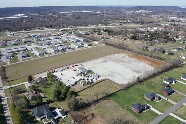
Property Record
127 Gavin Dr, Shepherdsville, KY 40165


NEARBY LISTINGS FOR SALE OR LEASE
Property Detail
127 Gavin Dr
Louisville/Jefferson County, KY-IN
Maplehurst
044NE022007
LT 7 SEC 1 MAPLEHURST PLAT 4/151 (44-81)
Sfr
Bullitt
X
Kentucky
21029C0069G
7
2025
Bullitt County
2025
Louisville
020401
DEMOGRAPHICS near 127 Gavin Dr
1 mile
3 mile
5 mile
2024 Total Population
1,685
23,757
69,358
2029 Population
1,777
24,930
71,496
Pop Growth 2024-2029
+ 5.46%
+ 4.94%
+ 3.08%
Average Age
50
43
40
2024 Total Households
710
9,217
26,622
HH Growth 2024-2029
+ 5.35%
+ 4.86%
+ 2.99%
Median Household Inc
$73,166
$67,829
$68,238
Avg Household Size
2.40
2.50
2.60
2024 Avg HH Vehicles
2.00
2.00
2.00
Median Home Value
$234,285
$190,282
$193,968
Median Year Built
1982
1987
1990
Nearby Places
Map Layers
Map Styles
 Street
 Aerial
Transit
 Traffic
 Biking
Places
Listings with unknown addresses are not visible on the map
- Restaurants
- Banks
- Shops
- Fitness
- Groceries
PUBLIC TRANSPORTATION
AIRPORT
Louisville Muhammad Ali International
Drive
Walk
Distance
Louisville Muhammad Ali International
21 min
13.0 mi
Freight Ports
Port of Toledo
Drive
Walk
Distance
Port of Toledo
374 min
320.1 mi
SALE & LEASE HISTORY
LISTING DATE
SALE/LEASE

Mar 08, 2024
For Lease
Mar 06, 2024
For Sale
Nearby Properties
Address
Land Use
TOTAL SIZE
Lot Size
Zoning
Address
Land Use
TOTAL SIZE
Lot Size
Zoning
21.73 AC
Address
Land Use
TOTAL SIZE
Lot Size
Zoning
45.17 AC
Address
Land Use
TOTAL SIZE
Lot Size
Zoning
Address
Land Use
TOTAL SIZE
Lot Size
Zoning
Address
Land Use
TOTAL SIZE
Lot Size
Zoning
29.36 AC
Address
Land Use
TOTAL SIZE
Lot Size
Zoning
253,951 SF
74.36 AC
Address
Land Use
TOTAL SIZE
Lot Size
Zoning
297,024 SF
14.08 AC
Address
Land Use
TOTAL SIZE
Lot Size
Zoning
Address
Land Use
TOTAL SIZE
Lot Size
Zoning
400,260 SF
32.97 AC
Address
Land Use
TOTAL SIZE
Lot Size
Zoning
15.25 AC
Address
Land Use
TOTAL SIZE
Lot Size
Zoning
13.24 AC
Address
Land Use
TOTAL SIZE
Lot Size
Zoning
Address
Land Use
TOTAL SIZE
Lot Size
Zoning
1,296 SF
44.67 AC
Address
Land Use
TOTAL SIZE
Lot Size
Zoning
32.90 AC
Address
Land Use
TOTAL SIZE
Lot Size
Zoning
Address
Land Use
TOTAL SIZE
Lot Size
Zoning
Address
Land Use
TOTAL SIZE
Lot Size
Zoning
12.85 AC
Address
Land Use
TOTAL SIZE
Lot Size
Zoning
Address
Land Use
TOTAL SIZE
Lot Size
Zoning
12.22 AC
Address
Land Use
TOTAL SIZE
Lot Size
Zoning
119,351 SF
7.80 AC
Address
Land Use
TOTAL SIZE
Lot Size
Zoning
Address
Land Use
TOTAL SIZE
Lot Size
Zoning
Address
Land Use
TOTAL SIZE
Lot Size
Zoning
Address
Land Use
TOTAL SIZE
Lot Size
Zoning
20,023 SF
3.88 AC
Address
Land Use
TOTAL SIZE
Lot Size
Zoning
33,724 SF
1.66 AC
Address
Land Use
TOTAL SIZE
Lot Size
Zoning
Address
Land Use
TOTAL SIZE
Lot Size
Zoning
Address
Land Use
TOTAL SIZE
Lot Size
Zoning
Address
Land Use
TOTAL SIZE
Lot Size
Zoning
Address
Land Use
TOTAL SIZE
Lot Size
Zoning
The World's #1 Commercial Real Estate Marketplace
Connect with us
© 2026 CoStar Group
The information above has been obtained from sources believed reliable. While we do not doubt its accuracy we have not verified it and make no guarantee, warranty or representation about it. It is your responsibility to independently confirm its accuracy and completeness. Any projections, opinions, assumptions, or estimates used are for example only and do not represent the current or future performance of the property. The value of this transaction to you depends on tax and other factors which should be evaluated by your tax, financial, and legal advisors. You and your advisors should conduct a careful, independent investigation of the property to determine to your satisfaction the suitability of the property for your needs.