Property Record
127 Mathews Dr, Gilbert, IA 50105
NEARBY LISTINGS FOR SALE OR LEASE
-
-
View all Gilbert listings for sale on LoopNet.com
Property Detail
127 Mathews Dr
Ames, IA
50504
05-04-475-300
SECTION:04 TOWNSHIP:84 RANGE:24 S198' OF TRACT: COMM SE COR W1/2 SE N34 RODS 12' W27 RODS S34 RODS 12' E TO BEG EX E300'
Apartment
Story
X
Iowa
19015C0250D
11
2024
0.36 AC
2025
Fort Dodge/Ames
000103
Other Market Areas
3,932 SF
DEMOGRAPHICS near 127 Mathews Dr
1 Mile
3 Mile
5 Mile
2024 Total Population
1,159
3,261
21,947
2029 Population
1,179
3,395
22,704
Pop Growth 2024-2029
+ 1.73%
+ 4.11%
+ 3.45%
Average Age
37
41
40
2024 Total Households
439
1,219
9,060
HH Growth 2024-2029
+ 1.82%
+ 4.18%
+ 3.77%
Median Household Inc
$71,447
$75,260
$75,144
Avg Household Size
2.60
2.60
2.30
2024 Avg HH Vehicles
2.00
2.00
2.00
Median Home Value
$251,119
$249,038
$263,904
Median Year Built
1990
1992
1988
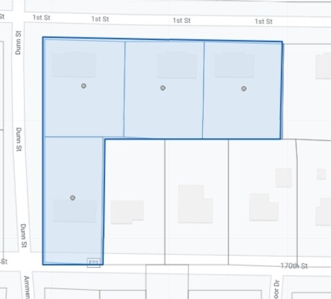
Nearby Places
Map Layers
Map Styles
 Street
 Aerial
- Restaurants
- Banks
- Shops
- Fitness
- Groceries
SALE & LEASE HISTORY
LISTING DATE
SALE/LEASE

Nov 07, 2017
For Sale
Nearby Properties
Address
Land Use
TOTAL SIZE
Lot Size
Zoning
Address
Land Use
TOTAL SIZE
Lot Size
Zoning
78,507 SF
3 AC
FS-RM
Address
Land Use
TOTAL SIZE
Lot Size
Zoning
54.61 AC
Address
Land Use
TOTAL SIZE
Lot Size
Zoning
78,244 SF
29.60 AC
A1
Address
Land Use
TOTAL SIZE
Lot Size
Zoning
2,880 SF
135.40 AC
A-1, AGRIC
Address
Land Use
TOTAL SIZE
Lot Size
Zoning
9,540 SF
35 AC
A-1, AGRIC
Address
Land Use
TOTAL SIZE
Lot Size
Zoning
19.06 AC
RMH
Address
Land Use
TOTAL SIZE
Lot Size
Zoning
Address
Land Use
TOTAL SIZE
Lot Size
Zoning
2,950 SF
2.23 AC
Address
Land Use
TOTAL SIZE
Lot Size
Zoning
15.17 AC
Address
Land Use
TOTAL SIZE
Lot Size
Zoning
4,278 SF
1.65 AC
Address
Land Use
TOTAL SIZE
Lot Size
Zoning
8,098 SF
1.04 AC
Address
Land Use
TOTAL SIZE
Lot Size
Zoning
11,646 SF
2.46 AC
Address
Land Use
TOTAL SIZE
Lot Size
Zoning
8,098 SF
0.66 AC
Address
Land Use
TOTAL SIZE
Lot Size
Zoning
2,520 SF
1.64 AC
Address
Land Use
TOTAL SIZE
Lot Size
Zoning
10,818 SF
8.58 AC
I1
Address
Land Use
TOTAL SIZE
Lot Size
Zoning
7,519 SF
1.03 AC
Address
Land Use
TOTAL SIZE
Lot Size
Zoning
2,370 SF
1.18 AC
Address
Land Use
TOTAL SIZE
Lot Size
Zoning
3,200 SF
1.85 AC
Address
Land Use
TOTAL SIZE
Lot Size
Zoning
7,632 SF
0.99 AC
Address
Land Use
TOTAL SIZE
Lot Size
Zoning
3.74 AC
Address
Land Use
TOTAL SIZE
Lot Size
Zoning
7.93 AC
A-1, AGRIC
Address
Land Use
TOTAL SIZE
Lot Size
Zoning
11,100 SF
0.85 AC
Address
Land Use
TOTAL SIZE
Lot Size
Zoning
4,120 SF
2.59 AC
Address
Land Use
TOTAL SIZE
Lot Size
Zoning
13,200 SF
3.06 AC
I1
Address
Land Use
TOTAL SIZE
Lot Size
Zoning
1,590 SF
1.03 AC
Address
Land Use
TOTAL SIZE
Lot Size
Zoning
1,532 SF
170.33 AC
A
Address
Land Use
TOTAL SIZE
Lot Size
Zoning
3,406 SF
2.16 AC
C
Address
Land Use
TOTAL SIZE
Lot Size
Zoning
3,300 SF
0.12 AC
Address
Land Use
TOTAL SIZE
Lot Size
Zoning
3,112 SF
0.23 AC
Address
Land Use
TOTAL SIZE
Lot Size
Zoning
2,000 SF
0.23 AC
The World's #1 Commercial Real Estate Marketplace
Connect with us
© 2026 CoStar Group
The information above has been obtained from sources believed reliable. While we do not doubt its accuracy we have not verified it and make no guarantee, warranty or representation about it. It is your responsibility to independently confirm its accuracy and completeness. Any projections, opinions, assumptions, or estimates used are for example only and do not represent the current or future performance of the property. The value of this transaction to you depends on tax and other factors which should be evaluated by your tax, financial, and legal advisors. You and your advisors should conduct a careful, independent investigation of the property to determine to your satisfaction the suitability of the property for your needs.