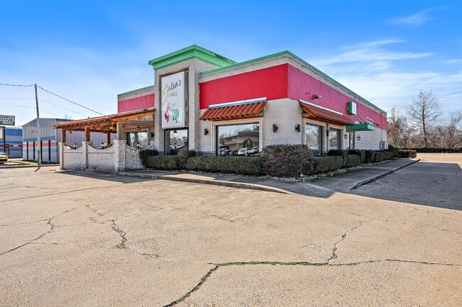
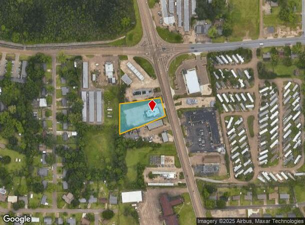
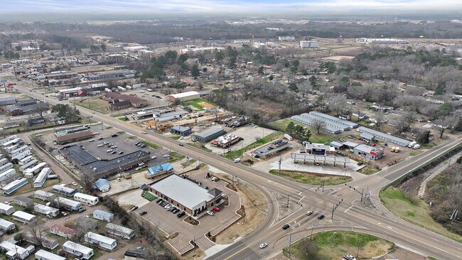
Property Record
127 S Pearson Rd, Pearl, MS 39208
NEARBY LISTINGS FOR SALE OR LEASE
Property Detail
127 S Pearson Rd
E08I-000029-00000
LOT APPROX 204 X 312 X 108 X 265 IN NE4 SW4 W PEARSON RD & N OF DRAINAGE DITCH DB 287 PG 434 0072772 DB 690 PG 0528 0012094
Restaurantbuilding
Rankin
X
Mississippi
28121C0169G
1.01 AC
2024
Brandon/Flowood/Pearl
2024
Jackson
020705
Jackson, MS
3,393 SF
DEMOGRAPHICS near 127 S Pearson Rd
1 Mile
3 Mile
5 Mile
2024 Total Population
5,054
18,927
60,307
2029 Population
5,171
19,447
60,520
Pop Growth 2024-2029
+ 2.31%
+ 2.75%
+ 0.35%
Average Age
37
38
38
2024 Total Households
2,135
7,169
23,330
HH Growth 2024-2029
+ 2.34%
+ 2.87%
+ 0.24%
Median Household Inc
$35,811
$45,799
$40,260
Avg Household Size
2.30
2.40
2.20
2024 Avg HH Vehicles
2.00
2.00
2.00
Median Home Value
$122,615
$130,942
$132,415
Median Year Built
1972
1975
1974
Nearby Places
Map Layers
Map Styles
 Street
 Aerial
- Restaurants
- Banks
- Shops
- Fitness
- Groceries
PUBLIC TRANSPORTATION
COMMUTER RAIL
DRIVE
WALK
Distance
9 min
5.8 mi
AIRPORT
Jackson-Medgar Wiley Evers International
DRIVE
WALK
Distance
Jackson-Medgar Wiley Evers International
14 min
6.3 mi
SALE & LEASE HISTORY
LISTING DATE
SALE/LEASE

Apr 23, 2025
For Lease
Nearby Properties
Address
Land Use
TOTAL SIZE
Lot Size
Zoning
Address
Land Use
TOTAL SIZE
Lot Size
Zoning
40,148 SF
37.47 AC
Address
Land Use
TOTAL SIZE
Lot Size
Zoning
58.94 AC
Address
Land Use
TOTAL SIZE
Lot Size
Zoning
123,308 SF
20.88 AC
Address
Land Use
TOTAL SIZE
Lot Size
Zoning
30,925 SF
38.73 AC
Address
Land Use
TOTAL SIZE
Lot Size
Zoning
4,008 SF
8.30 AC
Address
Land Use
TOTAL SIZE
Lot Size
Zoning
2,348 SF
16.45 AC
Address
Land Use
TOTAL SIZE
Lot Size
Zoning
1,257 SF
2.65 AC
Address
Land Use
TOTAL SIZE
Lot Size
Zoning
31,285 SF
2 AC
Address
Land Use
TOTAL SIZE
Lot Size
Zoning
31,427 SF
40.65 AC
Address
Land Use
TOTAL SIZE
Lot Size
Zoning
28,216 SF
6 AC
Address
Land Use
TOTAL SIZE
Lot Size
Zoning
139,417 SF
13.50 AC
Address
Land Use
TOTAL SIZE
Lot Size
Zoning
9,632 SF
32.54 AC
Address
Land Use
TOTAL SIZE
Lot Size
Zoning
10,086 SF
2.41 AC
Address
Land Use
TOTAL SIZE
Lot Size
Zoning
253,479 SF
17.08 AC
Address
Land Use
TOTAL SIZE
Lot Size
Zoning
67,442 SF
2.85 AC
Address
Land Use
TOTAL SIZE
Lot Size
Zoning
70,433 SF
2.53 AC
Address
Land Use
TOTAL SIZE
Lot Size
Zoning
6,538 SF
35.76 AC
Address
Land Use
TOTAL SIZE
Lot Size
Zoning
33.64 AC
Address
Land Use
TOTAL SIZE
Lot Size
Zoning
24,081 SF
24.48 AC
Address
Land Use
TOTAL SIZE
Lot Size
Zoning
5.06 AC
Address
Land Use
TOTAL SIZE
Lot Size
Zoning
71,705 SF
11.52 AC
Address
Land Use
TOTAL SIZE
Lot Size
Zoning
58,208 SF
2.41 AC
Address
Land Use
TOTAL SIZE
Lot Size
Zoning
17,128 SF
2 AC
Address
Land Use
TOTAL SIZE
Lot Size
Zoning
214,011 SF
17.50 AC
Address
Land Use
TOTAL SIZE
Lot Size
Zoning
19,989 SF
1.53 AC
Address
Land Use
TOTAL SIZE
Lot Size
Zoning
28,073 SF
6.72 AC
Address
Land Use
TOTAL SIZE
Lot Size
Zoning
47.80 AC
Address
Land Use
TOTAL SIZE
Lot Size
Zoning
16,095 SF
11.11 AC
Address
Land Use
TOTAL SIZE
Lot Size
Zoning
55,092 SF
2.21 AC
Address
Land Use
TOTAL SIZE
Lot Size
Zoning
8,272 SF
8.15 AC
The World's #1 Commercial Real Estate Marketplace
Connect with us
© 2025 CoStar Group
The information above has been obtained from sources believed reliable. While we do not doubt its accuracy we have not verified it and make no guarantee, warranty or representation about it. It is your responsibility to independently confirm its accuracy and completeness. Any projections, opinions, assumptions, or estimates used are for example only and do not represent the current or future performance of the property. The value of this transaction to you depends on tax and other factors which should be evaluated by your tax, financial, and legal advisors. You and your advisors should conduct a careful, independent investigation of the property to determine to your satisfaction the suitability of the property for your needs.