Property Record
127 Skillen St, Buffalo, NY 14207


NEARBY LISTINGS FOR SALE OR LEASE
Property Detail
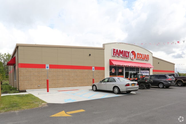
127 Skillen St
140200 77.34-3-22.12
Erie
Storebuilding
New York
X
22.120
36029C0184J
0.83 AC
2025
Greater Buffalo
2024
Buffalo/Niagara Falls
005801
Buffalo-Cheektowaga-Niagara Falls, NY
8,330 SF
DEMOGRAPHICS near 127 Skillen St
1 Mile
3 Mile
5 Mile
2024 Total Population
19,030
108,198
284,556
2029 Population
18,290
105,491
279,253
Pop Growth 2024-2029
(3.89%)
(2.50%)
(1.86%)
Average Age
36
39
39
2024 Total Households
7,692
48,151
125,954
HH Growth 2024-2029
(3.87%)
(2.56%)
(1.86%)
Median Household Inc
$41,170
$57,490
$52,768
Avg Household Size
2.40
2.20
2.20
2024 Avg HH Vehicles
1.00
1.00
1.00
Median Home Value
$118,750
$178,337
$171,688
Median Year Built
1947
1947
1948
Nearby Places
- Restaurants
- Banks
- Shops
- Fitness
- Groceries
PUBLIC TRANSPORTATION
AIRPORT
Buffalo Niagara International
DRIVE
WALK
Distance
Buffalo Niagara International
22 min
12.6 mi
Freight Ports
Albany, NY Port
DRIVE
WALK
Distance
Albany, NY Port
1 min
261.5 mi
SALE & LEASE HISTORY
LISTING DATE
SALE/LEASE

Jan 26, 2018
For Sale
Aug 07, 2017
For Sale
Nearby Properties
Address
Land Use
TOTAL SIZE
Lot Size
Zoning
Address
Land Use
TOTAL SIZE
Lot Size
Zoning
6,120 SF
87.10 AC
D-IL
Address
Land Use
TOTAL SIZE
Lot Size
Zoning
139,224 SF
13.72 AC
WID
Address
Land Use
TOTAL SIZE
Lot Size
Zoning
8,317 SF
39.03 AC
SPLIT ZONE
Address
Land Use
TOTAL SIZE
Lot Size
Zoning
80,927 SF
28.20 AC
WID
Address
Land Use
TOTAL SIZE
Lot Size
Zoning
121,015 SF
92.60 AC
D-E
Address
Land Use
TOTAL SIZE
Lot Size
Zoning
21,200 SF
20.94 AC
D-IL
Address
Land Use
TOTAL SIZE
Lot Size
Zoning
239,735 SF
17.73 AC
TND
Address
Land Use
TOTAL SIZE
Lot Size
Zoning
94,680 SF
175.90 AC
D-OG
Address
Land Use
TOTAL SIZE
Lot Size
Zoning
59,670 SF
911.28 AC
OS
Address
Land Use
TOTAL SIZE
Lot Size
Zoning
650,000 SF
42.15 AC
G-1
Address
Land Use
TOTAL SIZE
Lot Size
Zoning
61,327 SF
175 AC
D-OG
Address
Land Use
TOTAL SIZE
Lot Size
Zoning
67,666 SF
17.43 AC
G-1
Address
Land Use
TOTAL SIZE
Lot Size
Zoning
3.20 AC
G-1
Address
Land Use
TOTAL SIZE
Lot Size
Zoning
11,808 SF
11.93 AC
N-3R
Address
Land Use
TOTAL SIZE
Lot Size
Zoning
120,954 SF
9.74 AC
D-S
Address
Land Use
TOTAL SIZE
Lot Size
Zoning
356,891 SF
21.33 AC
B
Address
Land Use
TOTAL SIZE
Lot Size
Zoning
16 AC
G-1
Address
Land Use
TOTAL SIZE
Lot Size
Zoning
151,641 SF
1.53 AC
N-1S
Address
Land Use
TOTAL SIZE
Lot Size
Zoning
41,752 SF
8.95 AC
SPLIT ZONE
Address
Land Use
TOTAL SIZE
Lot Size
Zoning
138,000 SF
7.30 AC
P-S
Address
Land Use
TOTAL SIZE
Lot Size
Zoning
55,419 SF
14.78 AC
SPLIT ZONE
Address
Land Use
TOTAL SIZE
Lot Size
Zoning
97,298 SF
15.28 AC
D-S
Address
Land Use
TOTAL SIZE
Lot Size
Zoning
36,504 SF
D-OG
Address
Land Use
TOTAL SIZE
Lot Size
Zoning
3,840 SF
11.80 AC
D-R
Address
Land Use
TOTAL SIZE
Lot Size
Zoning
3,068 SF
239.50 AC
D-OG
Address
Land Use
TOTAL SIZE
Lot Size
Zoning
13,836 SF
7.70 AC
D-R
Address
Land Use
TOTAL SIZE
Lot Size
Zoning
62,169 SF
29.44 AC
N-3R
Address
Land Use
TOTAL SIZE
Lot Size
Zoning
265,850 SF
19.35 AC
Address
Land Use
TOTAL SIZE
Lot Size
Zoning
3,650 SF
0.13 AC
N-2R
Address
Land Use
TOTAL SIZE
Lot Size
Zoning
259,454 SF
7.66 AC
N-3R
The World's #1 Commercial Real Estate Marketplace
Connect with us
© 2025 CoStar Group
The information above has been obtained from sources believed reliable. While we do not doubt its accuracy we have not verified it and make no guarantee, warranty or representation about it. It is your responsibility to independently confirm its accuracy and completeness. Any projections, opinions, assumptions, or estimates used are for example only and do not represent the current or future performance of the property. The value of this transaction to you depends on tax and other factors which should be evaluated by your tax, financial, and legal advisors. You and your advisors should conduct a careful, independent investigation of the property to determine to your satisfaction the suitability of the property for your needs.