Property Record
127 W Byers Ave, New Stanton, PA 15672

NEARBY LISTINGS FOR SALE OR LEASE
-
-
View all New Stanton listings for sale on LoopNet.com
Property Detail
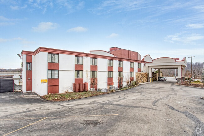
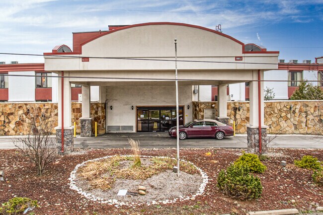
127 W Byers Ave
64-03-16-0-004
MOTEL SP GAR
Commercialofficeresidentialmixeduse
Westmoreland
X
Pennsylvania
42129C0628F
3.20 AC
2025
Pittsburgh South Area
2025
Pittsburgh
804901
Pittsburgh, PA
DEMOGRAPHICS near 127 W Byers Ave
1 Mile
3 Mile
5 Mile
2024 Total Population
2,016
9,037
22,190
2029 Population
1,967
8,823
21,654
Pop Growth 2024-2029
(2.43%)
(2.37%)
(2.42%)
Average Age
43
44
46
2024 Total Households
904
4,055
9,352
HH Growth 2024-2029
(2.65%)
(2.39%)
(2.57%)
Median Household Inc
$74,876
$66,972
$65,179
Avg Household Size
2.20
2.20
2.20
2024 Avg HH Vehicles
2.00
2.00
2.00
Median Home Value
$208,556
$169,748
$178,378
Median Year Built
1972
1968
1971
Nearby Places
Map Layers
Map Styles
 Street
 Aerial
- Restaurants
- Banks
- Shops
- Fitness
- Groceries
PUBLIC TRANSPORTATION
COMMUTER RAIL
DRIVE
WALK
Distance
15 min
8.5 mi
AIRPORT
Arnold Palmer Regional
DRIVE
WALK
Distance
Arnold Palmer Regional
31 min
17.4 mi
SALE & LEASE HISTORY
LISTING DATE
SALE/LEASE

Sep 26, 2023
For Sale
Aug 31, 2022
For Sale
Nearby Properties
Address
Land Use
TOTAL SIZE
Lot Size
Zoning
Address
Land Use
TOTAL SIZE
Lot Size
Zoning
168.67 AC
Address
Land Use
TOTAL SIZE
Lot Size
Zoning
37.67 AC
Address
Land Use
TOTAL SIZE
Lot Size
Zoning
185.70 AC
Address
Land Use
TOTAL SIZE
Lot Size
Zoning
44.36 AC
Address
Land Use
TOTAL SIZE
Lot Size
Zoning
21.91 AC
Address
Land Use
TOTAL SIZE
Lot Size
Zoning
208,800 SF
31.20 AC
Address
Land Use
TOTAL SIZE
Lot Size
Zoning
32.50 AC
Address
Land Use
TOTAL SIZE
Lot Size
Zoning
Address
Land Use
TOTAL SIZE
Lot Size
Zoning
14.79 AC
Address
Land Use
TOTAL SIZE
Lot Size
Zoning
13.39 AC
Address
Land Use
TOTAL SIZE
Lot Size
Zoning
326,000 SF
109.40 AC
Address
Land Use
TOTAL SIZE
Lot Size
Zoning
35.40 AC
Address
Land Use
TOTAL SIZE
Lot Size
Zoning
57.96 AC
Address
Land Use
TOTAL SIZE
Lot Size
Zoning
342.14 AC
Address
Land Use
TOTAL SIZE
Lot Size
Zoning
57.80 AC
Address
Land Use
TOTAL SIZE
Lot Size
Zoning
Address
Land Use
TOTAL SIZE
Lot Size
Zoning
9.23 AC
Address
Land Use
TOTAL SIZE
Lot Size
Zoning
Address
Land Use
TOTAL SIZE
Lot Size
Zoning
Address
Land Use
TOTAL SIZE
Lot Size
Zoning
1,924 SF
6.55 AC
Address
Land Use
TOTAL SIZE
Lot Size
Zoning
11.95 AC
Address
Land Use
TOTAL SIZE
Lot Size
Zoning
90,464 SF
21 AC
Address
Land Use
TOTAL SIZE
Lot Size
Zoning
54,542 SF
38.84 AC
Address
Land Use
TOTAL SIZE
Lot Size
Zoning
141.89 AC
Address
Land Use
TOTAL SIZE
Lot Size
Zoning
11.28 AC
Address
Land Use
TOTAL SIZE
Lot Size
Zoning
43,432 SF
4.18 AC
Address
Land Use
TOTAL SIZE
Lot Size
Zoning
7.40 AC
Address
Land Use
TOTAL SIZE
Lot Size
Zoning
82,116 SF
22.17 AC
Address
Land Use
TOTAL SIZE
Lot Size
Zoning
5,600 SF
4.41 AC
Address
Land Use
TOTAL SIZE
Lot Size
Zoning
5.20 AC
The World's #1 Commercial Real Estate Marketplace
Connect with us
© 2026 CoStar Group
The information above has been obtained from sources believed reliable. While we do not doubt its accuracy we have not verified it and make no guarantee, warranty or representation about it. It is your responsibility to independently confirm its accuracy and completeness. Any projections, opinions, assumptions, or estimates used are for example only and do not represent the current or future performance of the property. The value of this transaction to you depends on tax and other factors which should be evaluated by your tax, financial, and legal advisors. You and your advisors should conduct a careful, independent investigation of the property to determine to your satisfaction the suitability of the property for your needs.