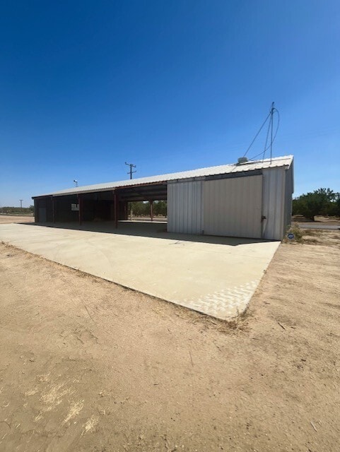
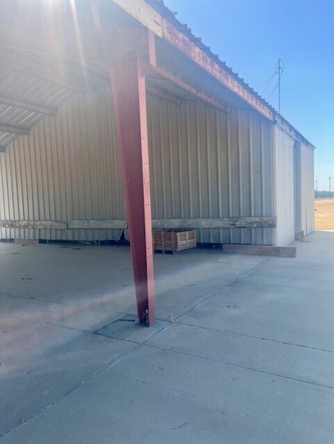
Property Record
1270 E Riverside St, Shafter, CA 93263


Property Detail
1270 E Riverside St
Bakersfield-Delano, CA
SECTION 14 , TOWNSHIP 28 , RANGE 25 , QUARTER
089-150-13-00-9
KERN
Commercialnec
California
B and X Area of moderate flood hazard, usually the area between the limits of the 100-year and 500-year floods.
27
2024
11.70 AC
2025
NW Outlying Kern County
004102
Bakersfield
1,680 SF
NEARBY LISTINGS FOR SALE OR LEASE
DEMOGRAPHICS near 1270 E Riverside St
1 mile
3 mile
5 mile
2025 Total Population
100
23,436
24,579
2030 Population
100
23,991
25,138
Pop Growth 2025-2030
0.00%
+ 2.37%
+ 2.27%
Average Age
35
33
33
2025 Total Households
20
6,200
6,449
HH Growth 2025-2030
0.00%
+ 3.00%
+ 2.98%
Median Household Inc
$71,249
$67,224
$67,297
Avg Household Size
3.60
3.60
3.60
2025 Avg HH Vehicles
2.00
2.00
2.00
Median Home Value
$383,333
$355,530
$357,896
Median Year Built
1982
1991
1990
Nearby Places
Map Layers
Map Styles
 Street
 Aerial
Transit
 Traffic
 Biking
Places
Listings with unknown addresses are not visible on the map
- Restaurants
- Banks
- Shops
- Fitness
- Groceries
PUBLIC TRANSPORTATION
AIRPORT
Meadows Field
Drive
Walk
Distance
Meadows Field
25 min
13.7 mi
Freight Ports
The Port of Hueneme
Drive
Walk
Distance
The Port of Hueneme
172 min
135.8 mi
SALE & LEASE HISTORY
LISTING DATE
SALE/LEASE

Oct 24, 2024
For Sale
Oct 15, 2018
For Lease
Jun 02, 2025
For Sale
Nearby Properties
Address
Land Use
TOTAL SIZE
Lot Size
Zoning
Address
Land Use
TOTAL SIZE
Lot Size
Zoning
622,678 SF
68.11 AC
I
Address
Land Use
TOTAL SIZE
Lot Size
Zoning
19.09 AC
Address
Land Use
TOTAL SIZE
Lot Size
Zoning
135,048 SF
34.98 AC
M
Address
Land Use
TOTAL SIZE
Lot Size
Zoning
8,340 SF
8.34 AC
R1
Address
Land Use
TOTAL SIZE
Lot Size
Zoning
92,011 SF
8.32 AC
Address
Land Use
TOTAL SIZE
Lot Size
Zoning
41.47 AC
M-3
Address
Land Use
TOTAL SIZE
Lot Size
Zoning
35,125 SF
20.70 AC
M-2
Address
Land Use
TOTAL SIZE
Lot Size
Zoning
75,675 SF
8.43 AC
A
Address
Land Use
TOTAL SIZE
Lot Size
Zoning
1,200 SF
519.50 AC
A
Address
Land Use
TOTAL SIZE
Lot Size
Zoning
15,000 SF
10.70 AC
M2
Address
Land Use
TOTAL SIZE
Lot Size
Zoning
3,119 SF
153.42 AC
BP
Address
Land Use
TOTAL SIZE
Lot Size
Zoning
75.88 AC
Address
Land Use
TOTAL SIZE
Lot Size
Zoning
140.40 AC
A
Address
Land Use
TOTAL SIZE
Lot Size
Zoning
17,588 SF
1.66 AC
GC
Address
Land Use
TOTAL SIZE
Lot Size
Zoning
7,200 SF
15.17 AC
M3
Address
Land Use
TOTAL SIZE
Lot Size
Zoning
5,291 SF
3.64 AC
M3
Address
Land Use
TOTAL SIZE
Lot Size
Zoning
Address
Land Use
TOTAL SIZE
Lot Size
Zoning
8,400 SF
45.59 AC
A
Address
Land Use
TOTAL SIZE
Lot Size
Zoning
7,437 SF
0.75 AC
GC
Address
Land Use
TOTAL SIZE
Lot Size
Zoning
5,200 SF
14.31 AC
Address
Land Use
TOTAL SIZE
Lot Size
Zoning
240.57 AC
A
Address
Land Use
TOTAL SIZE
Lot Size
Zoning
5,250 SF
38.18 AC
A
Address
Land Use
TOTAL SIZE
Lot Size
Zoning
21,357 SF
1.38 AC
R1
Address
Land Use
TOTAL SIZE
Lot Size
Zoning
9,720 SF
7.87 AC
M-2
Address
Land Use
TOTAL SIZE
Lot Size
Zoning
Address
Land Use
TOTAL SIZE
Lot Size
Zoning
159 AC
A
Address
Land Use
TOTAL SIZE
Lot Size
Zoning
1,200 SF
0.17 AC
R-2
Address
Land Use
TOTAL SIZE
Lot Size
Zoning
10,715 SF
1.45 AC
Address
Land Use
TOTAL SIZE
Lot Size
Zoning
2,100 SF
0.61 AC
GC
The World's #1 Commercial Real Estate Marketplace
Connect with us
© 2026 CoStar Group
The information above has been obtained from sources believed reliable. While we do not doubt its accuracy we have not verified it and make no guarantee, warranty or representation about it. It is your responsibility to independently confirm its accuracy and completeness. Any projections, opinions, assumptions, or estimates used are for example only and do not represent the current or future performance of the property. The value of this transaction to you depends on tax and other factors which should be evaluated by your tax, financial, and legal advisors. You and your advisors should conduct a careful, independent investigation of the property to determine to your satisfaction the suitability of the property for your needs.