Property Record
1270 Parrish St, Lake Oswego, OR 97034
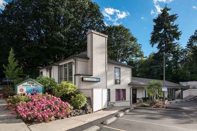

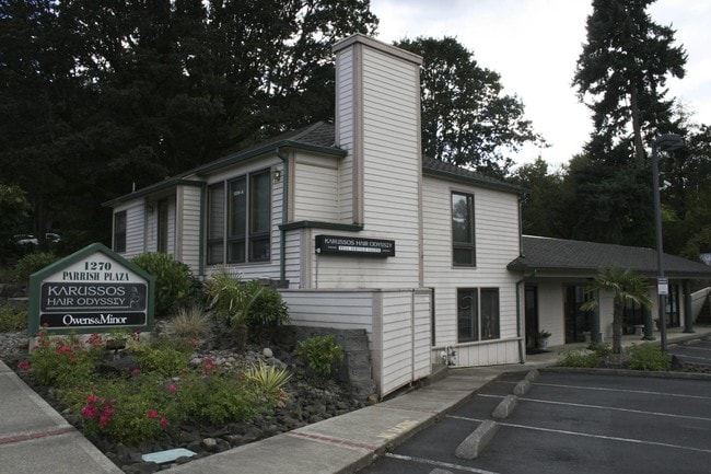
Property Detail
1270 Parrish St
Portland-Vancouver-Hillsboro, OR-WA
SECTION 10 TOWNSHIP 2S RANGE 1E QUARTER CC TAX LOT 05900
00262600
Clackamas
Commercialbuilding
Oregon
NC
5900
B and X Area of moderate flood hazard, usually the area between the limits of the 100-year and 500-year floods.
0.30 AC
2025
Lake Oswego/West Linn
2025
Portland
020503
NEARBY LISTINGS FOR SALE OR LEASE
DEMOGRAPHICS near 1270 Parrish St
1 mile
3 mile
5 mile
2025 Total Population
7,996
76,061
239,242
2030 Population
8,023
76,256
239,248
Pop Growth 2025-2030
+ 0.34%
+ 0.26%
0.00%
Average Age
46
45
43
2025 Total Households
3,257
31,126
97,114
HH Growth 2025-2030
+ 0.37%
+ 0.24%
(0.04%)
Median Household Inc
$153,495
$123,938
$109,404
Avg Household Size
2.40
2.40
2.40
2025 Avg HH Vehicles
2.00
2.00
2.00
Median Home Value
$986,049
$801,794
$701,321
Median Year Built
1971
1977
1977
Nearby Places
Map Layers
Map Styles
 Street
 Aerial
Layers
 Traffic
 Biking
Places
Listings with unknown addresses are not visible on the map
- Restaurants
- Banks
- Shops
- Fitness
- Groceries
PUBLIC TRANSPORTATION
COMMUTER RAIL
Tigard Transit Center (Westside Express Service - Tri-County Metropolitan Transportation District of Oregon Rail (TriMet Rail))
Drive
Walk
Distance
Tigard Transit Center (Westside Express Service - Tri-County Metropolitan Transportation District of Oregon Rail (TriMet Rail))
17 min
6.7 mi
Drive
Walk
Distance
16 min
6.7 mi
AIRPORT
Portland International
Drive
Walk
Distance
Portland International
37 min
21.0 mi
Freight Ports
Port of Portland
Drive
Walk
Distance
Port of Portland
23 min
12.2 mi
SALE & LEASE HISTORY
LISTING DATE
SALE/LEASE

Sep 25, 2016
For Lease
Nov 10, 2020
For Lease
Apr 25, 2017
For Lease
Nearby Properties
Address
Land Use
TOTAL SIZE
Lot Size
Zoning
Address
Land Use
TOTAL SIZE
Lot Size
Zoning
Address
Land Use
TOTAL SIZE
Lot Size
Zoning
28.30 AC
EC/R-0
Address
Land Use
TOTAL SIZE
Lot Size
Zoning
20.82 AC
R-5
Address
Land Use
TOTAL SIZE
Lot Size
Zoning
Address
Land Use
TOTAL SIZE
Lot Size
Zoning
1 SF
1 AC
PF
Address
Land Use
TOTAL SIZE
Lot Size
Zoning
3,550 SF
3.99 AC
DMU
Address
Land Use
TOTAL SIZE
Lot Size
Zoning
5,724 SF
13.95 AC
NC/R-0
Address
Land Use
TOTAL SIZE
Lot Size
Zoning
1 SF
0.14 AC
EC
Address
Land Use
TOTAL SIZE
Lot Size
Zoning
10.35 AC
PF
Address
Land Use
TOTAL SIZE
Lot Size
Zoning
0.26 AC
C3
Address
Land Use
TOTAL SIZE
Lot Size
Zoning
21.39 AC
CI
Address
Land Use
TOTAL SIZE
Lot Size
Zoning
3 AC
CR&D
Address
Land Use
TOTAL SIZE
Lot Size
Zoning
11.35 AC
C3
Address
Land Use
TOTAL SIZE
Lot Size
Zoning
5.12 AC
CR&D
Address
Land Use
TOTAL SIZE
Lot Size
Zoning
62,048 SF
8.58 AC
R20
Address
Land Use
TOTAL SIZE
Lot Size
Zoning
5 AC
CR&D
Address
Land Use
TOTAL SIZE
Lot Size
Zoning
35.26 AC
PNA
Address
Land Use
TOTAL SIZE
Lot Size
Zoning
3,162 SF
4 AC
CR&D
Address
Land Use
TOTAL SIZE
Lot Size
Zoning
11.10 AC
HDR
Address
Land Use
TOTAL SIZE
Lot Size
Zoning
1 SF
4.73 AC
R-3
Address
Land Use
TOTAL SIZE
Lot Size
Zoning
3 AC
CR&D
Address
Land Use
TOTAL SIZE
Lot Size
Zoning
6 AC
R-0
Address
Land Use
TOTAL SIZE
Lot Size
Zoning
122,430 SF
10.85 AC
NC
Address
Land Use
TOTAL SIZE
Lot Size
Zoning
3.45 AC
R-15
Address
Land Use
TOTAL SIZE
Lot Size
Zoning
1 SF
11.53 AC
OC/R-3
Address
Land Use
TOTAL SIZE
Lot Size
Zoning
2 AC
CR&D
Address
Land Use
TOTAL SIZE
Lot Size
Zoning
2 AC
CR&D
Address
Land Use
TOTAL SIZE
Lot Size
Zoning
8.37 AC
R-5
Address
Land Use
TOTAL SIZE
Lot Size
Zoning
Address
Land Use
TOTAL SIZE
Lot Size
Zoning
121,443 SF
6.58 AC
NC/R-0
The World's #1 Commercial Real Estate Marketplace
Connect with us
© 2026 CoStar Group
The information above has been obtained from sources believed reliable. While we do not doubt its accuracy we have not verified it and make no guarantee, warranty or representation about it. It is your responsibility to independently confirm its accuracy and completeness. Any projections, opinions, assumptions, or estimates used are for example only and do not represent the current or future performance of the property. The value of this transaction to you depends on tax and other factors which should be evaluated by your tax, financial, and legal advisors. You and your advisors should conduct a careful, independent investigation of the property to determine to your satisfaction the suitability of the property for your needs.