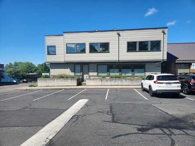
Property Record
12700 Nw Cornell Rd, Portland, OR 97229

Property Detail
12700 Nw Cornell Rd
Portland-Vancouver-Hillsboro, OR-WA
WASHINGTON
R0972692
Oregon
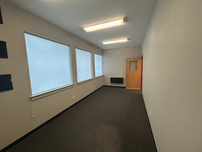
Commercialbuilding
0.45 AC
TO:RC
North Beaverton
B and X Area of moderate flood hazard, usually the area between the limits of the 100-year and 500-year floods.
Portland
9,905 SF
NEARBY LISTINGS FOR SALE OR LEASE
DEMOGRAPHICS near 12700 Nw Cornell Rd
1 mile
3 mile
5 mile
2025 Total Population
16,184
127,966
304,687
2030 Population
16,305
129,207
307,443
Pop Growth 2025-2030
+ 0.75%
+ 0.97%
+ 0.90%
Average Age
40
40
40
2025 Total Households
6,684
50,119
119,187
HH Growth 2025-2030
+ 0.82%
+ 1.09%
+ 0.99%
Median Household Inc
$103,318
$113,950
$107,639
Avg Household Size
2.40
2.50
2.50
2025 Avg HH Vehicles
2.00
2.00
2.00
Median Home Value
$661,764
$711,887
$672,674
Median Year Built
1980
1991
1988
Nearby Places
Map Layers
Map Styles
 Street
 Aerial
Transit
 Traffic
 Biking
Places
Listings with unknown addresses are not visible on the map
- Restaurants
- Banks
- Shops
- Fitness
- Groceries
PUBLIC TRANSPORTATION
COMMUTER RAIL
Beaverton Transit Center (West Side Express) (Westside Express Service - Tri-County Metropolitan Transportation District of Oregon Rail (TriMet Rail))
Drive
Walk
Distance
Beaverton Transit Center (West Side Express) (Westside Express Service - Tri-County Metropolitan Transportation District of Oregon Rail (TriMet Rail))
9 min
4.1 mi
Hall/Nimbus (Westside Express Service - Tri-County Metropolitan Transportation District of Oregon Rail (TriMet Rail))
Drive
Walk
Distance
Hall/Nimbus (Westside Express Service - Tri-County Metropolitan Transportation District of Oregon Rail (TriMet Rail))
10 min
5.9 mi
AIRPORT
Portland International
Drive
Walk
Distance
Portland International
34 min
20.6 mi
Freight Ports
Port of Portland
Drive
Walk
Distance
Port of Portland
17 min
9.6 mi
SALE & LEASE HISTORY
LISTING DATE
SALE/LEASE

Aug 18, 2024
For Lease
Nearby Properties
Address
Land Use
TOTAL SIZE
Lot Size
Zoning
Address
Land Use
TOTAL SIZE
Lot Size
Zoning
0.05 AC
IND
Address
Land Use
TOTAL SIZE
Lot Size
Zoning
2,936,291 SF
72.49 AC
TO:EMP
Address
Land Use
TOTAL SIZE
Lot Size
Zoning
0.08 AC
IND
Address
Land Use
TOTAL SIZE
Lot Size
Zoning
58.68 AC
IND
Address
Land Use
TOTAL SIZE
Lot Size
Zoning
716,311 SF
75.07 AC
TO:EMP
Address
Land Use
TOTAL SIZE
Lot Size
Zoning
303,158 SF
18.18 AC
R10
Address
Land Use
TOTAL SIZE
Lot Size
Zoning
194.52 AC
R1
Address
Land Use
TOTAL SIZE
Lot Size
Zoning
1,031,421 SF
22.20 AC
SC-HDR
Address
Land Use
TOTAL SIZE
Lot Size
Zoning
461,858 SF
36.37 AC
CS
Address
Land Use
TOTAL SIZE
Lot Size
Zoning
704,877 SF
18.72 AC
OI-NC
Address
Land Use
TOTAL SIZE
Lot Size
Zoning
1,380,937 SF
36.42 AC
INST
Address
Land Use
TOTAL SIZE
Lot Size
Zoning
8,967 SF
13.12 AC
GC
Address
Land Use
TOTAL SIZE
Lot Size
Zoning
281,695 SF
7.41 AC
SC-HDR
Address
Land Use
TOTAL SIZE
Lot Size
Zoning
44.66 AC
IND
Address
Land Use
TOTAL SIZE
Lot Size
Zoning
359,574 SF
6.75 AC
R-9
Address
Land Use
TOTAL SIZE
Lot Size
Zoning
179,180 SF
36.77 AC
INST
Address
Land Use
TOTAL SIZE
Lot Size
Zoning
152,339 SF
28.70 AC
R1
Address
Land Use
TOTAL SIZE
Lot Size
Zoning
253,727 SF
38.06 AC
OI
Address
Land Use
TOTAL SIZE
Lot Size
Zoning
120,400 SF
16.28 AC
TC-HDR
Address
Land Use
TOTAL SIZE
Lot Size
Zoning
22.13 AC
R-15
Address
Land Use
TOTAL SIZE
Lot Size
Zoning
37.55 AC
IND
Address
Land Use
TOTAL SIZE
Lot Size
Zoning
214,045 SF
21.70 AC
R2
Address
Land Use
TOTAL SIZE
Lot Size
Zoning
210,649 SF
15.51 AC
R-15
Address
Land Use
TOTAL SIZE
Lot Size
Zoning
18.15 AC
SC-E
Address
Land Use
TOTAL SIZE
Lot Size
Zoning
155,788 SF
16.84 AC
R-6
Address
Land Use
TOTAL SIZE
Lot Size
Zoning
21.97 AC
R1
Address
Land Use
TOTAL SIZE
Lot Size
Zoning
188,509 SF
17.27 AC
UC-OR
Address
Land Use
TOTAL SIZE
Lot Size
Zoning
270,237 SF
22.44 AC
R-15
Address
Land Use
TOTAL SIZE
Lot Size
Zoning
62,693 SF
16.43 AC
CC
Address
Land Use
TOTAL SIZE
Lot Size
Zoning
431,653 SF
10.76 AC
R1
The World's #1 Commercial Real Estate Marketplace
Connect with us
© 2026 CoStar Group
The information above has been obtained from sources believed reliable. While we do not doubt its accuracy we have not verified it and make no guarantee, warranty or representation about it. It is your responsibility to independently confirm its accuracy and completeness. Any projections, opinions, assumptions, or estimates used are for example only and do not represent the current or future performance of the property. The value of this transaction to you depends on tax and other factors which should be evaluated by your tax, financial, and legal advisors. You and your advisors should conduct a careful, independent investigation of the property to determine to your satisfaction the suitability of the property for your needs.