Property Record
12701 Grand River Rd, Brighton, MI 48116


NEARBY LISTINGS FOR SALE OR LEASE
-
-
View all Brighton listings for sale on LoopNet.com
Property Detail
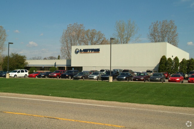
12701 Grand River Rd
Detroit-Warren-Dearborn, MI
Brgtn Industrial Pk
12-35-401-010
SEC 35, T2N, R6E, BRIGHTON INDUSTRIAL PARK LOT 2
Industrialgeneral
Livingston
X
Michigan
26093C0364D
2
2025
2.27 AC
2025
Livingston County
740200
Detroit
16,033 SF
DEMOGRAPHICS near 12701 Grand River Rd
1 Mile
3 Mile
5 Mile
2024 Total Population
569
12,429
58,156
2029 Population
583
12,670
59,131
Pop Growth 2024-2029
+ 2.46%
+ 1.94%
+ 1.68%
Average Age
44
42
43
2024 Total Households
202
4,694
22,919
HH Growth 2024-2029
+ 2.48%
+ 2.02%
+ 1.76%
Median Household Inc
$112,500
$102,545
$101,538
Avg Household Size
2.70
2.60
2.50
2024 Avg HH Vehicles
3.00
2.00
2.00
Median Home Value
$377,205
$344,693
$335,776
Median Year Built
1979
1982
1989
Nearby Places
Map Layers
Map Styles
 Street
 Aerial
- Restaurants
- Banks
- Shops
- Fitness
- Groceries
PUBLIC TRANSPORTATION
AIRPORT
Bishop International
DRIVE
WALK
Distance
Bishop International
51 min
37.5 mi
Detroit Metro Wayne County
DRIVE
WALK
Distance
Detroit Metro Wayne County
49 min
39.9 mi
SALE & LEASE HISTORY
LISTING DATE
SALE/LEASE

Nov 14, 2017
For Sale
Aug 24, 2017
For Sale
Nearby Properties
Address
Land Use
TOTAL SIZE
Lot Size
Zoning
Address
Land Use
TOTAL SIZE
Lot Size
Zoning
394,554 SF
28.66 AC
GI
Address
Land Use
TOTAL SIZE
Lot Size
Zoning
265,248 SF
59.38 AC
CD-RZ
Address
Land Use
TOTAL SIZE
Lot Size
Zoning
139,056 SF
50.33 AC
GI
Address
Land Use
TOTAL SIZE
Lot Size
Zoning
9,784 SF
68.90 AC
MM
Address
Land Use
TOTAL SIZE
Lot Size
Zoning
140,000 SF
9.08 AC
LI PUD
Address
Land Use
TOTAL SIZE
Lot Size
Zoning
164,517 SF
27.78 AC
GI
Address
Land Use
TOTAL SIZE
Lot Size
Zoning
183,105 SF
13.38 AC
I-1
Address
Land Use
TOTAL SIZE
Lot Size
Zoning
54,615 SF
6.14 AC
LI PUD
Address
Land Use
TOTAL SIZE
Lot Size
Zoning
106,347 SF
11.47 AC
LI
Address
Land Use
TOTAL SIZE
Lot Size
Zoning
96,480 SF
11.44 AC
GI
Address
Land Use
TOTAL SIZE
Lot Size
Zoning
73,010 SF
25.37 AC
GI
Address
Land Use
TOTAL SIZE
Lot Size
Zoning
83,785 SF
9.63 AC
CD-RZ
Address
Land Use
TOTAL SIZE
Lot Size
Zoning
43,758 SF
3.18 AC
B-3
Address
Land Use
TOTAL SIZE
Lot Size
Zoning
87,046 SF
9.76 AC
GI
Address
Land Use
TOTAL SIZE
Lot Size
Zoning
47,339 SF
9.56 AC
GI
Address
Land Use
TOTAL SIZE
Lot Size
Zoning
116,663 SF
8.98 AC
AI
Address
Land Use
TOTAL SIZE
Lot Size
Zoning
91,510 SF
9.73 AC
GI
Address
Land Use
TOTAL SIZE
Lot Size
Zoning
33,808 SF
4.16 AC
LI PUD
Address
Land Use
TOTAL SIZE
Lot Size
Zoning
4.60 AC
RM
Address
Land Use
TOTAL SIZE
Lot Size
Zoning
76,240 SF
4.39 AC
GI
Address
Land Use
TOTAL SIZE
Lot Size
Zoning
47,675 SF
1.30 AC
PUD
Address
Land Use
TOTAL SIZE
Lot Size
Zoning
45,340 SF
2.86 AC
LI PUD
Address
Land Use
TOTAL SIZE
Lot Size
Zoning
43,838 SF
10.05 AC
GI
Address
Land Use
TOTAL SIZE
Lot Size
Zoning
50,000 SF
1.26 AC
PUD
Address
Land Use
TOTAL SIZE
Lot Size
Zoning
56,745 SF
5.09 AC
GI
Address
Land Use
TOTAL SIZE
Lot Size
Zoning
34,200 SF
1.53 AC
RO
Address
Land Use
TOTAL SIZE
Lot Size
Zoning
42,510 SF
4.79 AC
B-1
Address
Land Use
TOTAL SIZE
Lot Size
Zoning
49,710 SF
5.61 AC
LI PUD
Address
Land Use
TOTAL SIZE
Lot Size
Zoning
32,841 SF
10.92 AC
GI
Address
Land Use
TOTAL SIZE
Lot Size
Zoning
90,500 SF
7.15 AC
B-3
The World's #1 Commercial Real Estate Marketplace
Connect with us
© 2025 CoStar Group
The information above has been obtained from sources believed reliable. While we do not doubt its accuracy we have not verified it and make no guarantee, warranty or representation about it. It is your responsibility to independently confirm its accuracy and completeness. Any projections, opinions, assumptions, or estimates used are for example only and do not represent the current or future performance of the property. The value of this transaction to you depends on tax and other factors which should be evaluated by your tax, financial, and legal advisors. You and your advisors should conduct a careful, independent investigation of the property to determine to your satisfaction the suitability of the property for your needs.