Property Record
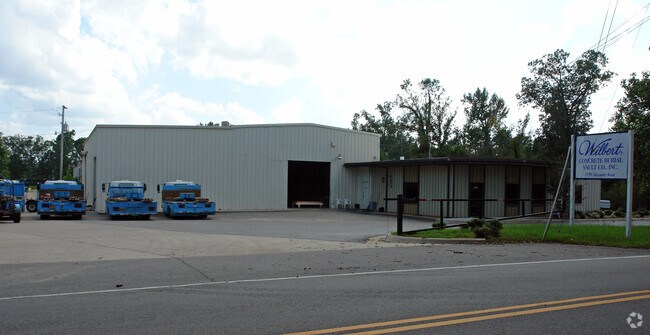
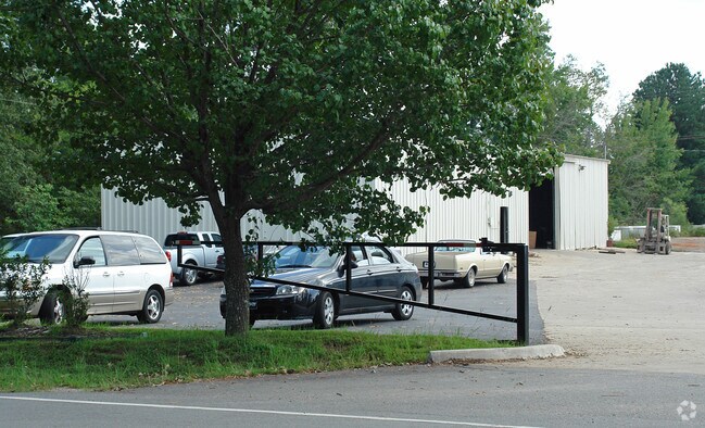
12705 Alexander Rd, Alexander, AR 72002

Property Detail
12705 Alexander Rd
45L-092-00-008-00
THE WEST 1/2 NW 1/4 NE 1/4 NE 1/4 SECTION 17, TOWNSHIP 1 SOUTH, RANGE 13 WEST, LESS AND EXCEPT PART OF THE NE 1/ 4 NE 1/ 4 OF SECTION 17, TOWNSHIP 1 SOUTH, RANGE 13 WEST, MORE PARTICULARLY DESCRIBED AS: COMMENCING AT THE NORTHEAST CORNER OF THE NE 1/
Lightindustrial
Pulaski
B and X Area of moderate flood hazard, usually the area between the limits of the 100-year and 500-year floods.
Arkansas
2025
4.24 AC
2025
Outlying Pulaski County
004104
Little Rock/N Little Rock
4,416 SF
Little Rock-North Little Rock-Conway, AR
NEARBY LISTINGS FOR SALE OR LEASE
DEMOGRAPHICS near 12705 Alexander Rd
1 mile
3 mile
5 mile
2025 Total Population
2,005
26,295
63,564
2030 Population
2,015
26,943
65,164
Pop Growth 2025-2030
+ 0.50%
+ 2.46%
+ 2.52%
Average Age
37
37
38
2025 Total Households
806
10,396
24,631
HH Growth 2025-2030
+ 0.74%
+ 2.30%
+ 2.46%
Median Household Inc
$34,667
$65,706
$63,242
Avg Household Size
2.50
2.50
2.50
2025 Avg HH Vehicles
2.00
2.00
2.00
Median Home Value
$157,743
$203,400
$190,317
Median Year Built
1998
1996
1990
Nearby Places
Map Layers
Map Styles
 Street
 Aerial
Transit
 Traffic
 Biking
Places
Listings with unknown addresses are not visible on the map
- Restaurants
- Banks
- Shops
- Fitness
- Groceries
PUBLIC TRANSPORTATION
AIRPORT
Bill and Hillary Clinton Ntl/Adams Field
Drive
Walk
Distance
Bill and Hillary Clinton Ntl/Adams Field
20 min
14.7 mi
Freight Ports
Port of Shreveport
Drive
Walk
Distance
Port of Shreveport
239 min
222.1 mi
Nearby Properties
Address
Land Use
TOTAL SIZE
Lot Size
Zoning
Address
Land Use
TOTAL SIZE
Lot Size
Zoning
189,729 SF
57.75 AC
Address
Land Use
TOTAL SIZE
Lot Size
Zoning
177,413 SF
35.78 AC
Address
Land Use
TOTAL SIZE
Lot Size
Zoning
185,805 SF
8.29 AC
Address
Land Use
TOTAL SIZE
Lot Size
Zoning
304,000 SF
20.93 AC
Address
Land Use
TOTAL SIZE
Lot Size
Zoning
317,302 SF
44.38 AC
Address
Land Use
TOTAL SIZE
Lot Size
Zoning
26,199 SF
19.22 AC
Address
Land Use
TOTAL SIZE
Lot Size
Zoning
201,039 SF
146.98 AC
Address
Land Use
TOTAL SIZE
Lot Size
Zoning
13,888 SF
21.57 AC
Address
Land Use
TOTAL SIZE
Lot Size
Zoning
83,022 SF
6.20 AC
Address
Land Use
TOTAL SIZE
Lot Size
Zoning
365,104 SF
29.75 AC
Address
Land Use
TOTAL SIZE
Lot Size
Zoning
104,359 SF
14.63 AC
Address
Land Use
TOTAL SIZE
Lot Size
Zoning
13,952 SF
12.35 AC
Address
Land Use
TOTAL SIZE
Lot Size
Zoning
7,937 SF
5.50 AC
Address
Land Use
TOTAL SIZE
Lot Size
Zoning
12,420 SF
12.25 AC
Address
Land Use
TOTAL SIZE
Lot Size
Zoning
16,957 SF
6.04 AC
Address
Land Use
TOTAL SIZE
Lot Size
Zoning
8,510 SF
13.20 AC
Address
Land Use
TOTAL SIZE
Lot Size
Zoning
45,600 SF
6.45 AC
Address
Land Use
TOTAL SIZE
Lot Size
Zoning
189,160 SF
40.53 AC
Address
Land Use
TOTAL SIZE
Lot Size
Zoning
30,356 SF
5.42 AC
Address
Land Use
TOTAL SIZE
Lot Size
Zoning
71,581 SF
10.69 AC
Address
Land Use
TOTAL SIZE
Lot Size
Zoning
11,762 SF
9.05 AC
Address
Land Use
TOTAL SIZE
Lot Size
Zoning
309,271 SF
41.75 AC
Address
Land Use
TOTAL SIZE
Lot Size
Zoning
7,482 SF
6.58 AC
Address
Land Use
TOTAL SIZE
Lot Size
Zoning
7,950 SF
8.74 AC
Address
Land Use
TOTAL SIZE
Lot Size
Zoning
19,440 SF
23.16 AC
Address
Land Use
TOTAL SIZE
Lot Size
Zoning
6,282 SF
61.51 AC
Address
Land Use
TOTAL SIZE
Lot Size
Zoning
162,970 SF
12.66 AC
Address
Land Use
TOTAL SIZE
Lot Size
Zoning
26,864 SF
7.95 AC
Address
Land Use
TOTAL SIZE
Lot Size
Zoning
20,440 SF
5.61 AC
Address
Land Use
TOTAL SIZE
Lot Size
Zoning
54.01 AC
The World's #1 Commercial Real Estate Marketplace
Connect with us
© 2026 CoStar Group
The information above has been obtained from sources believed reliable. While we do not doubt its accuracy we have not verified it and make no guarantee, warranty or representation about it. It is your responsibility to independently confirm its accuracy and completeness. Any projections, opinions, assumptions, or estimates used are for example only and do not represent the current or future performance of the property. The value of this transaction to you depends on tax and other factors which should be evaluated by your tax, financial, and legal advisors. You and your advisors should conduct a careful, independent investigation of the property to determine to your satisfaction the suitability of the property for your needs.