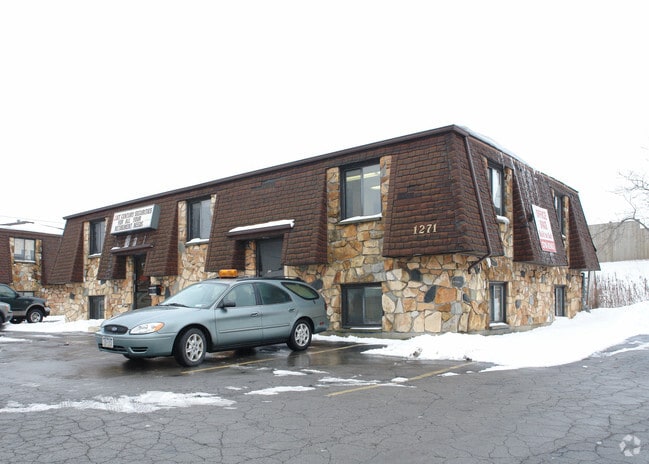
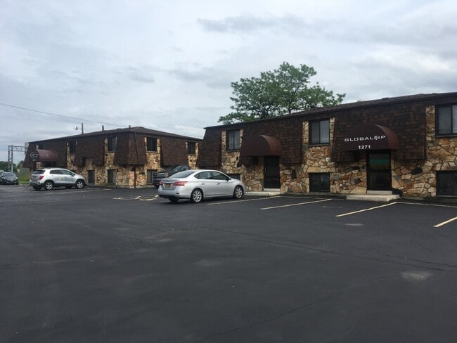
Property Record
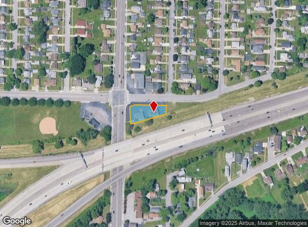
1271 Harlem Rd, Buffalo, NY 14206
Current Lease Availabilities
NEARBY LISTINGS FOR SALE OR LEASE
Property Detail
1271 Harlem Rd
143089-113-780-0003-011-000
SE CORNER OF DINGENS STRE MC 799 BL 7 SL 1 THRU 8 210 X 50/114 IRREGULAR
Officebuilding
Erie
X
New York
36029C0218H
11.000
2025
0.38 AC
2024
East
011000
Buffalo/Niagara Falls
1,776 SF
Buffalo-Cheektowaga, NY
DEMOGRAPHICS near 1271 Harlem Rd
1 Mile
3 Mile
5 Mile
2024 Total Population
8,712
101,743
288,817
2029 Population
8,558
99,196
283,745
Pop Growth 2024-2029
(1.77%)
(2.50%)
(1.76%)
Average Age
43
40
40
2024 Total Households
4,041
43,868
125,424
HH Growth 2024-2029
(1.86%)
(2.49%)
(1.71%)
Median Household Inc
$58,263
$50,618
$49,264
Avg Household Size
2.10
2.20
2.20
2024 Avg HH Vehicles
2.00
1.00
1.00
Median Home Value
$130,442
$134,078
$144,673
Median Year Built
1953
1950
1951
Nearby Places
Map Layers
Map Styles
 Street
 Aerial
- Restaurants
- Banks
- Shops
- Fitness
- Groceries
PUBLIC TRANSPORTATION
COMMUTER RAIL
DRIVE
WALK
Distance
9 min
4.7 mi
DRIVE
WALK
Distance
10 min
5.4 mi
AIRPORT
Buffalo Niagara International
DRIVE
WALK
Distance
Buffalo Niagara International
15 min
8.0 mi
Niagara Falls International
DRIVE
WALK
Distance
Niagara Falls International
37 min
21.5 mi
Nearby Properties
Address
Land Use
TOTAL SIZE
Lot Size
Zoning
Address
Land Use
TOTAL SIZE
Lot Size
Zoning
461,943 SF
21.10 AC
Address
Land Use
TOTAL SIZE
Lot Size
Zoning
262,560 SF
26.40 AC
05C
Address
Land Use
TOTAL SIZE
Lot Size
Zoning
425,796 SF
7.10 AC
D-M
Address
Land Use
TOTAL SIZE
Lot Size
Zoning
610,311 SF
33.66 AC
05C
Address
Land Use
TOTAL SIZE
Lot Size
Zoning
420,205 SF
34.42 AC
05
Address
Land Use
TOTAL SIZE
Lot Size
Zoning
31,608 SF
4.36 AC
05C
Address
Land Use
TOTAL SIZE
Lot Size
Zoning
94,165 SF
24.34 AC
05C
Address
Land Use
TOTAL SIZE
Lot Size
Zoning
9,999 SF
27.02 AC
05C
Address
Land Use
TOTAL SIZE
Lot Size
Zoning
Address
Land Use
TOTAL SIZE
Lot Size
Zoning
7,200 SF
20.20 AC
03RA
Address
Land Use
TOTAL SIZE
Lot Size
Zoning
257,248 SF
61.44 AC
05C
Address
Land Use
TOTAL SIZE
Lot Size
Zoning
362,095 SF
25.40 AC
D-IL
Address
Land Use
TOTAL SIZE
Lot Size
Zoning
7,242 SF
18 AC
03RA
Address
Land Use
TOTAL SIZE
Lot Size
Zoning
35,000 SF
30.13 AC
Address
Land Use
TOTAL SIZE
Lot Size
Zoning
972 SF
194.01 AC
D-OG
Address
Land Use
TOTAL SIZE
Lot Size
Zoning
6,720 SF
11.10 AC
03RA
Address
Land Use
TOTAL SIZE
Lot Size
Zoning
87,289 SF
11.55 AC
05C
Address
Land Use
TOTAL SIZE
Lot Size
Zoning
5,304 SF
17.90 AC
03RA
Address
Land Use
TOTAL SIZE
Lot Size
Zoning
92,350 SF
9.20 AC
05C
Address
Land Use
TOTAL SIZE
Lot Size
Zoning
70,480 SF
4.07 AC
05C
Address
Land Use
TOTAL SIZE
Lot Size
Zoning
104,881 SF
24.43 AC
12
Address
Land Use
TOTAL SIZE
Lot Size
Zoning
2,600 SF
14.80 AC
D-IL
Address
Land Use
TOTAL SIZE
Lot Size
Zoning
17,920 SF
9 AC
03RA
Address
Land Use
TOTAL SIZE
Lot Size
Zoning
Address
Land Use
TOTAL SIZE
Lot Size
Zoning
463,006 SF
23.03 AC
05C
Address
Land Use
TOTAL SIZE
Lot Size
Zoning
119,168 SF
9.33 AC
05C
Address
Land Use
TOTAL SIZE
Lot Size
Zoning
42,396 SF
6.48 AC
Address
Land Use
TOTAL SIZE
Lot Size
Zoning
117,000 SF
8.88 AC
05C
Address
Land Use
TOTAL SIZE
Lot Size
Zoning
119,412 SF
12.70 AC
05C
Address
Land Use
TOTAL SIZE
Lot Size
Zoning
123,147 SF
7.03 AC
CF
The World's #1 Commercial Real Estate Marketplace
Connect with us
© 2026 CoStar Group
The information above has been obtained from sources believed reliable. While we do not doubt its accuracy we have not verified it and make no guarantee, warranty or representation about it. It is your responsibility to independently confirm its accuracy and completeness. Any projections, opinions, assumptions, or estimates used are for example only and do not represent the current or future performance of the property. The value of this transaction to you depends on tax and other factors which should be evaluated by your tax, financial, and legal advisors. You and your advisors should conduct a careful, independent investigation of the property to determine to your satisfaction the suitability of the property for your needs.