Property Record
1271 Pulaski Blvd, Bellingham, MA 02019

NEARBY LISTINGS FOR SALE OR LEASE
-
-
View all Bellingham listings for sale on LoopNet.com
Property Detail
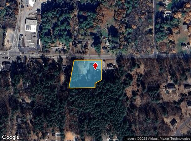
1271 Pulaski Blvd
Commercialbuilding
Norfolk
X
Massachusetts
25021C0312F
1.57 AC
2025
I-95 Corridor South
2025
Boston
443103
Boston-Cambridge-Newton, MA-NH
8,990 SF
BELL-000089-000030A
DEMOGRAPHICS near 1271 Pulaski Blvd
1 Mile
3 Mile
5 Mile
2024 Total Population
2,531
35,415
102,900
2029 Population
2,504
35,144
102,117
Pop Growth 2024-2029
(1.07%)
(0.77%)
(0.76%)
Average Age
41
41
41
2024 Total Households
898
13,991
41,492
HH Growth 2024-2029
(1.11%)
(0.84%)
(0.84%)
Median Household Inc
$139,610
$81,788
$76,124
Avg Household Size
2.80
2.50
2.40
2024 Avg HH Vehicles
2.00
2.00
2.00
Median Home Value
$443,750
$355,730
$362,754
Median Year Built
1977
1969
1965
Nearby Places
Map Layers
Map Styles
 Street
 Aerial
- Restaurants
- Banks
- Shops
- Fitness
- Groceries
PUBLIC TRANSPORTATION
COMMUTER RAIL
Forge Park/Route 495 (Franklin Line - Massachusetts Bay Transportation Authority Commuter Rail (Purple Line))
DRIVE
WALK
Distance
Forge Park/Route 495 (Franklin Line - Massachusetts Bay Transportation Authority Commuter Rail (Purple Line))
10 min
5.1 mi
Franklin (Franklin Line - Massachusetts Bay Transportation Authority Commuter Rail (Purple Line))
DRIVE
WALK
Distance
Franklin (Franklin Line - Massachusetts Bay Transportation Authority Commuter Rail (Purple Line))
11 min
5.4 mi
AIRPORT
Rhode Island Tf Green International
DRIVE
WALK
Distance
Rhode Island Tf Green International
40 min
25.7 mi
Worcester Regional
DRIVE
WALK
Distance
Worcester Regional
52 min
35.6 mi
Freight Ports
Port of Davisville, RI
DRIVE
WALK
Distance
Port of Davisville, RI
53 min
37.6 mi
SALE & LEASE HISTORY
LISTING DATE
SALE/LEASE

Nov 29, 2018
For Sale
May 14, 2021
For Sale
Aug 02, 2019
For Lease
Aug 02, 2019
For Sale
Nearby Properties
Address
Land Use
TOTAL SIZE
Lot Size
Zoning
Address
Land Use
TOTAL SIZE
Lot Size
Zoning
16.88 AC
I1
Address
Land Use
TOTAL SIZE
Lot Size
Zoning
210,008 SF
13.95 AC
C1
Address
Land Use
TOTAL SIZE
Lot Size
Zoning
227,000 SF
6.72 AC
R3
Address
Land Use
TOTAL SIZE
Lot Size
Zoning
148,387 SF
47.03 AC
Address
Land Use
TOTAL SIZE
Lot Size
Zoning
238,602 SF
109.37 AC
Address
Land Use
TOTAL SIZE
Lot Size
Zoning
7,580 SF
32.61 AC
R4
Address
Land Use
TOTAL SIZE
Lot Size
Zoning
300,000 SF
37.97 AC
Address
Land Use
TOTAL SIZE
Lot Size
Zoning
203,792 SF
27.93 AC
IND
Address
Land Use
TOTAL SIZE
Lot Size
Zoning
152,752 SF
10.21 AC
Address
Land Use
TOTAL SIZE
Lot Size
Zoning
11.61 AC
60
Address
Land Use
TOTAL SIZE
Lot Size
Zoning
16.49 AC
PR1
Address
Land Use
TOTAL SIZE
Lot Size
Zoning
5,520 SF
9.81 AC
R1
Address
Land Use
TOTAL SIZE
Lot Size
Zoning
19,774 SF
23.53 AC
R1
Address
Land Use
TOTAL SIZE
Lot Size
Zoning
8.33 AC
R2
Address
Land Use
TOTAL SIZE
Lot Size
Zoning
157,856 SF
2.13 AC
C2
Address
Land Use
TOTAL SIZE
Lot Size
Zoning
73,287 SF
22.03 AC
Address
Land Use
TOTAL SIZE
Lot Size
Zoning
167,990 SF
10.47 AC
Address
Land Use
TOTAL SIZE
Lot Size
Zoning
149,422 SF
14.45 AC
60
Address
Land Use
TOTAL SIZE
Lot Size
Zoning
128,693 SF
28.30 AC
Address
Land Use
TOTAL SIZE
Lot Size
Zoning
5.63 AC
R2
Address
Land Use
TOTAL SIZE
Lot Size
Zoning
65,093 SF
4.65 AC
R4
Address
Land Use
TOTAL SIZE
Lot Size
Zoning
23.19 AC
C2
Address
Land Use
TOTAL SIZE
Lot Size
Zoning
103,988 SF
25.42 AC
30
Address
Land Use
TOTAL SIZE
Lot Size
Zoning
83,040 SF
2.17 AC
R4
Address
Land Use
TOTAL SIZE
Lot Size
Zoning
110,931 SF
46.97 AC
Address
Land Use
TOTAL SIZE
Lot Size
Zoning
8.25 AC
C2
Address
Land Use
TOTAL SIZE
Lot Size
Zoning
4,440 SF
5.73 AC
R2
Address
Land Use
TOTAL SIZE
Lot Size
Zoning
41,206 SF
2.92 AC
R3
Address
Land Use
TOTAL SIZE
Lot Size
Zoning
65,698 SF
19.07 AC
B
Address
Land Use
TOTAL SIZE
Lot Size
Zoning
89,714 SF
7.67 AC
R2
The World's #1 Commercial Real Estate Marketplace
Connect with us
© 2025 CoStar Group
The information above has been obtained from sources believed reliable. While we do not doubt its accuracy we have not verified it and make no guarantee, warranty or representation about it. It is your responsibility to independently confirm its accuracy and completeness. Any projections, opinions, assumptions, or estimates used are for example only and do not represent the current or future performance of the property. The value of this transaction to you depends on tax and other factors which should be evaluated by your tax, financial, and legal advisors. You and your advisors should conduct a careful, independent investigation of the property to determine to your satisfaction the suitability of the property for your needs.