Property Record
1271 Rayford Bnd, Spring, TX 77386

NEARBY LISTINGS FOR SALE OR LEASE
-
-
-
-
-
I-45 Feeder Road South Of Sawdust & Pruitt Road
Spring, TX 77380
Rent Upon Request
1.79 AC Lots
Land
-
-
-
-
-
-
-
-
-
-
-
-
-
-
-
View all Spring listings for sale on LoopNet.com
Property Detail
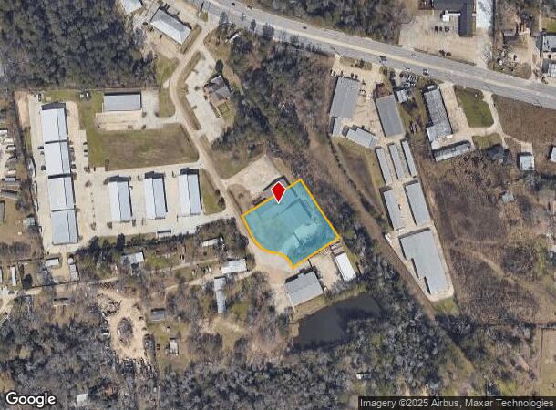
1271 Rayford Bnd
8249-00-00103
Rayford Bend South
Commercialnec
S824900 - RAYFORD BEND SOUTH, BLOCK 1, RES A-1, RES A1-B, ACRES 2.9636
X
Montgomery
48339C0685G
Texas
2024
2.96 AC
2025
The Woodlands
691900
Houston
26,905 SF
Houston-Pasadena-The Woodlands, TX
DEMOGRAPHICS near 1271 Rayford Bnd
1 Mile
3 Mile
5 Mile
2024 Total Population
7,464
84,830
175,924
2029 Population
9,155
101,638
204,950
Pop Growth 2024-2029
+ 22.66%
+ 19.81%
+ 16.50%
Average Age
35
35
37
2024 Total Households
2,593
30,061
63,794
HH Growth 2024-2029
+ 22.75%
+ 19.95%
+ 16.92%
Median Household Inc
$81,325
$93,765
$98,000
Avg Household Size
2.80
2.80
2.70
2024 Avg HH Vehicles
2.00
2.00
2.00
Median Home Value
$226,094
$268,863
$274,469
Median Year Built
1996
2003
2004
Nearby Places
Map Layers
Map Styles
 Street
 Aerial
- Restaurants
- Banks
- Shops
- Fitness
- Groceries
PUBLIC TRANSPORTATION
AIRPORT
George Bush Intcntl/Houston
DRIVE
WALK
Distance
George Bush Intcntl/Houston
27 min
20.1 mi
Freight Ports
Port of Houston
DRIVE
WALK
Distance
Port of Houston
50 min
35.8 mi
Nearby Properties
Address
Land Use
TOTAL SIZE
Lot Size
Zoning
Address
Land Use
TOTAL SIZE
Lot Size
Zoning
6,576,138 SF
186.74 AC
Address
Land Use
TOTAL SIZE
Lot Size
Zoning
1,186,001 SF
13.27 AC
Address
Land Use
TOTAL SIZE
Lot Size
Zoning
1,004,830 SF
7.83 AC
Address
Land Use
TOTAL SIZE
Lot Size
Zoning
974,064 SF
11.79 AC
Address
Land Use
TOTAL SIZE
Lot Size
Zoning
802,274 SF
2.68 AC
Address
Land Use
TOTAL SIZE
Lot Size
Zoning
178,645 SF
8.74 AC
Address
Land Use
TOTAL SIZE
Lot Size
Zoning
970,101 SF
48.05 AC
Address
Land Use
TOTAL SIZE
Lot Size
Zoning
457,883 SF
3.74 AC
Address
Land Use
TOTAL SIZE
Lot Size
Zoning
296,094 SF
10.19 AC
Address
Land Use
TOTAL SIZE
Lot Size
Zoning
532,751 SF
6.43 AC
Address
Land Use
TOTAL SIZE
Lot Size
Zoning
314,169 SF
3.09 AC
Address
Land Use
TOTAL SIZE
Lot Size
Zoning
388,855 SF
19.86 AC
6
Address
Land Use
TOTAL SIZE
Lot Size
Zoning
454,330 SF
9.77 AC
Address
Land Use
TOTAL SIZE
Lot Size
Zoning
373,310 SF
2.47 AC
Address
Land Use
TOTAL SIZE
Lot Size
Zoning
327,690 SF
14.50 AC
Address
Land Use
TOTAL SIZE
Lot Size
Zoning
141,454 SF
21.13 AC
Address
Land Use
TOTAL SIZE
Lot Size
Zoning
471,015 SF
6.63 AC
Address
Land Use
TOTAL SIZE
Lot Size
Zoning
397,984 SF
6.42 AC
Address
Land Use
TOTAL SIZE
Lot Size
Zoning
333,146 SF
14.81 AC
6
Address
Land Use
TOTAL SIZE
Lot Size
Zoning
343,521 SF
9.88 AC
Address
Land Use
TOTAL SIZE
Lot Size
Zoning
293,997 SF
12.87 AC
6
Address
Land Use
TOTAL SIZE
Lot Size
Zoning
278,533 SF
14.79 AC
6
Address
Land Use
TOTAL SIZE
Lot Size
Zoning
331,264 SF
12.92 AC
Address
Land Use
TOTAL SIZE
Lot Size
Zoning
321,024 SF
8.73 AC
6
Address
Land Use
TOTAL SIZE
Lot Size
Zoning
281,487 SF
25.29 AC
6
Address
Land Use
TOTAL SIZE
Lot Size
Zoning
215,019 SF
15.32 AC
6
Address
Land Use
TOTAL SIZE
Lot Size
Zoning
446,410 SF
9.31 AC
6
Address
Land Use
TOTAL SIZE
Lot Size
Zoning
224,000 SF
6.51 AC
6
Address
Land Use
TOTAL SIZE
Lot Size
Zoning
214,156 SF
5.34 AC
Address
Land Use
TOTAL SIZE
Lot Size
Zoning
294,925 SF
21.79 AC
The World's #1 Commercial Real Estate Marketplace
Connect with us
© 2026 CoStar Group
The information above has been obtained from sources believed reliable. While we do not doubt its accuracy we have not verified it and make no guarantee, warranty or representation about it. It is your responsibility to independently confirm its accuracy and completeness. Any projections, opinions, assumptions, or estimates used are for example only and do not represent the current or future performance of the property. The value of this transaction to you depends on tax and other factors which should be evaluated by your tax, financial, and legal advisors. You and your advisors should conduct a careful, independent investigation of the property to determine to your satisfaction the suitability of the property for your needs.