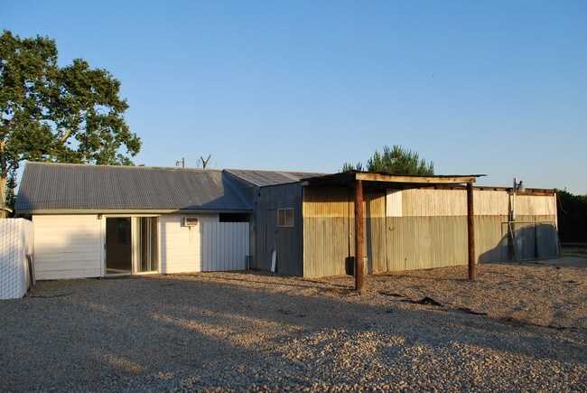
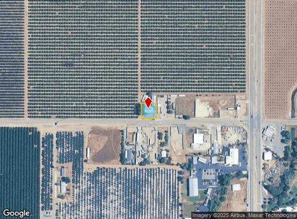
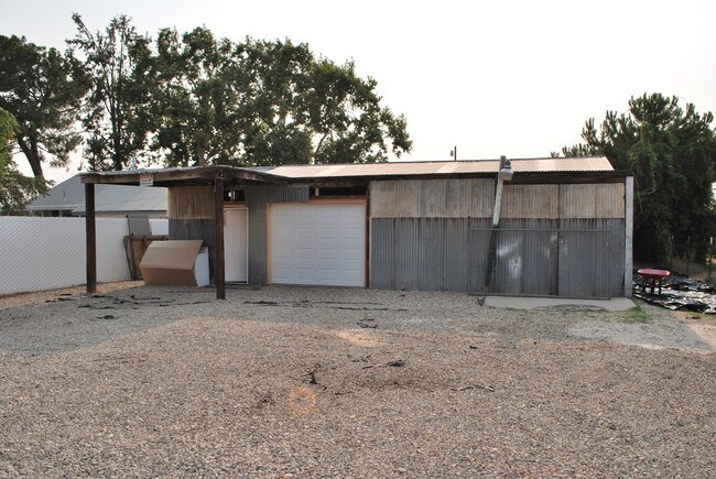
Property Record
12844 E Mckinley Ave, Sanger, CA 93657
NEARBY LISTINGS FOR SALE OR LEASE
-
-
View all Sanger listings for lease on LoopNet.com
Property Detail
12844 E Mckinley Ave
Fresno, CA
Fresno
309-192-06
California
Sfr
0.23 AC
AO
Outlying Fresno Cnty
06019C1620H
Fresno
1,820 SF
DEMOGRAPHICS near 12844 E Mckinley Ave
1 Mile
3 Mile
5 Mile
2024 Total Population
359
4,511
41,828
2029 Population
361
4,525
42,616
Pop Growth 2024-2029
+ 0.56%
+ 0.31%
+ 1.88%
Average Age
40
41
36
2024 Total Households
114
1,469
12,615
HH Growth 2024-2029
+ 0.88%
+ 0.27%
+ 1.85%
Median Household Inc
$127,500
$116,745
$78,147
Avg Household Size
3.00
3.00
3.30
2024 Avg HH Vehicles
2.00
2.00
2.00
Median Home Value
$659,836
$608,600
$397,980
Median Year Built
1975
1977
1987
Nearby Places
- Restaurants
- Banks
- Shops
- Fitness
- Groceries
PUBLIC TRANSPORTATION
AIRPORT
Fresno Yosemite International
DRIVE
WALK
Distance
Fresno Yosemite International
18 min
13.0 mi
Freight Ports
Port of Stockton
DRIVE
WALK
Distance
Port of Stockton
169 min
143.0 mi
SALE & LEASE HISTORY
LISTING DATE
SALE/LEASE

Sep 17, 2025
For Lease
May 15, 2017
For Lease
Jul 03, 2018
For Lease
Nearby Properties
Address
Land Use
TOTAL SIZE
Lot Size
Zoning
Address
Land Use
TOTAL SIZE
Lot Size
Zoning
50 AC
RR
Address
Land Use
TOTAL SIZE
Lot Size
Zoning
158.81 AC
AE20
Address
Land Use
TOTAL SIZE
Lot Size
Zoning
33,524 SF
36.90 AC
AE20
Address
Land Use
TOTAL SIZE
Lot Size
Zoning
73,577 SF
25.18 AC
AE20
Address
Land Use
TOTAL SIZE
Lot Size
Zoning
1,058 SF
77.22 AC
AE20
Address
Land Use
TOTAL SIZE
Lot Size
Zoning
354.54 AC
AE20
Address
Land Use
TOTAL SIZE
Lot Size
Zoning
14,794 SF
7.14 AC
Address
Land Use
TOTAL SIZE
Lot Size
Zoning
40 AC
AE20
Address
Land Use
TOTAL SIZE
Lot Size
Zoning
1,432 SF
78.80 AC
AE20
Address
Land Use
TOTAL SIZE
Lot Size
Zoning
816 SF
76.51 AC
AE20
Address
Land Use
TOTAL SIZE
Lot Size
Zoning
1,070 SF
221.11 AC
AE20
Address
Land Use
TOTAL SIZE
Lot Size
Zoning
1,886 SF
56.46 AC
AE20
Address
Land Use
TOTAL SIZE
Lot Size
Zoning
1,012 SF
45.96 AC
AE20
Address
Land Use
TOTAL SIZE
Lot Size
Zoning
16,584 SF
3.83 AC
AE20
Address
Land Use
TOTAL SIZE
Lot Size
Zoning
1,343 SF
226.18 AC
Address
Land Use
TOTAL SIZE
Lot Size
Zoning
132.35 AC
AE20
Address
Land Use
TOTAL SIZE
Lot Size
Zoning
34.56 AC
AE20
Address
Land Use
TOTAL SIZE
Lot Size
Zoning
7,920 SF
1.27 AC
CC
Address
Land Use
TOTAL SIZE
Lot Size
Zoning
20,443 SF
26.03 AC
RR
Address
Land Use
TOTAL SIZE
Lot Size
Zoning
80 AC
AE20
Address
Land Use
TOTAL SIZE
Lot Size
Zoning
7,812 SF
20.73 AC
AE20
Address
Land Use
TOTAL SIZE
Lot Size
Zoning
3,135 SF
20.18 AC
AE20
Address
Land Use
TOTAL SIZE
Lot Size
Zoning
3,080 SF
19.55 AC
AE20
Address
Land Use
TOTAL SIZE
Lot Size
Zoning
1,508 SF
40.66 AC
AE20
Address
Land Use
TOTAL SIZE
Lot Size
Zoning
38.41 AC
AE20
Address
Land Use
TOTAL SIZE
Lot Size
Zoning
40 AC
AE20
Address
Land Use
TOTAL SIZE
Lot Size
Zoning
1,612 SF
43.55 AC
RR
Address
Land Use
TOTAL SIZE
Lot Size
Zoning
15.29 AC
AE20
The World's #1 Commercial Real Estate Marketplace
Connect with us
© 2025 CoStar Group
The information above has been obtained from sources believed reliable. While we do not doubt its accuracy we have not verified it and make no guarantee, warranty or representation about it. It is your responsibility to independently confirm its accuracy and completeness. Any projections, opinions, assumptions, or estimates used are for example only and do not represent the current or future performance of the property. The value of this transaction to you depends on tax and other factors which should be evaluated by your tax, financial, and legal advisors. You and your advisors should conduct a careful, independent investigation of the property to determine to your satisfaction the suitability of the property for your needs.