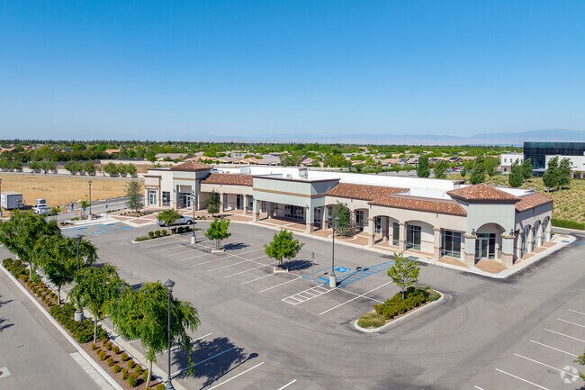
Property Record
12716 Stockdale Hwy, Bakersfield, CA 93314


NEARBY LISTINGS FOR SALE OR LEASE
-
-
SWC Stockdale Highway & Buena Vista Road Hwy @ Buena Vista Toad
Bakersfield, CA 93311
Negotiable
3,300 SF
Retail
-
-
-
-
View all Bakersfield listings for lease on LoopNet.com
Property Detail
12716 Stockdale Hwy
Bakersfield-Delano, CA
Parcel Map No. 12354 Phase 1
500-780-25-00-5
PM 12354 PH1 PAR 6
Regionalshoppingcenterormallwithanchorstore
Kern
X
California
06029C2257F
1.72 AC
2024
University Centre
2025
Bakersfield
003820
DEMOGRAPHICS near 12716 Stockdale Hwy
1 Mile
3 Mile
5 Mile
2024 Total Population
8,373
66,211
180,472
2029 Population
8,320
66,553
180,736
Pop Growth 2024-2029
(0.63%)
+ 0.52%
+ 0.15%
Average Age
40
39
37
2024 Total Households
2,933
22,714
60,678
HH Growth 2024-2029
(0.72%)
+ 0.42%
+ 0.06%
Median Household Inc
$105,530
$113,427
$98,021
Avg Household Size
2.90
2.80
2.90
2024 Avg HH Vehicles
2.00
2.00
2.00
Median Home Value
$354,840
$412,175
$361,802
Median Year Built
2001
1999
1995
Nearby Places
Map Layers
Map Styles
 Street
 Aerial
- Restaurants
- Banks
- Shops
- Fitness
- Groceries
PUBLIC TRANSPORTATION
COMMUTER RAIL
Bakersfield (San Joaquins - Amtrak)
DRIVE
WALK
Distance
Bakersfield (San Joaquins - Amtrak)
15 min
9.0 mi
AIRPORT
Meadows Field
DRIVE
WALK
Distance
Meadows Field
22 min
11.2 mi
Freight Ports
The Port of Hueneme
DRIVE
WALK
Distance
The Port of Hueneme
161 min
126.4 mi
SALE & LEASE HISTORY
LISTING DATE
SALE/LEASE

Oct 10, 2016
For Lease
Mar 29, 2017
For Lease
Nearby Properties
Address
Land Use
TOTAL SIZE
Lot Size
Zoning
Address
Land Use
TOTAL SIZE
Lot Size
Zoning
319,531 SF
17.66 AC
R3
Address
Land Use
TOTAL SIZE
Lot Size
Zoning
5,850 SF
10.96 AC
C2
Address
Land Use
TOTAL SIZE
Lot Size
Zoning
6,702 SF
18.75 AC
C-2
Address
Land Use
TOTAL SIZE
Lot Size
Zoning
241,051 SF
18.48 AC
CO
Address
Land Use
TOTAL SIZE
Lot Size
Zoning
7,008 SF
46 AC
R1
Address
Land Use
TOTAL SIZE
Lot Size
Zoning
253,532 SF
14.69 AC
Address
Land Use
TOTAL SIZE
Lot Size
Zoning
35,250 SF
10.33 AC
C-2 PCD
Address
Land Use
TOTAL SIZE
Lot Size
Zoning
149,197 SF
8.21 AC
PUD
Address
Land Use
TOTAL SIZE
Lot Size
Zoning
15,027 SF
17.72 AC
C-2
Address
Land Use
TOTAL SIZE
Lot Size
Zoning
51,517 SF
8.11 AC
CO
Address
Land Use
TOTAL SIZE
Lot Size
Zoning
99,368 SF
6.95 AC
CO
Address
Land Use
TOTAL SIZE
Lot Size
Zoning
214,746 SF
14.91 AC
Address
Land Use
TOTAL SIZE
Lot Size
Zoning
138,923 SF
9.97 AC
C-2
Address
Land Use
TOTAL SIZE
Lot Size
Zoning
210,432 SF
13.52 AC
R-2
Address
Land Use
TOTAL SIZE
Lot Size
Zoning
55,532 SF
4.18 AC
CO
Address
Land Use
TOTAL SIZE
Lot Size
Zoning
83,388 SF
3.15 AC
Address
Land Use
TOTAL SIZE
Lot Size
Zoning
192,500 SF
11.48 AC
R-2
Address
Land Use
TOTAL SIZE
Lot Size
Zoning
83,936 SF
4.39 AC
R-2
Address
Land Use
TOTAL SIZE
Lot Size
Zoning
24,888 SF
5.75 AC
WM-R2
Address
Land Use
TOTAL SIZE
Lot Size
Zoning
51,666 SF
6.08 AC
C2
Address
Land Use
TOTAL SIZE
Lot Size
Zoning
63,702 SF
6.82 AC
WM C-O
Address
Land Use
TOTAL SIZE
Lot Size
Zoning
55,586 SF
2.49 AC
C-O
Address
Land Use
TOTAL SIZE
Lot Size
Zoning
72,330 SF
2.59 AC
C-O
Address
Land Use
TOTAL SIZE
Lot Size
Zoning
67,337 SF
2.52 AC
C-O
Address
Land Use
TOTAL SIZE
Lot Size
Zoning
73,055 SF
3.83 AC
PUD
Address
Land Use
TOTAL SIZE
Lot Size
Zoning
71,922 SF
4.99 AC
CO
Address
Land Use
TOTAL SIZE
Lot Size
Zoning
45,113 SF
2.68 AC
CO
Address
Land Use
TOTAL SIZE
Lot Size
Zoning
53,468 SF
3.80 AC
C-O
Address
Land Use
TOTAL SIZE
Lot Size
Zoning
70,410 SF
1.55 AC
C-2
The World's #1 Commercial Real Estate Marketplace
Connect with us
© 2026 CoStar Group
The information above has been obtained from sources believed reliable. While we do not doubt its accuracy we have not verified it and make no guarantee, warranty or representation about it. It is your responsibility to independently confirm its accuracy and completeness. Any projections, opinions, assumptions, or estimates used are for example only and do not represent the current or future performance of the property. The value of this transaction to you depends on tax and other factors which should be evaluated by your tax, financial, and legal advisors. You and your advisors should conduct a careful, independent investigation of the property to determine to your satisfaction the suitability of the property for your needs.