Property Record
12720 E Highway 287, Florence, AZ 85132

Property Detail
12720 E Highway 287
Phoenix-Mesa-Chandler, AZ
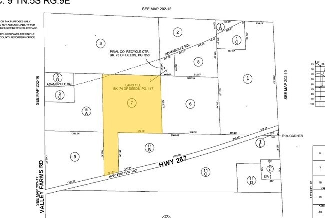
SE NW & W1/2 W1/2 NE SW LYING N OF HWY 287 SEC 9-5S-9E 79 46 AC L YING S OF ADAMSVILLE RD ALL IN SEC 9-5S-9E 79 51 AC
202-18-007
PINAL
Commercialnec
Arizona
B and X Area of moderate flood hazard, usually the area between the limits of the 100-year and 500-year floods.
46 AC
2024
Pinal County
2025
Phoenix
000804
NEARBY LISTINGS FOR SALE OR LEASE
-
-
View all Florence listings for sale on LoopNet.com
DEMOGRAPHICS near 12720 E Highway 287
1 mile
3 mile
5 mile
2025 Total Population
35
3,915
20,395
2030 Population
42
4,489
23,748
Pop Growth 2025-2030
+ 20.00%
+ 14.66%
+ 16.44%
Average Age
46
39
48
2025 Total Households
15
1,278
7,011
HH Growth 2025-2030
+ 26.67%
+ 16.20%
+ 19.80%
Median Household Inc
$44,999
$70,917
$71,912
Avg Household Size
2.00
2.60
2.30
2025 Avg HH Vehicles
2.00
2.00
2.00
Median Home Value
$91,666
$278,671
$354,069
Median Year Built
1993
1987
2006
Nearby Places
Map Layers
Map Styles
 Street
 Aerial
Layers
 Traffic
 Biking
Places
Listings with unknown addresses are not visible on the map
- Restaurants
- Banks
- Shops
- Fitness
- Groceries
PUBLIC TRANSPORTATION
AIRPORT
Phoenix-Mesa Gateway
Drive
Walk
Distance
Phoenix-Mesa Gateway
52 min
29.6 mi
Freight Ports
Port of San Diego
Drive
Walk
Distance
Port of San Diego
415 min
376.5 mi
Nearby Properties
Address
Land Use
TOTAL SIZE
Lot Size
Zoning
Address
Land Use
TOTAL SIZE
Lot Size
Zoning
11.58 AC
Address
Land Use
TOTAL SIZE
Lot Size
Zoning
71,889 SF
10.43 AC
Address
Land Use
TOTAL SIZE
Lot Size
Zoning
27,177 SF
125.23 AC
Address
Land Use
TOTAL SIZE
Lot Size
Zoning
89,998 SF
7.92 AC
Address
Land Use
TOTAL SIZE
Lot Size
Zoning
19.98 AC
UNDESIGNAT
Address
Land Use
TOTAL SIZE
Lot Size
Zoning
56,028 SF
2.44 AC
UNDESIGNAT
Address
Land Use
TOTAL SIZE
Lot Size
Zoning
32.30 AC
Address
Land Use
TOTAL SIZE
Lot Size
Zoning
39,036 SF
4.88 AC
UNDESIGNAT
Address
Land Use
TOTAL SIZE
Lot Size
Zoning
14,990 SF
6.44 AC
UNDESIGNAT
Address
Land Use
TOTAL SIZE
Lot Size
Zoning
12,100 SF
2.40 AC
Address
Land Use
TOTAL SIZE
Lot Size
Zoning
Address
Land Use
TOTAL SIZE
Lot Size
Zoning
Address
Land Use
TOTAL SIZE
Lot Size
Zoning
11.97 AC
UNDESIGNAT
Address
Land Use
TOTAL SIZE
Lot Size
Zoning
17,914 SF
2.23 AC
UNDESIGNAT
Address
Land Use
TOTAL SIZE
Lot Size
Zoning
7,636 SF
3.56 AC
Address
Land Use
TOTAL SIZE
Lot Size
Zoning
210.16 AC
UNDESIGNAT
Address
Land Use
TOTAL SIZE
Lot Size
Zoning
784 SF
3.84 AC
Address
Land Use
TOTAL SIZE
Lot Size
Zoning
95.90 AC
UNDESIGNAT
Address
Land Use
TOTAL SIZE
Lot Size
Zoning
3.96 AC
Address
Land Use
TOTAL SIZE
Lot Size
Zoning
7,139 SF
0.73 AC
UNDESIGNAT
Address
Land Use
TOTAL SIZE
Lot Size
Zoning
10,116 SF
50 AC
UNDESIGNAT
Address
Land Use
TOTAL SIZE
Lot Size
Zoning
20,712 SF
230.48 AC
Address
Land Use
TOTAL SIZE
Lot Size
Zoning
6,561 SF
0.34 AC
UNDESIGNAT
Address
Land Use
TOTAL SIZE
Lot Size
Zoning
15,158 SF
2.50 AC
Address
Land Use
TOTAL SIZE
Lot Size
Zoning
122.94 AC
GR
Address
Land Use
TOTAL SIZE
Lot Size
Zoning
7,848 SF
1.79 AC
Address
Land Use
TOTAL SIZE
Lot Size
Zoning
6,000 SF
11.25 AC
UNDESIGNAT
The World's #1 Commercial Real Estate Marketplace
Connect with us
© 2026 CoStar Group
The information above has been obtained from sources believed reliable. While we do not doubt its accuracy we have not verified it and make no guarantee, warranty or representation about it. It is your responsibility to independently confirm its accuracy and completeness. Any projections, opinions, assumptions, or estimates used are for example only and do not represent the current or future performance of the property. The value of this transaction to you depends on tax and other factors which should be evaluated by your tax, financial, and legal advisors. You and your advisors should conduct a careful, independent investigation of the property to determine to your satisfaction the suitability of the property for your needs.