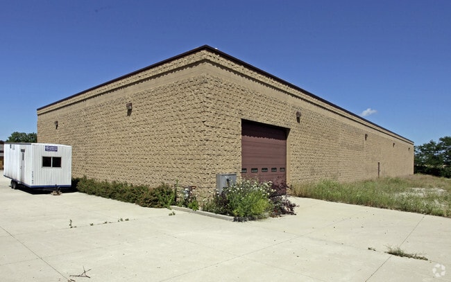
Property Record
12721 12Th St, Kenosha, WI 53144


NEARBY LISTINGS FOR SALE OR LEASE
Property Detail
12721 12Th St
Chicago-Naperville-Elgin, IL-IN-WI
Town Of Paris
45-4-221-131-0205
105-C-2-1 PT NE 1/4 & NW 1/4 SEC 13 T 2 R 21 COMM NW CORN OF NE 1/4 SEC TH E 330 FT TH S 661.00 FT TH W 470 FT TH N 661 FT TH
Commercialnec
Kenosha
X
Wisconsin
55059C0064D
205
2024
6.78 AC
2024
Kenosha East
002802
Chicago
6,136 SF
DEMOGRAPHICS near 12721 12Th St
1 Mile
3 Mile
5 Mile
2024 Total Population
162
2,178
15,932
2029 Population
157
2,152
15,985
Pop Growth 2024-2029
(3.09%)
(1.19%)
+ 0.33%
Average Age
46
46
40
2024 Total Households
66
973
5,986
HH Growth 2024-2029
(3.03%)
(1.03%)
+ 0.22%
Median Household Inc
$83,333
$69,249
$95,208
Avg Household Size
2.40
2.20
2.60
2024 Avg HH Vehicles
3.00
2.00
2.00
Median Home Value
$429,166
$281,648
$285,599
Median Year Built
1965
1974
1994
Nearby Places
Map Layers
Map Styles
 Street
 Aerial
- Restaurants
- Banks
- Shops
- Fitness
- Groceries
PUBLIC TRANSPORTATION
COMMUTER RAIL
Sturtevant Amtrak Station (Hiawatha Service - Amtrak)
DRIVE
WALK
Distance
Sturtevant Amtrak Station (Hiawatha Service - Amtrak)
13 min
9.0 mi
AIRPORT
General Mitchell International
DRIVE
WALK
Distance
General Mitchell International
29 min
23.6 mi
Freight Ports
Port Milwaukee
DRIVE
WALK
Distance
Port Milwaukee
34 min
27.5 mi
Nearby Properties
Address
Land Use
TOTAL SIZE
Lot Size
Zoning
Address
Land Use
TOTAL SIZE
Lot Size
Zoning
1,015,740 SF
113.58 AC
C2
Address
Land Use
TOTAL SIZE
Lot Size
Zoning
2,565 SF
65.18 AC
Address
Land Use
TOTAL SIZE
Lot Size
Zoning
58.93 AC
Address
Land Use
TOTAL SIZE
Lot Size
Zoning
68.19 AC
Address
Land Use
TOTAL SIZE
Lot Size
Zoning
67.63 AC
FW
Address
Land Use
TOTAL SIZE
Lot Size
Zoning
795,471 SF
49.72 AC
Address
Land Use
TOTAL SIZE
Lot Size
Zoning
77.22 AC
Address
Land Use
TOTAL SIZE
Lot Size
Zoning
481,854 SF
84.10 AC
FW
Address
Land Use
TOTAL SIZE
Lot Size
Zoning
48.22 AC
Address
Land Use
TOTAL SIZE
Lot Size
Zoning
35.73 AC
M2
Address
Land Use
TOTAL SIZE
Lot Size
Zoning
43.56 AC
Address
Land Use
TOTAL SIZE
Lot Size
Zoning
44.09 AC
Address
Land Use
TOTAL SIZE
Lot Size
Zoning
1,467 SF
50.67 AC
Address
Land Use
TOTAL SIZE
Lot Size
Zoning
513,760 SF
48.61 AC
C1
Address
Land Use
TOTAL SIZE
Lot Size
Zoning
509,017 SF
34.37 AC
Address
Land Use
TOTAL SIZE
Lot Size
Zoning
35.18 AC
M2
Address
Land Use
TOTAL SIZE
Lot Size
Zoning
81.82 AC
Address
Land Use
TOTAL SIZE
Lot Size
Zoning
72.29 AC
Address
Land Use
TOTAL SIZE
Lot Size
Zoning
14,576 SF
25.05 AC
Address
Land Use
TOTAL SIZE
Lot Size
Zoning
43.43 AC
Address
Land Use
TOTAL SIZE
Lot Size
Zoning
20,872 SF
8.08 AC
Address
Land Use
TOTAL SIZE
Lot Size
Zoning
12,425 SF
15.11 AC
Address
Land Use
TOTAL SIZE
Lot Size
Zoning
25,920 SF
243.33 AC
Address
Land Use
TOTAL SIZE
Lot Size
Zoning
9.85 AC
Address
Land Use
TOTAL SIZE
Lot Size
Zoning
621 SF
22.40 AC
Address
Land Use
TOTAL SIZE
Lot Size
Zoning
4,581 SF
36.78 AC
Address
Land Use
TOTAL SIZE
Lot Size
Zoning
77.94 AC
Address
Land Use
TOTAL SIZE
Lot Size
Zoning
4,624 SF
1.04 AC
Address
Land Use
TOTAL SIZE
Lot Size
Zoning
4.85 AC
Address
Land Use
TOTAL SIZE
Lot Size
Zoning
11,360 SF
1.62 AC
The World's #1 Commercial Real Estate Marketplace
Connect with us
© 2026 CoStar Group
The information above has been obtained from sources believed reliable. While we do not doubt its accuracy we have not verified it and make no guarantee, warranty or representation about it. It is your responsibility to independently confirm its accuracy and completeness. Any projections, opinions, assumptions, or estimates used are for example only and do not represent the current or future performance of the property. The value of this transaction to you depends on tax and other factors which should be evaluated by your tax, financial, and legal advisors. You and your advisors should conduct a careful, independent investigation of the property to determine to your satisfaction the suitability of the property for your needs.