Property Record
1273 Kalahari Dr, Baraboo, WI 53913

NEARBY LISTINGS FOR SALE OR LEASE
Property Detail
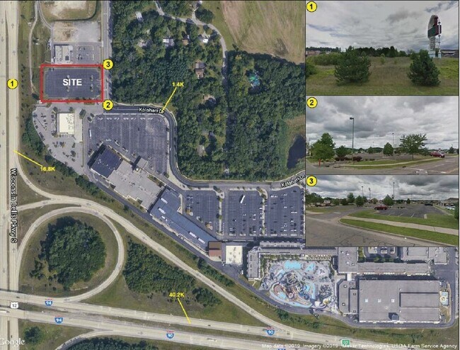
1273 Kalahari Dr
Baraboo, WI
Certified Surv Map 4932
146-0356-01100
S 27-13-6 PRT NW SW = CSM #4932 LOT 2 EXC COM SWCOR -N1 29'51 W 29.84' ALG WLI- N89 44'2 E 100.28'-S0 30'52 E 29.87' TO S LI-
Commercialnec
Sauk
X
Wisconsin
55021C0185F
2
2024
1.93 AC
2024
Wisconsin South Area
000102
Other Market Areas
DEMOGRAPHICS near 1273 Kalahari Dr
1 Mile
3 Mile
5 Mile
2024 Total Population
933
5,953
11,893
2029 Population
948
5,997
11,992
Pop Growth 2024-2029
+ 1.61%
+ 0.74%
+ 0.83%
Average Age
42
41
42
2024 Total Households
455
2,556
5,005
HH Growth 2024-2029
+ 1.76%
+ 0.86%
+ 1.00%
Median Household Inc
$60,429
$68,127
$68,687
Avg Household Size
2.00
2.30
2.30
2024 Avg HH Vehicles
2.00
2.00
2.00
Median Home Value
$132,524
$180,959
$195,104
Median Year Built
1994
1992
1990
Nearby Places
Map Layers
Map Styles
 Street
 Aerial
- Restaurants
- Banks
- Shops
- Fitness
- Groceries
PUBLIC TRANSPORTATION
COMMUTER RAIL
Wisconsin Dells Amtrak Station (Empire Builder - Amtrak)
DRIVE
WALK
Distance
Wisconsin Dells Amtrak Station (Empire Builder - Amtrak)
10 min
4.9 mi
Freight Ports
Port Milwaukee
DRIVE
WALK
Distance
Port Milwaukee
136 min
119.8 mi
SALE & LEASE HISTORY
LISTING DATE
SALE/LEASE

Feb 28, 2020
For Sale
Nearby Properties
Address
Land Use
TOTAL SIZE
Lot Size
Zoning
Address
Land Use
TOTAL SIZE
Lot Size
Zoning
25.30 AC
Address
Land Use
TOTAL SIZE
Lot Size
Zoning
Address
Land Use
TOTAL SIZE
Lot Size
Zoning
16.33 AC
Address
Land Use
TOTAL SIZE
Lot Size
Zoning
Address
Land Use
TOTAL SIZE
Lot Size
Zoning
5.41 AC
Address
Land Use
TOTAL SIZE
Lot Size
Zoning
2.79 AC
Address
Land Use
TOTAL SIZE
Lot Size
Zoning
Address
Land Use
TOTAL SIZE
Lot Size
Zoning
6.23 AC
Address
Land Use
TOTAL SIZE
Lot Size
Zoning
Address
Land Use
TOTAL SIZE
Lot Size
Zoning
Address
Land Use
TOTAL SIZE
Lot Size
Zoning
16.22 AC
Address
Land Use
TOTAL SIZE
Lot Size
Zoning
18.32 AC
Address
Land Use
TOTAL SIZE
Lot Size
Zoning
Address
Land Use
TOTAL SIZE
Lot Size
Zoning
Address
Land Use
TOTAL SIZE
Lot Size
Zoning
Address
Land Use
TOTAL SIZE
Lot Size
Zoning
16.48 AC
Address
Land Use
TOTAL SIZE
Lot Size
Zoning
Address
Land Use
TOTAL SIZE
Lot Size
Zoning
3.26 AC
Address
Land Use
TOTAL SIZE
Lot Size
Zoning
Address
Land Use
TOTAL SIZE
Lot Size
Zoning
Address
Land Use
TOTAL SIZE
Lot Size
Zoning
4.22 AC
Address
Land Use
TOTAL SIZE
Lot Size
Zoning
Address
Land Use
TOTAL SIZE
Lot Size
Zoning
14.73 AC
Address
Land Use
TOTAL SIZE
Lot Size
Zoning
Address
Land Use
TOTAL SIZE
Lot Size
Zoning
3.71 AC
Address
Land Use
TOTAL SIZE
Lot Size
Zoning
4.81 AC
The World's #1 Commercial Real Estate Marketplace
Connect with us
© 2025 CoStar Group
The information above has been obtained from sources believed reliable. While we do not doubt its accuracy we have not verified it and make no guarantee, warranty or representation about it. It is your responsibility to independently confirm its accuracy and completeness. Any projections, opinions, assumptions, or estimates used are for example only and do not represent the current or future performance of the property. The value of this transaction to you depends on tax and other factors which should be evaluated by your tax, financial, and legal advisors. You and your advisors should conduct a careful, independent investigation of the property to determine to your satisfaction the suitability of the property for your needs.