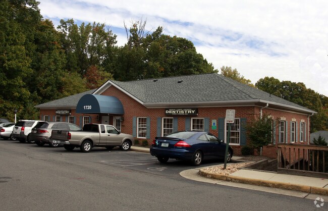
Property Record
12733 Directors Loop, Woodbridge, VA 22192
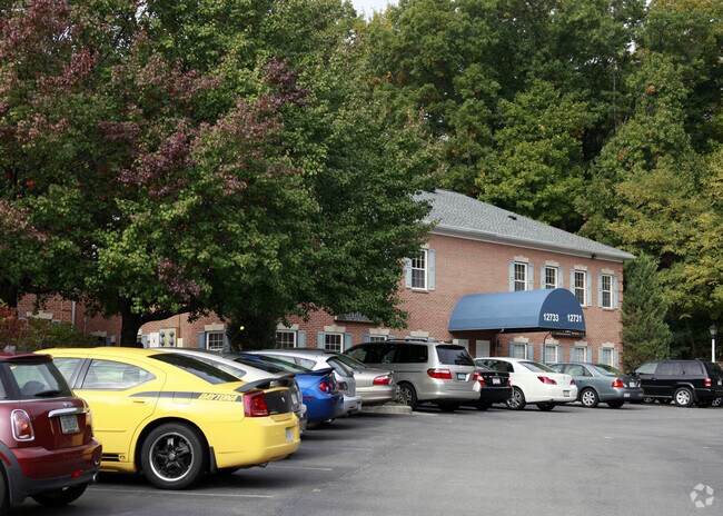
Property Detail
12733 Directors Loop
8393-51-0979.01
INDEPENDENT EXECUTIVE CENTER UNIT 12
Officecondo
PRINCE WILLIAM
OL
Virginia
B and X Area of moderate flood hazard, usually the area between the limits of the 100-year and 500-year floods.
0882.
2024
0.52 AC
2025
Woodbridge/I-95 Corridor
900301
Washington, DC
1,343 SF
Washington-Arlington-Alexandria, DC-VA-MD-WV
NEARBY LISTINGS FOR SALE OR LEASE
DEMOGRAPHICS near 12733 Directors Loop
1 mile
3 mile
5 mile
2025 Total Population
15,082
80,307
212,669
2030 Population
15,345
82,131
217,216
Pop Growth 2025-2030
+ 1.74%
+ 2.27%
+ 2.14%
Average Age
39
38
38
2025 Total Households
5,619
26,881
70,600
HH Growth 2025-2030
+ 1.51%
+ 2.22%
+ 2.10%
Median Household Inc
$100,108
$112,270
$119,555
Avg Household Size
2.60
2.90
2.90
2025 Avg HH Vehicles
2.00
2.00
2.00
Median Home Value
$421,911
$463,435
$472,257
Median Year Built
1981
1984
1987
Nearby Places
Map Layers
Map Styles
 Street
 Aerial
Transit
 Traffic
 Biking
Places
Listings with unknown addresses are not visible on the map
- Restaurants
- Banks
- Shops
- Fitness
- Groceries
PUBLIC TRANSPORTATION
COMMUTER RAIL
Woodbridge (Fredericksburg Line - Virginia Railway Express)
Drive
Walk
Distance
Woodbridge (Fredericksburg Line - Virginia Railway Express)
4 min
1.9 mi
Lorton Amtrak Auto Train Station (Auto Train - Amtrak)
Drive
Walk
Distance
Lorton Amtrak Auto Train Station (Auto Train - Amtrak)
10 min
5.1 mi
AIRPORT
Ronald Reagan Washington Ntl
Drive
Walk
Distance
Ronald Reagan Washington Ntl
32 min
21.1 mi
Washington Dulles International
Drive
Walk
Distance
Washington Dulles International
51 min
29.4 mi
Freight Ports
Port of Baltimore
Drive
Walk
Distance
Port of Baltimore
91 min
62.3 mi
Nearby Properties
Address
Land Use
TOTAL SIZE
Lot Size
Zoning
Address
Land Use
TOTAL SIZE
Lot Size
Zoning
1,402,177 SF
104.72 AC
B1
Address
Land Use
TOTAL SIZE
Lot Size
Zoning
570,195 SF
38.70 AC
OH
Address
Land Use
TOTAL SIZE
Lot Size
Zoning
609,447 SF
44.24 AC
R16
Address
Land Use
TOTAL SIZE
Lot Size
Zoning
465,616 SF
6.45 AC
PMR
Address
Land Use
TOTAL SIZE
Lot Size
Zoning
568,505 SF
7.19 AC
PMR
Address
Land Use
TOTAL SIZE
Lot Size
Zoning
456,284 SF
70.54 AC
RPC
Address
Land Use
TOTAL SIZE
Lot Size
Zoning
377,248 SF
26.67 AC
R16
Address
Land Use
TOTAL SIZE
Lot Size
Zoning
93,321 SF
26.28 AC
R16
Address
Land Use
TOTAL SIZE
Lot Size
Zoning
175,001 SF
28.60 AC
R16
Address
Land Use
TOTAL SIZE
Lot Size
Zoning
382,173 SF
91.53 AC
A1
Address
Land Use
TOTAL SIZE
Lot Size
Zoning
605,863 SF
14.52 AC
PMD
Address
Land Use
TOTAL SIZE
Lot Size
Zoning
394,404 SF
64.52 AC
RPC
Address
Land Use
TOTAL SIZE
Lot Size
Zoning
354,638 SF
28.32 AC
B1
Address
Land Use
TOTAL SIZE
Lot Size
Zoning
86,869 SF
9.54 AC
PMD
Address
Land Use
TOTAL SIZE
Lot Size
Zoning
376,424 SF
24.48 AC
R16
Address
Land Use
TOTAL SIZE
Lot Size
Zoning
151,176 SF
34.10 AC
RPC
Address
Land Use
TOTAL SIZE
Lot Size
Zoning
424,533 SF
14.74 AC
R16
Address
Land Use
TOTAL SIZE
Lot Size
Zoning
22,993 SF
11.28 AC
RPC
Address
Land Use
TOTAL SIZE
Lot Size
Zoning
120,620 SF
13.10 AC
596
Address
Land Use
TOTAL SIZE
Lot Size
Zoning
199,448 SF
6.14 AC
R30
Address
Land Use
TOTAL SIZE
Lot Size
Zoning
67,551 SF
12.69 AC
R16
Address
Land Use
TOTAL SIZE
Lot Size
Zoning
212,472 SF
13.77 AC
316
Address
Land Use
TOTAL SIZE
Lot Size
Zoning
182,611 SF
18.63 AC
B1
Address
Land Use
TOTAL SIZE
Lot Size
Zoning
170,328 SF
13.21 AC
R16
Address
Land Use
TOTAL SIZE
Lot Size
Zoning
120,203 SF
17.35 AC
MIXED
Address
Land Use
TOTAL SIZE
Lot Size
Zoning
41.11 AC
110
Address
Land Use
TOTAL SIZE
Lot Size
Zoning
174,210 SF
11.45 AC
R16
Address
Land Use
TOTAL SIZE
Lot Size
Zoning
164,207 SF
11.65 AC
540
Address
Land Use
TOTAL SIZE
Lot Size
Zoning
139,500 SF
11.90 AC
M1
Address
Land Use
TOTAL SIZE
Lot Size
Zoning
159,679 SF
4.76 AC
R30
The World's #1 Commercial Real Estate Marketplace
Connect with us
© 2026 CoStar Group
The information above has been obtained from sources believed reliable. While we do not doubt its accuracy we have not verified it and make no guarantee, warranty or representation about it. It is your responsibility to independently confirm its accuracy and completeness. Any projections, opinions, assumptions, or estimates used are for example only and do not represent the current or future performance of the property. The value of this transaction to you depends on tax and other factors which should be evaluated by your tax, financial, and legal advisors. You and your advisors should conduct a careful, independent investigation of the property to determine to your satisfaction the suitability of the property for your needs.