Property Record
1274 S Holly Rd, Fenton, MI 48430
NEARBY LISTINGS FOR SALE OR LEASE
Property Detail
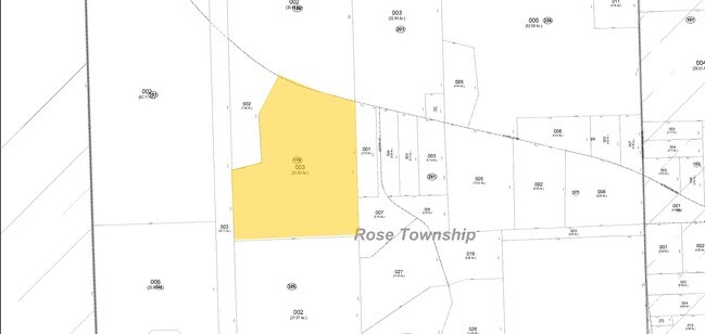
1274 S Holly Rd
06-06-176-003
Acres
Agriculturalland
Oakland
A
Michigan
26049C0445D
31.05 AC
2022
Lakes Area
2022
Detroit
125000
Detroit-Warren-Dearborn, MI
2,685 SF
DEMOGRAPHICS near 1274 S Holly Rd
1 Mile
3 Mile
5 Mile
2024 Total Population
519
18,465
41,691
2029 Population
518
18,397
41,543
Pop Growth 2024-2029
(0.19%)
(0.37%)
(0.35%)
Average Age
43
41
42
2024 Total Households
201
7,343
16,838
HH Growth 2024-2029
(0.50%)
(0.52%)
(0.46%)
Median Household Inc
$105,357
$80,269
$79,594
Avg Household Size
2.60
2.50
2.40
2024 Avg HH Vehicles
2.00
2.00
2.00
Median Home Value
$275,384
$235,824
$262,866
Median Year Built
1988
1978
1984
Nearby Places
- Restaurants
- Banks
- Shops
- Fitness
- Groceries
PUBLIC TRANSPORTATION
AIRPORT
Bishop International
DRIVE
WALK
Distance
Bishop International
32 min
17.0 mi
Freight Ports
Port of Toledo
DRIVE
WALK
Distance
Port of Toledo
121 min
100.0 mi
Nearby Properties
Address
Land Use
TOTAL SIZE
Lot Size
Zoning
Address
Land Use
TOTAL SIZE
Lot Size
Zoning
30,286 SF
3.29 AC
SEVERAL
Address
Land Use
TOTAL SIZE
Lot Size
Zoning
70,522 SF
23.58 AC
SEVERAL
Address
Land Use
TOTAL SIZE
Lot Size
Zoning
13,220 SF
7.90 AC
GBD
Address
Land Use
TOTAL SIZE
Lot Size
Zoning
241,145 SF
Address
Land Use
TOTAL SIZE
Lot Size
Zoning
112,330 SF
11.82 AC
IND
Address
Land Use
TOTAL SIZE
Lot Size
Zoning
46,732 SF
10.50 AC
SEVERAL
Address
Land Use
TOTAL SIZE
Lot Size
Zoning
41,427 SF
0.41 AC
CBD
Address
Land Use
TOTAL SIZE
Lot Size
Zoning
72,624 SF
8.18 AC
MHR
Address
Land Use
TOTAL SIZE
Lot Size
Zoning
44,343 SF
3.94 AC
NO DATA TO
Address
Land Use
TOTAL SIZE
Lot Size
Zoning
48,096 SF
6.39 AC
GBD
Address
Land Use
TOTAL SIZE
Lot Size
Zoning
103,896 SF
7.30 AC
IND
Address
Land Use
TOTAL SIZE
Lot Size
Zoning
73,243 SF
7.55 AC
NO DATA TO
Address
Land Use
TOTAL SIZE
Lot Size
Zoning
94,597 SF
9.10 AC
NO DATA TO
Address
Land Use
TOTAL SIZE
Lot Size
Zoning
92,600 SF
13.34 AC
Address
Land Use
TOTAL SIZE
Lot Size
Zoning
47,372 SF
7.12 AC
GBD
Address
Land Use
TOTAL SIZE
Lot Size
Zoning
20,969 SF
3.67 AC
LDR
Address
Land Use
TOTAL SIZE
Lot Size
Zoning
59,089 SF
10.29 AC
IND
Address
Land Use
TOTAL SIZE
Lot Size
Zoning
78,232 SF
4.79 AC
IND
Address
Land Use
TOTAL SIZE
Lot Size
Zoning
49,541 SF
Address
Land Use
TOTAL SIZE
Lot Size
Zoning
28,990 SF
1.07 AC
HDR
Address
Land Use
TOTAL SIZE
Lot Size
Zoning
85,698 SF
10.66 AC
IND
Address
Land Use
TOTAL SIZE
Lot Size
Zoning
21,986 SF
2.28 AC
GBD
Address
Land Use
TOTAL SIZE
Lot Size
Zoning
24,984 SF
22.82 AC
RM-1
Address
Land Use
TOTAL SIZE
Lot Size
Zoning
46,320 SF
2.28 AC
IND
Address
Land Use
TOTAL SIZE
Lot Size
Zoning
15,180 SF
0.64 AC
CBD
Address
Land Use
TOTAL SIZE
Lot Size
Zoning
6,950 SF
33.64 AC
RE
Address
Land Use
TOTAL SIZE
Lot Size
Zoning
75,680 SF
10.38 AC
IND
Address
Land Use
TOTAL SIZE
Lot Size
Zoning
10,715 SF
1.18 AC
CBD
Address
Land Use
TOTAL SIZE
Lot Size
Zoning
47,000 SF
5.16 AC
C2
Address
Land Use
TOTAL SIZE
Lot Size
Zoning
21,196 SF
0.86 AC
CBD
The World's #1 Commercial Real Estate Marketplace
Connect with us
© 2025 CoStar Group
The information above has been obtained from sources believed reliable. While we do not doubt its accuracy we have not verified it and make no guarantee, warranty or representation about it. It is your responsibility to independently confirm its accuracy and completeness. Any projections, opinions, assumptions, or estimates used are for example only and do not represent the current or future performance of the property. The value of this transaction to you depends on tax and other factors which should be evaluated by your tax, financial, and legal advisors. You and your advisors should conduct a careful, independent investigation of the property to determine to your satisfaction the suitability of the property for your needs.