Property Record
12740 Buffington Rd, Union City, GA 30291
NEARBY LISTINGS FOR SALE OR LEASE
Property Detail
12740 Buffington Rd
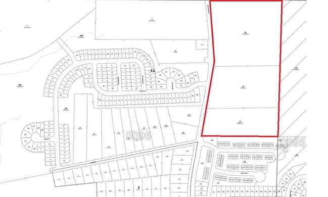
13-0096-LL-030-6
AN FLMAPPL:NO SEWER, REM -INFHB
Residentialacreage
Fulton
X
Georgia
13121C0476F
96
2024
12 AC
2025
North Clayton/Airport
010524
Atlanta
4,323 SF
Atlanta-Sandy Springs-Roswell, GA
DEMOGRAPHICS near 12740 Buffington Rd
1 Mile
3 Mile
5 Mile
2024 Total Population
5,439
62,025
155,676
2029 Population
5,678
64,323
159,980
Pop Growth 2024-2029
+ 4.39%
+ 3.70%
+ 2.76%
Average Age
36
36
37
2024 Total Households
2,067
23,595
60,256
HH Growth 2024-2029
+ 4.50%
+ 3.81%
+ 2.74%
Median Household Inc
$63,103
$51,853
$53,746
Avg Household Size
2.60
2.60
2.50
2024 Avg HH Vehicles
2.00
2.00
2.00
Median Home Value
$135,020
$164,224
$190,361
Median Year Built
2002
1985
1989
Nearby Places
Map Layers
Map Styles
 Street
 Aerial
- Restaurants
- Banks
- Shops
- Fitness
- Groceries
PUBLIC TRANSPORTATION
AIRPORT
Hartsfield - Jackson Atlanta International
DRIVE
WALK
Distance
Hartsfield - Jackson Atlanta International
14 min
8.0 mi
Freight Ports
Georgia Ports - Savannah
DRIVE
WALK
Distance
Georgia Ports - Savannah
276 min
245.3 mi
Nearby Properties
Address
Land Use
TOTAL SIZE
Lot Size
Zoning
Address
Land Use
TOTAL SIZE
Lot Size
Zoning
929,571 SF
65.66 AC
M1
Address
Land Use
TOTAL SIZE
Lot Size
Zoning
2,329,350 SF
32.55 AC
A
Address
Land Use
TOTAL SIZE
Lot Size
Zoning
992,870 SF
59.71 AC
M1
Address
Land Use
TOTAL SIZE
Lot Size
Zoning
115.30 AC
I
Address
Land Use
TOTAL SIZE
Lot Size
Zoning
1,231,833 SF
15.51 AC
C2
Address
Land Use
TOTAL SIZE
Lot Size
Zoning
1,026,040 SF
72.52 AC
M1
Address
Land Use
TOTAL SIZE
Lot Size
Zoning
948,900 SF
16.24 AC
RM
Address
Land Use
TOTAL SIZE
Lot Size
Zoning
4,381,104 SF
26.70 AC
AG1
Address
Land Use
TOTAL SIZE
Lot Size
Zoning
32,000 SF
8.86 AC
C
Address
Land Use
TOTAL SIZE
Lot Size
Zoning
920,396 SF
62.40 AC
R3
Address
Land Use
TOTAL SIZE
Lot Size
Zoning
352 SF
32.69 AC
RM
Address
Land Use
TOTAL SIZE
Lot Size
Zoning
997,011 SF
68.07 AC
M1
Address
Land Use
TOTAL SIZE
Lot Size
Zoning
663,520 SF
62.96 AC
C1
Address
Land Use
TOTAL SIZE
Lot Size
Zoning
85,347 SF
49.56 AC
AG1
Address
Land Use
TOTAL SIZE
Lot Size
Zoning
17,174,332 SF
39.44 AC
R3
Address
Land Use
TOTAL SIZE
Lot Size
Zoning
855,399 SF
41.79 AC
C2
Address
Land Use
TOTAL SIZE
Lot Size
Zoning
3,904,656 SF
30.58 AC
RM
Address
Land Use
TOTAL SIZE
Lot Size
Zoning
634,503 SF
19.94 AC
R3
Address
Land Use
TOTAL SIZE
Lot Size
Zoning
3,259,200 SF
17.69 AC
MF
Address
Land Use
TOTAL SIZE
Lot Size
Zoning
4,461,259 SF
18.79 AC
MF
Address
Land Use
TOTAL SIZE
Lot Size
Zoning
602,694 SF
9.32 AC
C1
Address
Land Use
TOTAL SIZE
Lot Size
Zoning
768,288 SF
40.65 AC
M1
Address
Land Use
TOTAL SIZE
Lot Size
Zoning
619,194 SF
49.22 AC
R3
Address
Land Use
TOTAL SIZE
Lot Size
Zoning
7,229,804 SF
29.30 AC
AC
Address
Land Use
TOTAL SIZE
Lot Size
Zoning
2,563,484 SF
12.54 AC
MF
Address
Land Use
TOTAL SIZE
Lot Size
Zoning
327,250 SF
23.20 AC
R3
Address
Land Use
TOTAL SIZE
Lot Size
Zoning
358,011 SF
60.44 AC
AG1
Address
Land Use
TOTAL SIZE
Lot Size
Zoning
773,776 SF
61.42 AC
M1
Address
Land Use
TOTAL SIZE
Lot Size
Zoning
679,728 SF
38.08 AC
M2
Address
Land Use
TOTAL SIZE
Lot Size
Zoning
499,800 SF
18.43 AC
AG1
The World's #1 Commercial Real Estate Marketplace
Connect with us
© 2025 CoStar Group
The information above has been obtained from sources believed reliable. While we do not doubt its accuracy we have not verified it and make no guarantee, warranty or representation about it. It is your responsibility to independently confirm its accuracy and completeness. Any projections, opinions, assumptions, or estimates used are for example only and do not represent the current or future performance of the property. The value of this transaction to you depends on tax and other factors which should be evaluated by your tax, financial, and legal advisors. You and your advisors should conduct a careful, independent investigation of the property to determine to your satisfaction the suitability of the property for your needs.