Property Record
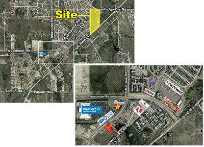
12740 E Highway 24, Peyton, CO 80831


Property Detail
12740 E Highway 24
43050-00-001
TRACT IN SEC 5-13-64 AS FOLS, COM AT NW COR OF SD SEC, TH S 0<0000 W ON W LN THEREOF 30.0 FT FOR POB, CONT ON LAST MENT COURSE 2836.67 FT TO A PT ON NWLY R/W LN OF C R I + P RR, N 46<2525 E ON SD NWLY R/W LN 1242.26 FT TO INTSEC E LN OF W 900.0 FT OF
Vacantlandnec
EL PASO
M
Colorado
B and X Area of moderate flood hazard, usually the area between the limits of the 100-year and 500-year floods.
49.68 AC
2024
Northeast
2025
Colorado Springs
003914
Colorado Springs, CO
NEARBY LISTINGS FOR SALE OR LEASE
DEMOGRAPHICS near 12740 E Highway 24
1 mile
3 mile
5 mile
2025 Total Population
4,364
25,332
41,850
2030 Population
4,367
25,978
43,406
Pop Growth 2025-2030
+ 0.07%
+ 2.55%
+ 3.72%
Average Age
36
36
36
2025 Total Households
1,333
7,864
13,372
HH Growth 2025-2030
+ 0.30%
+ 2.76%
+ 3.98%
Median Household Inc
$129,480
$138,367
$135,536
Avg Household Size
3.30
3.20
3.10
2025 Avg HH Vehicles
2.00
3.00
3.00
Median Home Value
$477,596
$601,928
$608,016
Median Year Built
2004
2007
2010
Nearby Places
Map Layers
Map Styles
 Street
 Aerial
Transit
 Traffic
 Biking
Places
Listings with unknown addresses are not visible on the map
- Restaurants
- Banks
- Shops
- Fitness
- Groceries
PUBLIC TRANSPORTATION
AIRPORT
City of Colorado Springs Municipal
Drive
Walk
Distance
City of Colorado Springs Municipal
25 min
12.7 mi
Freight Ports
Tulsa Port Of Catoosa
Drive
Walk
Distance
Tulsa Port Of Catoosa
716 min
678.2 mi
SALE & LEASE HISTORY
LISTING DATE
SALE/LEASE

Sep 30, 2016
For Sale
Sep 24, 2016
For Sale
Mar 31, 2017
For Sale
Apr 15, 2017
For Sale
Apr 14, 2017
For Sale
Apr 14, 2017
For Sale
Nearby Properties
Address
Land Use
TOTAL SIZE
Lot Size
Zoning
Address
Land Use
TOTAL SIZE
Lot Size
Zoning
43,256 SF
4.49 AC
PUD
Address
Land Use
TOTAL SIZE
Lot Size
Zoning
43,256 SF
4.73 AC
Address
Land Use
TOTAL SIZE
Lot Size
Zoning
39,446 SF
10.71 AC
RR-5
Address
Land Use
TOTAL SIZE
Lot Size
Zoning
123,673 SF
9.98 AC
CR
Address
Land Use
TOTAL SIZE
Lot Size
Zoning
195,448 SF
19.86 AC
CR
Address
Land Use
TOTAL SIZE
Lot Size
Zoning
46,935 SF
13.62 AC
PUD
Address
Land Use
TOTAL SIZE
Lot Size
Zoning
16,915 SF
5.19 AC
PUD
Address
Land Use
TOTAL SIZE
Lot Size
Zoning
7,573 SF
757.70 AC
PUD R-4 R-
Address
Land Use
TOTAL SIZE
Lot Size
Zoning
16,455 SF
6.89 AC
A-35 RR-2.
Address
Land Use
TOTAL SIZE
Lot Size
Zoning
15,406 SF
5.42 AC
RR-5
Address
Land Use
TOTAL SIZE
Lot Size
Zoning
10,017 SF
1.50 AC
CR
Address
Land Use
TOTAL SIZE
Lot Size
Zoning
13,048 SF
1.63 AC
CR
Address
Land Use
TOTAL SIZE
Lot Size
Zoning
3,148 SF
0.58 AC
CR
Address
Land Use
TOTAL SIZE
Lot Size
Zoning
38,804 SF
39.37 AC
RR-5
Address
Land Use
TOTAL SIZE
Lot Size
Zoning
41,592 SF
8.59 AC
RR-5
Address
Land Use
TOTAL SIZE
Lot Size
Zoning
6,289 SF
2.04 AC
CC
Address
Land Use
TOTAL SIZE
Lot Size
Zoning
5,970 SF
35.54 AC
RR-2.5
Address
Land Use
TOTAL SIZE
Lot Size
Zoning
219.19 AC
PUD
Address
Land Use
TOTAL SIZE
Lot Size
Zoning
12,111 SF
2.54 AC
PUD
Address
Land Use
TOTAL SIZE
Lot Size
Zoning
29,113 SF
3.43 AC
CR
Address
Land Use
TOTAL SIZE
Lot Size
Zoning
8,788 SF
35.90 AC
RR-5
Address
Land Use
TOTAL SIZE
Lot Size
Zoning
8,134 SF
10.19 AC
I-2
Address
Land Use
TOTAL SIZE
Lot Size
Zoning
26,235 SF
2.93 AC
CR
Address
Land Use
TOTAL SIZE
Lot Size
Zoning
85,148 SF
8.12 AC
I-2
Address
Land Use
TOTAL SIZE
Lot Size
Zoning
4,957 SF
1.77 AC
CR RS-2000
Address
Land Use
TOTAL SIZE
Lot Size
Zoning
9,901 SF
2.49 AC
CR
Address
Land Use
TOTAL SIZE
Lot Size
Zoning
22,680 SF
2.84 AC
CR
Address
Land Use
TOTAL SIZE
Lot Size
Zoning
326.51 AC
RR2
Address
Land Use
TOTAL SIZE
Lot Size
Zoning
55,980 SF
5.95 AC
CR
Address
Land Use
TOTAL SIZE
Lot Size
Zoning
160 AC
RR-5
The World's #1 Commercial Real Estate Marketplace
Connect with us
© 2026 CoStar Group
The information above has been obtained from sources believed reliable. While we do not doubt its accuracy we have not verified it and make no guarantee, warranty or representation about it. It is your responsibility to independently confirm its accuracy and completeness. Any projections, opinions, assumptions, or estimates used are for example only and do not represent the current or future performance of the property. The value of this transaction to you depends on tax and other factors which should be evaluated by your tax, financial, and legal advisors. You and your advisors should conduct a careful, independent investigation of the property to determine to your satisfaction the suitability of the property for your needs.