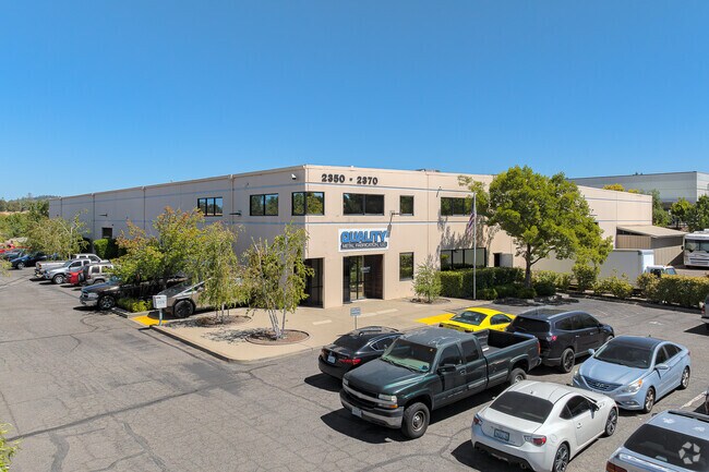
Property Record
12785 Earhart Ave, Auburn, CA 95602


NEARBY LISTINGS FOR SALE OR LEASE
Property Detail
12785 Earhart Ave
Sacramento--Roseville--Arden-Arcade, CA
Auburn Airport Indl Park Ph 02
052-010-007
40 A FR SEC 28 13 8
Lightindustrial
Placer
X
California
06061C0754H
30
0
2.86 AC
2025
Auburn/Newcastle
021802
Sacramento
18,906 SF
DEMOGRAPHICS near 12785 Earhart Ave
1 Mile
3 Mile
5 Mile
2024 Total Population
3,745
24,253
40,500
2029 Population
3,992
26,004
43,333
Pop Growth 2024-2029
+ 6.60%
+ 7.22%
+ 7.00%
Average Age
44
46
46
2024 Total Households
1,460
9,736
16,510
HH Growth 2024-2029
+ 6.71%
+ 7.34%
+ 7.12%
Median Household Inc
$64,873
$82,822
$83,361
Avg Household Size
2.40
2.40
2.40
2024 Avg HH Vehicles
2.00
2.00
2.00
Median Home Value
$476,270
$575,906
$636,785
Median Year Built
1979
1979
1979
Nearby Places
Map Layers
Map Styles
 Street
 Aerial
- Restaurants
- Banks
- Shops
- Fitness
- Groceries
PUBLIC TRANSPORTATION
COMMUTER RAIL
Auburn-Conheim (Capitol Corridor - Capitol Corridor Joint Powers Authority)
DRIVE
WALK
Distance
Auburn-Conheim (Capitol Corridor - Capitol Corridor Joint Powers Authority)
10 min
4.6 mi
Auburn Amtrak (Capitol Corridor - Amtrak)
DRIVE
WALK
Distance
Auburn Amtrak (Capitol Corridor - Amtrak)
11 min
4.7 mi
Freight Ports
Port of Stockton
DRIVE
WALK
Distance
Port of Stockton
103 min
86.7 mi
Nearby Properties
Address
Land Use
TOTAL SIZE
Lot Size
Zoning
Address
Land Use
TOTAL SIZE
Lot Size
Zoning
76,919 SF
17.36 AC
OPUPDC
Address
Land Use
TOTAL SIZE
Lot Size
Zoning
84,588 SF
7.30 AC
CPDDC
Address
Land Use
TOTAL SIZE
Lot Size
Zoning
161,602 SF
5.49 AC
Address
Land Use
TOTAL SIZE
Lot Size
Zoning
135,680 SF
9.20 AC
CPDDC
Address
Land Use
TOTAL SIZE
Lot Size
Zoning
58,492 SF
5.80 AC
CPDDC
Address
Land Use
TOTAL SIZE
Lot Size
Zoning
90,494 SF
4.20 AC
OPRMDC
Address
Land Use
TOTAL SIZE
Lot Size
Zoning
113,452 SF
10.20 AC
CPDDC
Address
Land Use
TOTAL SIZE
Lot Size
Zoning
81,175 SF
2.70 AC
Address
Land Use
TOTAL SIZE
Lot Size
Zoning
72,664 SF
9.80 AC
CPDDC
Address
Land Use
TOTAL SIZE
Lot Size
Zoning
124,714 SF
7.90 AC
Address
Land Use
TOTAL SIZE
Lot Size
Zoning
97,458 SF
7.90 AC
HSDC
Address
Land Use
TOTAL SIZE
Lot Size
Zoning
61,677 SF
2.50 AC
OPRMDC
Address
Land Use
TOTAL SIZE
Lot Size
Zoning
78,672 SF
9.20 AC
RMDL10DC
Address
Land Use
TOTAL SIZE
Lot Size
Zoning
53,660 SF
3.90 AC
OPRMDC
Address
Land Use
TOTAL SIZE
Lot Size
Zoning
44,951 SF
3 AC
C2DC
Address
Land Use
TOTAL SIZE
Lot Size
Zoning
64,602 SF
1.80 AC
Address
Land Use
TOTAL SIZE
Lot Size
Zoning
101,170 SF
4.95 AC
Address
Land Use
TOTAL SIZE
Lot Size
Zoning
53,860 SF
3.70 AC
RMDL15DC
Address
Land Use
TOTAL SIZE
Lot Size
Zoning
25,316 SF
2 AC
HSDC
Address
Land Use
TOTAL SIZE
Lot Size
Zoning
18.50 AC
CPDDC
Address
Land Use
TOTAL SIZE
Lot Size
Zoning
18,860 SF
2.60 AC
OPDC
Address
Land Use
TOTAL SIZE
Lot Size
Zoning
40,924 SF
2 AC
RMDC
Address
Land Use
TOTAL SIZE
Lot Size
Zoning
37,259 SF
5.80 AC
Address
Land Use
TOTAL SIZE
Lot Size
Zoning
49,659 SF
8.60 AC
Address
Land Use
TOTAL SIZE
Lot Size
Zoning
61,334 SF
6.60 AC
INPDC
Address
Land Use
TOTAL SIZE
Lot Size
Zoning
34,412 SF
1.50 AC
Address
Land Use
TOTAL SIZE
Lot Size
Zoning
49,000 SF
2 AC
Address
Land Use
TOTAL SIZE
Lot Size
Zoning
38,276 SF
5.60 AC
Address
Land Use
TOTAL SIZE
Lot Size
Zoning
18,862 SF
1.80 AC
OPDC
The World's #1 Commercial Real Estate Marketplace
Connect with us
© 2026 CoStar Group
The information above has been obtained from sources believed reliable. While we do not doubt its accuracy we have not verified it and make no guarantee, warranty or representation about it. It is your responsibility to independently confirm its accuracy and completeness. Any projections, opinions, assumptions, or estimates used are for example only and do not represent the current or future performance of the property. The value of this transaction to you depends on tax and other factors which should be evaluated by your tax, financial, and legal advisors. You and your advisors should conduct a careful, independent investigation of the property to determine to your satisfaction the suitability of the property for your needs.